


July 12, 2026
Iran Formally Closes the Strait of Hormuz as the U.S. Launches a Third Round of Strikes


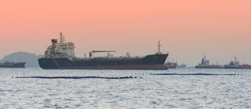
AIS Ship Tracking
What is AIS Ship Tracking?
Automatic Identification System (AIS) ship tracking is a radio-based system used by the maritime industry to monitor and track vessel movements in real time. Ships broadcast their identification, position, course, speed, and other data, allowing other ships and shore stations to track them. Ships that are heavier than 300 tons are required by the International Maritime Organization (IMO) to keep their AIS activated at all times.
How Does AIS Ship Tracking Work?
AIS tracking captures a vessel’s position and movements through the ship’s onboard GPS system, or through an internal sensor built into the AIS unit. The location data is broadcast through the very high frequency (VHF) maritime band, together with information that can be used to identify the ship.
The data packets have three distinct recipients, each of which has a different reason for tracking the ship:
- Other ships in the area that want to avoid a collision
- Shore stations, such as ports, use the information for logistics planning
- Satellite stations make the data available to stakeholders around the world
What Types of Data are Transmitted over AIS?
There are two types of data transmitted through the AIS, static and dynamic information. Static information is automatically transmitted every six minutes, but it can also be sent on-demand. This data includes:
- MMSI number
- IMO number
- Name and call sign
- Length and beam
- Type of ship
- Location of position fixing antenna
The second type of data is dynamic and has no set intervals for transmission. It depends on the vessel’s speed and changes in its course. This data includes:
- Ship’s position, with accuracy indication
- Position timestamp (in UTC)
- Course over ground (COG)
How Has AIS Ship Tracking Impacted the Maritime Industry?
AIS has made a significant impact since its creation in the 1990s. According to the NATO Shipping Center, the introduction of AIS was the most significant development in navigation since the introduction of radar!
Prior to the introduction of AIS, there was no way to have real-time visibility into the location of a ship’s movements. Using AIS data, stakeholders can easily monitor ships, their routes, and essential details as they happen.
This capability has led to a number of optimizations and improvements in the world’s oceans and shipping lanes, and include:
- Optimized shipping routes: by analyzing current positions and traffic patterns, shippers and organizations can make informed decisions to ensure the most efficient and cost-effective routes are taken.
- Compliance and regulations: meeting environmental regulations and compliance standards is a top priority in the maritime industry. AIS ship tracking aids in ensuring vessels adhere to these regulations, promoting environmental responsibility and sustainable practices.
- Insights for decision making: AIS data provides a wealth of insights for decision-makers in various industries. From national intelligence agencies to energy companies and shipping entities, the data is a valuable resource for informed decision-making and strategic planning.
- Transparency in the supply chain: stakeholders are able to trace the movement of goods, optimize logistics, and ensure timely deliveries, contributing to a streamlined and efficient supply chain.
Using AIS Ship Tracking to Detect Deceptive Shipping Practices
AIS plays an important role in the detection of deceptive shipping practices. Some ships engaging in illegal activities turn their AIS transponder off. When they go dark, they believe they can participate in these illicit crimes without fear of being caught.
Other ships play identity games, where they continue to transmit data over their AIS, but deliberately falsify data on the AIS broadcast. Still others use strategies, where they use a decoy vessel as a disguise. This is known as an AIS handshake – two ships will temporarily trade identities. The ship, assuming the identity of the decoy ship, participates in some illegal activity and then returns to the same location as the decoy ship. At that point, each ship switches back to its original identity.
Despite the AIS being turned off, disabled, or used by a different ship in these scenarios, investigative teams using Maritime AI™ technology can often determine which illegal activities were done at these times. Using millions of data points from the crew, ship owners, weather, other ships in the region, law enforcement data, and other sources of information, investigators can often determine when ships act illicitly.
Do All AIS Gaps Indicate Illegal Activity Took Place?
AIS gaps, or points in time when an AIS doesn’t send out a signal, doesn’t always mean a crime took place. In fact, the vast majority of AIS transmission gaps worldwide are not deliberate. The most common reason for gaps in AIS transmissions is that they are simply not detected by any sensor. This can be caused by:
- Poor coverage (no close terrestrial station or satellite revisits are less frequent)
- Overcrowded areas, which cause signal collision (a bit like trying to get a mobile phone signal at a concert)
- Weather conditions
- GPS jamming
But with its transponder turned off, ships become difficult to track until the transmission is reactivated. This tactic is used to hide stops in countries that are under sanction, or if ships are involved in illegal ship-to-ship transfers.
Without the right AI-powered solution, it can be difficult to determine whether an AIS gap was a missed transmission, or indicative of deceptive shipping practices.
Getting More Out of AIS Ship Tracking
Having access to AIS ship tracking data isn’t always enough. The data can be hard to understand, and making proactive, instead of reactive, decisions can be costly.
Combining AIS ship tracking data with a Maritime AI™ platform can enrich the insights gained from AIS data. This combo can be used to generate highly accurate predictive intelligence, anticipating future vessel behavior and risks.
Explore more

OFAC Compliance
What Is OFAC Compliance? OFAC compliance refers to adherence to regulations set by the U.S. Office of Foreign Assets Control, which administers economic and trade sanctions as part of U.S. foreign policy. In the maritime and shipping context, maintaining OFAC compliance is essential to avoid severe penalties, safeguard operations, and ensure due diligence in vessel...
Read more

SHIP Act
What is the SHIP Act? The Stop Harboring Iranian Petroleum Act (SHIP Act) was enacted as part of the Emergency Supplemental Appropriations for the 2024 Fiscal Year. It aims to impose sanctions on foreign individuals and entities involved in the trade of petroleum and petroleum products originating in Iran. It specifically targets the shadow fleet...
Read more

Data Fusion
What is Data Fusion? Data fusion is the process of integrating data from multiple sources to create a unified, accurate, and comprehensive view. In the maritime industry, where data can often be noisy or fragmented, fusion eliminates inconsistencies and enables advanced AI models to deliver full visibility and actionable insights. Without data fusion, organizations face...
Read more

Commodity Trading
What is Commodity Trading? Commodity trading is the buying, selling, and exchanging of raw materials or primary goods. These goods are typically classified into two categories: hard commodities (like metals and energy resources) and soft commodities (such as agricultural products). Traders engage in this activity to profit from price fluctuations, hedge risks, or fulfill supply...
Read more

Security Teams
What is a Security Team in the Maritime Industry? A security team in the maritime industry is a specialized group tasked with ensuring the safety and security of vessels, crews, and cargo in maritime environments. They work for a variety of organizations and are essential in the planning and execution of commercial shipments that traverse...
Read more