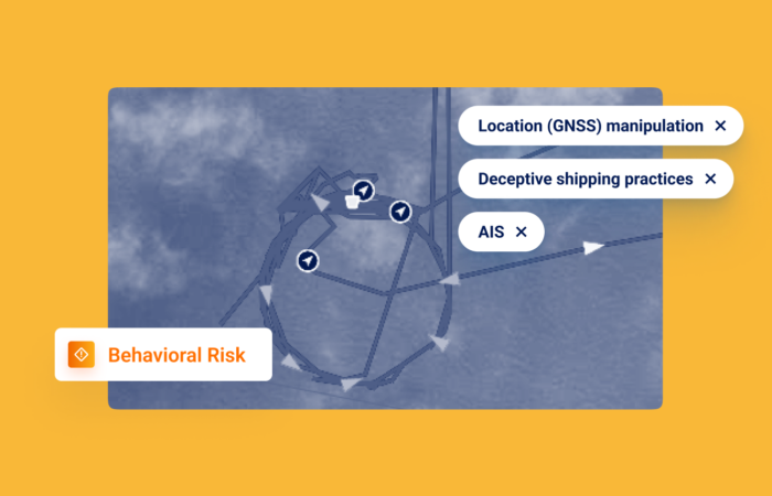
3,000 Unique Location (GNSS) Manipulation Cases – Expert Interview

What’s inside?
Windward recently integrated advanced deep learning technology into our Location (GNSS) Manipulation Risk model, so our customers can stay on top of this morphing deceptive shipping practice (DSP). We sat down with three of the employees spearheading this new technology:
- Dror Salzman, Windward’s Director of Trading & Shipping Products
- Tal Yogev, a Windward Data Scientist
- Ruth Ben Chaim, a Data Analyst at Windward
This first blog post in this series features the interview with Dror, who explains how Windward began detecting location (GNSS) manipulation, how it has evolved, and the importance of deep learning for accurate detection and staying ahead of the cat-and-mouse game.
Dror Salzman started noticing strange vessel behavior in 2021. Windward’s Director of Trading & Shipping Products and other members of the Windward team started seeing vessel anomalies, often near the Caribbean Sea.
A 2022 article in The New York Times featuring Windward’s expertise described this initial investigation.
QUESTION (Q): How did you discover location (GNSS) manipulation behavior in 2021? What was this behavior?
Dror: There were a few cases coming in from the market about vessels behaving in a strange pattern, mainly around the Caribbean Sea. We were being asked about these behaviors by reporters, or customers.
They were asking: “OK, how can a tanker of 330 meters be doing 180-degree turns in under three minutes?”
First of all, we (Windward) corroborated the fact that the vessel was behaving in a strange way and then we used our domain expertise, to understand what would be the reason for a vessel to do that.
When we looked at satellite images of the main oil terminals, we were able to locate vessels engaging in location (GNSS) manipulation. So, we could actually find the smoking gun, which is the vessels loading oil, while transmitting as if they are somewhere else.
We started to reverse engineer the signal itself. We understood that there was something about the GPS signal that was being transmitted that was fake and then we started looking at raw AIS and specific elements within the AIS message that were able to show us what was fake and what was real. That was essentially the first typology and then we started discovering more and more different types of behavior.
Q: What is the status of GNSS tracking in the industry currently?
Dror: We are seeing exponential growth. Now we have crossed 3,000 unique location (GNSS) manipulation cases involving nearly 1,000 vessels. What’s also interesting is the areas where they are happening. The main area of GNSS manipulation is actually the Persian Gulf, followed by West Africa, and there are more and more areas where this is being done. If you look at what is a common denominator between them, it’s that they are all areas in which location (GNSS) manipulation will be a potential disguise for the behavior taking place.
For example, if you are trying to disguise your visit to an oil exporting country, you would want to fake your presence as being near another oil exporting country, such as Angola or Nigeria, when you are actually traveling to sanctioned Venezuela. We also saw cargo vessels and fishing vessels.
It has been apparent for a long time that whenever a new deceptive shipping practice emerges, bad actors from across the spectrum adopt and utilize it for their own purposes, such as arms smuggling and IUU fishing.
When we originally spotlighted location (GNSS) manipulation as an issue, our customers from the intelligence and security worlds were concerned about how this will inevitably affect them, which it has.
Q: How has location (GNSS) manipulation technology progressed in the past few years?
Dror: Originally, everything that was fake looked really, really fake. Now, you need to be an expert to discern if vessel paths are fake or not.

Q: What is the importance of deep learning for location (GNSS) manipulation detection?
Dror: Everyone that says they have spoofing or GNSS manipulation detection is reactive. There’s a new typology, we learn how it’s done and then we react by defining the typology. Windward decided that we want to step out of this cat-and-mouse game, we don’t want to be part of the chase anymore. We wanted to create a model that can distinguish between real AIS and fake AIS.
Regardless of which typology will come next, we’ll be able to uncover it using our deep learning model.
Q: Why should maritime, governmental, and supply chain organizations care about GNSS manipulations?
Dror: Location (GNSS) manipulation has been recognized this past year in the 11th package and the Quint-Seal Compliance Note as a sanctions evasion tactic. Sometimes it’s defined as “spoofing.” The regulator is saying you need to look at this, but it doesn’t say how to look at this. That’s where the private market comes in…
Additionally, spoofing is used in the context of geopolitical conflicts to smuggle illegal weapons, so it is necessary for defense and intelligence organizations to stay ahead of the game.
Stay tuned for our next blog post in this series, which will feature the interviews with Tal and Ruth. They’ll detail the difficulties in training a deep learning model to go beyond existing typologies, the importance of a “human-in-the-loop,” and the holy grail of location (GNSS) manipulation…


