


July 29, 2026
From Awareness to Action: Where Maritime Domain Awareness Is Heading


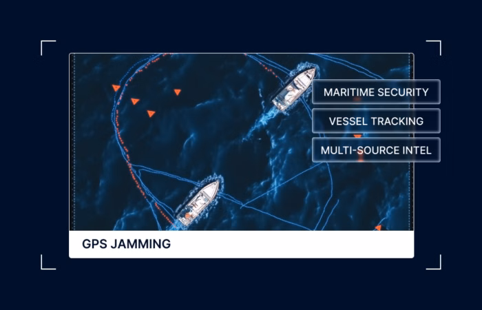
What Is GPS Jamming and Why Are We Seeing So Much of It?
What’s inside?
At a Glance
- GPS jamming is deliberate interference with the positioning signals that vessels, aircraft, and other GPS-dependent systems rely on to navigate, with the affected area either denied (signal suppressed entirely) or injected (false position signals broadcast).
- Nearly 978,000 GPS jamming events were recorded globally in Q1 2026, with 98% concentrated in the Middle East Gulf, accelerating sharply in the first two weeks of the Iran conflict.
- More than 1,100 vessels were directly affected by GPS jamming in the Middle East Gulf during the first quarter, with operational positioning compromised across the Strait of Hormuz, the Persian Gulf, and the Gulf of Oman.
- GPS jamming concentrates in military zones, contested waterways, and active conflict theaters, with the Strait of Hormuz, the Baltic Sea, and the Eastern Mediterranean among the most affected regions globally.
- GPS jamming undermines the cooperative signals that AIS-based maritime monitoring relies on, making vessel positioning, port operations, and incident detection harder to verify in real time.
- Maritime AI™ and Multi-Source Intelligence are increasingly being used to maintain operational visibility when GPS and AIS signals can no longer be trusted independently.
What Is GPS Jamming?
GPS jamming is the deliberate interference with GPS signals that disrupts the ability of receivers to determine accurate location. It operates in two primary modes. The first is signal denial, where jamming equipment overwhelms the GPS signal with radio frequency interference, preventing a receiver from establishing a positioning fix at all. The second is signal injection, where false positioning data is broadcast in the affected area, causing vessels to report incorrect locations.
For maritime operations, both modes have direct operational consequences. A ship that cannot establish positioning cannot navigate safely. A ship broadcasting positioning that does not match its actual location cannot be tracked reliably by port authorities, coast guards, or commercial monitoring systems. The downstream effects ripple through cargo tracking, collision avoidance, port scheduling, sanctions enforcement, and emergency response.
GPS jamming is not new. It has existed as a military and intelligence capability for decades. What changed in recent years is the scale, geographic concentration, and operational impact of jamming events on global shipping. The first quarter of 2026 marked the largest concentration of maritime GPS jamming events ever recorded.
Why GPS Jamming Is Surging Right Now
Three structural factors are driving the current scale of GPS jamming.
The first is conflict-related military activity. GPS jamming concentrates in military zones and contested waterways because military operations routinely use signal interference to protect sensitive activity from adversary tracking, deny adversary navigation, and prevent the targeting of military assets. The first two weeks of the Iran conflict in early 2026 produced the sharpest acceleration in jamming events recorded in maritime history, with the Middle East Gulf accounting for 98% of all global GPS jamming events in the first quarter.
The second is maritime sanctions evasion. Sanctioned vessels operating outside G7 enforcement frameworks have incentives to obscure their movements. Shadow fleet vessels increasingly use AIS manipulation to conceal location, port calls, and ship-to-ship transfers from sanctions monitoring, and may also operate through jamming-affected regions where positioning data becomes inherently less reliable. The infrastructure that enables this activity has matured alongside the growth of the dark fleet, which Windward tracks at 2,108 vessels in Q1 2026.
The third is deliberate disruption of commercial trade. Some actors use jamming as a tactic to disrupt regional or global trade flows, complicate adversary economies, or signal political pressure. The Strait of Hormuz, the Baltic Sea, the Black Sea, the Red Sea, and the Eastern Mediterranean all sit at intersections of competing geopolitical interests, and all show elevated jamming activity that maps to ongoing political tensions in each region.
What GPS Jamming Looks Like in Practice
For vessels operating in affected regions, GPS jamming manifests in several observable ways.
AIS broadcasts become unreliable. AIS depends on GPS positioning data, so vessels under jamming may transmit positions that do not match their actual location, broadcast positions in clusters that are physically impossible, or appear to teleport across hundreds of nautical miles between transmissions.


Monitoring systems that rely on AIS alone cannot distinguish jamming-affected positions from genuine vessel movements without additional sensor data.
False vessel activities appear in monitoring systems. Ships under jamming may show as conducting ship-to-ship transfers, port calls, or anchoring events that did not actually happen. In one documented case in late 2024, 32 vessels appeared to be conducting ship-to-ship operations in China’s exclusive economic zone, more than triple the historical average. The cluster was identified as the result of GPS jamming affecting the area, not actual maritime activity in the EEZ.


Slow-speed clustering emerges in unexpected locations. Vessels under jamming may appear to be loitering at low speeds in patterns inconsistent with normal commercial activity. The clusters often have geometric regularity that does not match real-world maritime movements, indicating coordinate manipulation rather than actual vessel behavior.

Port operations and emergency response degrade. Port authorities relying on AIS-based vessel tracking lose accuracy on incoming traffic during jamming events. Search and rescue operations become more difficult when distressed vessels cannot reliably transmit their positions. Insurance, sanctions compliance, and cargo tracking workflows that depend on AIS data face increased verification challenges across the affected region.
Where GPS Jamming Is Concentrated
Q1 2026 produced a clear geographic hierarchy of jamming activity globally.
The Middle East Gulf is the dominant theater. The Strait of Hormuz, the Persian Gulf, and the Gulf of Oman together account for 98% of all global jamming events in the first quarter, with more than 1,100 vessels directly affected. The concentration tracks closely with the Iran conflict and the Operation Epic Fury operational environment.
The Baltic Sea continues to record sustained jamming activity, particularly in the Gulf of Finland and the eastern Baltic. Multiple coastal states, including Finland, Estonia, and Lithuania, have publicly attributed jamming in their airspace and territorial waters to Russian sources, with the activity affecting both commercial maritime navigation and civil aviation.
The Black Sea ranks as the second-largest jamming theater globally after the Middle East Gulf, with 7,630 cases recorded in the first quarter. The activity reflects the active conflict environment around the Ukraine-Russia war and the broader Black Sea security environment.
The Eastern Mediterranean records elevated jamming activity tied to the ongoing security situation across multiple coastal states and the broader maritime security environment in the Levant basin.
The Red Sea, the Gulf of Aden, and Sudan’s coastline also record persistent jamming activity tied to regional conflicts and to the disruption of commercial shipping lanes connecting the Indian Ocean to the Mediterranean.
Why GPS Jamming Matters for Maritime Operations
The operational consequences of GPS jamming extend across multiple domains.
For commercial operators, jamming creates safety risk, route uncertainty, and cargo tracking degradation. A vessel that cannot establish positioning faces increased collision risk, particularly in high-traffic chokepoints. A vessel whose broadcast position is unreliable cannot be efficiently scheduled into port operations, complicating logistics across the supply chain.
For sanctions compliance teams, jamming creates a verification problem. A vessel broadcasting positioning data that may be falsified provides no reliable evidence of where it has actually been, what cargo it has handled, or which ports it has called. Sanctions screening that depends on AIS-broadcast data alone becomes less reliable in jamming-affected regions, requiring multi-source intelligence to verify actual vessel activity.
For insurance and P&I clubs, jamming complicates risk pricing. A vessel transiting a jamming-affected region carries operational risk that is harder to verify and may shift over time as the jamming environment evolves.
For port authorities and government enforcement, jamming undermines maritime situational awareness. Authorities responsible for monitoring vessels of interest, conducting incident response, or supporting search and rescue operations lose accuracy on the vessels operating in their jurisdiction during jamming events.
How Maritime AI™ Helps Detect and Adapt to GPS Jamming
Maritime AI™ technology is increasingly used to detect and adapt to GPS jamming events, often before the affected operators are aware of them.
Pattern recognition surfaces jamming as it occurs. Sometimes, what appears to be a spike in ship-to-ship meetings or a sudden cluster of slow-speed loitering in a specific area is actually a jammed area, where vessels are reporting false positions because the GPS signal in that area has been injected. Investigation confirms the anomaly by cross-referencing AIS-derived activity against satellite imagery, radio frequency data, and behavioral baselines.
Multi-source intelligence verifies vessel activity independently of AIS. When GPS and AIS signals can no longer be trusted, synthetic aperture radar (SAR), electro-optical (EO) imagery, and radio frequency (RF) detection provide sensor-confirmed vessel positioning that does not depend on cooperative signaling. The fused operational picture allows operators, sanctions teams, port authorities, and government enforcement bodies to maintain visibility through jamming environments.
Behavioral models adapt to known jammed areas. As jamming events are confirmed, the system suppresses false activities in affected regions, reducing noise in monitoring workflows. The presence of a vessel in a jammed area is not itself a risk indicator — vessel risk is assessed independently based on the vessel’s own behavioral profile.
What Comes Next
The trajectory of GPS jamming throughout the rest of 2026 will depend on the evolution of the conflict environments driving most current activity. The Iran conflict and the resulting Hormuz disruption have established the Middle East Gulf as the dominant jamming theater for the foreseeable future. The Russia-Ukraine war continues to drive Black Sea activity.
Two structural shifts are worth tracking. The first is the increasing use of jamming as a routine operational tool by both state and non-state actors, expanding beyond active conflict zones into broader gray-zone competition. The second is the maturation of multi-source intelligence as the operational answer to widespread GPS unreliability, with commercial and government maritime operators alike investing in sensor-verified tracking that does not depend on cooperative signals.
The era of treating AIS as the trusted, default monitoring layer is closing. The era of treating it as one input among many, verified against independent sensor sources, is the operational reality that maritime operators are now navigating.
Frequently Asked Questions (FAQs)
What is GPS jamming?
GPS jamming is the deliberate interference with GPS signals in a specific area, disrupting a receiver’s ability to determine accurate location. It operates either by denying the signal entirely (the GPS signal is suppressed so no position is reported) or by injecting false positioning data (false location signals are broadcast, causing receivers to report incorrect positions).
How widespread is GPS jamming in 2026?
Nearly 978,000 GPS jamming events were recorded globally in Q1 2026, with 98% concentrated in the Middle East Gulf and more than 1,100 vessels directly affected. The Black Sea ranked as the second-largest jamming theater with 7,630 cases, followed by additional concentrations in the Baltic Sea, the Eastern Mediterranean, and the Red Sea.
Why is GPS jamming surging right now?
Three factors are driving the current scale of jamming. Active conflicts, particularly the Iran conflict and the Russia-Ukraine war, are generating intense military jamming activity. Sanctions evasion by shadow fleet vessels increasingly relies on GPS and AIS manipulation. In addition, gray-zone competition between major powers has normalized jamming as a routine operational tool beyond active conflict zones.
How does GPS jamming affect maritime operations?
Jamming creates safety risks for vessel navigation, undermines the reliability of AIS-based vessel tracking, complicates port scheduling and cargo monitoring, creates sanctions compliance verification challenges, and degrades search and rescue capability in affected regions. The cumulative impact is a measurable reduction in maritime situational awareness across the affected geography.
Where is GPS jamming most concentrated globally?
The Middle East Gulf, including the Strait of Hormuz, Persian Gulf, and Gulf of Oman, accounts for 98% of global jamming events recorded in Q1 2026. Other major concentrations include the Black Sea, the Baltic Sea, the Eastern Mediterranean, the Red Sea, the Gulf of Aden, and Sudan’s coastline, with each linked to ongoing conflicts or geopolitical tensions in the respective region.
How can maritime operators maintain visibility during GPS jamming?
Multi-source intelligence that fuses AIS data with satellite imagery, radio frequency detection, and electro-optical imagery provides sensor-confirmed vessel positioning that does not depend on the integrity of the GPS signal. Maritime AI™ technology identifies jamming events as they occur, suppresses false vessel activities, and maintains operational visibility for commercial operators, sanctions teams, port authorities, and government enforcement bodies.
Explore more

From Awareness to Action: Where Maritime Domain Awareness Is Heading
At a Glance Speed-to-Understanding Is the Dominant Demand For much of the past decade, the AI conversation in maritime intelligence focused on accuracy and coverage. In 2026, the conversation has shifted to latency and comprehension. A capability that produces the right answer 72 hours after the operational window has closed is no longer valuable in...
Read more

Why Russian-Linked Vessels Are Loitering Above European Subsea Cables
At a Glance Behavior With No Commercial Explanation The signature is consistent across multiple vessels in different parts of European waters. A tanker arcs off its expected route. It loiters above a cable system, sometimes for hours, sometimes for days. Its AIS goes dark for long enough to obscure precise positioning but short enough to...
Read more

Why Russia’s Sanctioned Shadow Fleet Is Bypassing the English Channel
At a Glance Russian Tankers Repeatedly Bypass the English Channel Western-sanctioned tankers loading oil at Russian Baltic ports normally transit the English Channel as part of standard voyage routing. In the past 30 days, Windward tracked 84 Western-sanctioned tankers through the Channel — 44% flagged with Sierra Leone, 19% with Cameroon, and 18% with Russia....
Read more

Why Customs Enforcement Is Moving from Document Screening to Behavioral Intelligence
At a Glance The Screening Model Customs Was Built On No Longer Holds For most of the last twenty years, customs enforcement has operated on a screening model. Cargo manifests arrive ahead of port call, risk scores are calculated against the declared origin, shipper, and route, and anomalies trigger inspection. The model worked while the...
Read more