


March 29, 2026
March 29, 2026: Iran War Maritime Intelligence Daily


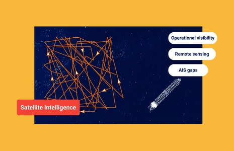
From Government to Global: How Satellite Intelligence Became a Commercial Advantage
What’s inside?
At a Glance
- Satellite intelligence has evolved from government reconnaissance programs to widely accessible commercial constellations.
- Modern maritime, trade, and security teams rely on remote sensing satellite imagery, RF detection, and SAR coverage to see beyond AIS and paperwork.
- AI and multi-sensor fusion turn vast streams of satellite data into real operational insight.
- Commercial sectors now have access to imagery and analytics once considered “military-grade.”
- Windward transforms this data into decision-ready intelligence for compliance, security, and supply-chain resilience.
From Government Asset to Commercial Advantage
Satellite intelligence began as a government-only capability – expensive, classified, and inaccessible to nearly everyone outside national security. Today, it’s a commercial advantage available to traders, insurers, logistics teams, energy operators, and maritime security professionals who need verified visibility across global operations.
This shift didn’t happen overnight. It resulted from decades of technological progress, the democratization of space data, and the rise of commercial constellations capable of delivering high-frequency, high-resolution imagery once reserved for military programs. The line between government-grade and commercially accessible intelligence is now thinner than ever, and organizations that understand how to harness satellite data stand to gain a real strategic edge.

From the Space Race to the Open Market
The early purpose of space-based observation was singular: national security. Throughout the 1960s-1990s, governments invested heavily in satellite reconnaissance to monitor geopolitical rivals, verify treaties, and observe strategic infrastructure. These systems were powerful, but also classified, expensive, and limited to a handful of nations with the budgets and launch capabilities to operate them.
The commercial shift began slowly with government-funded civil programs like Landsat, which introduced open Earth-observation imagery to researchers and industries. But real change came when private companies began launching their own high-resolution satellites in the 2000s and 2010s. This wave – driven by smaller sensors, cheaper launches, and rising demand for imagery – made commercial satellite data a viable operational tool instead of a scientific curiosity.

By 2025, hundreds of commercial satellites deliver high-resolution SAR, EO, infrared, and RF-based intelligence at a frequency that even legacy government systems cannot match. What once required classified tasking is now accessible through API calls, platform dashboards, and automated alerts.
How Commercial Satellite Intelligence Became a Maritime Advantage
What began as a government capability has become a commercial advantage, with satellite intelligence giving maritime stakeholders the ability to validate real conditions across global trade routes. Against a backdrop of shifting trade flows, geopolitical pressure, and expanding dark fleet networks, satellite intelligence delivers the verified situational awareness that conventional data sources can no longer guarantee. It bridges the gap between reported and actual activity, offering independent confirmation of vessel behavior far beyond what AIS alone can provide.
The Commercial Shift That Made Satellite Intelligence Operational
Three shifts unlocked satellite intelligence for commercial maritime use, not just in volume, but in strategic value:
1. Higher Frequency
Commercial constellations now revisit key locations multiple times per day, providing a level of persistence once limited to national programs. This cadence enables continuous tracking of port operations, STS hotspots, and geopolitical flashpoints without waiting for the next government collection cycle.
2. Higher Resolution
Modern EO and SAR systems routinely deliver sub-meter imagery, revealing vessel class, cargo activity, and even equipment configuration. For maritime users, this means the ability to validate ship-to-ship transfers, measure dry bulk stockpiles, confirm port congestion, or identify unauthorized offshore activity with precision once reserved for defense agencies.
3. Higher Accessibility
Imagery that previously required formal tasking, clearance, or long lead times is now available through commercial platforms. Compliance teams, traders, insurers, and security units can pull imagery on demand, often within minutes, and integrate it directly into operational workflows.
Together, these shifts turned satellite data from an occasional reference point into a frontline decision tool, giving commercial organizations military-grade visibility at commercial speed.
What Commercial Satellite Image Shows That AIS Cannot
AIS is cooperative. Satellite intelligence is not.
AIS shows how a vessel chooses to represent itself, while satellite sensors reveal its actual behavior. The table below outlines what each sensor contributes, and where AIS alone falls short.
| Visibility Layer | What It Shows | Why It Matters |
| Electro-Optical (EO) Imagery | Visual confirmation of vessels, cargo handling, and port activity. | Validates identity, activity, and changes over time. |
| Synthetic Aperture Radar (SAR) Imagery | Vessel presence through clouds, weather, and darkness. | Critical for detecting dark and non-reporting ships. |
| Radio Frequency (RF) Detection | Radio emissions from radar, satcom, and VHF. | Identifies vessels even when AIS is off. |
| Archived Imagery | Historical patterns, baselines, and change detection. | Reveals long-term behavior, flag hopping cycles, or repeat STS areas. |
| Tasked Imagery | On-demand, high-priority capture. | Validates emerging risk or high-stakes decisions. |
Together, these layers provide a grounded, verifiable understanding of maritime activity that AIS alone cannot offer.
How Commercial Industries Now Use Satellite Intelligence
Today’s maritime environment is shaped by fast-moving risks – dark fleet expansion, geopolitical chokepoints, sanctions evasion, shifting commodity flows, and increasingly unpredictable port operations. AIS and documentation provide part of the picture, but not the full reality. As these risks intensify, commercial industries have adopted satellite intelligence to gain the verified, non-cooperative visibility required to operate with confidence.
This shift isn’t limited to one sector. Across the commercial maritime ecosystem, organizations are integrating remote sensing intelligence into daily operations, each applying it to solve a different category of mission-critical risk.
Commodity & Energy Trading
Satellite intelligence validates cargo flows, port calls, loading events, and ship-to-ship transfers that may be misreported or hidden on AIS. Traders use EO and SAR to confirm supply disruptions, detect unsanctioned movements, and track stockpile changes that can move global markets.
Maritime Compliance & Sanctions Monitoring
Sanctions evasion increasingly depends on AIS manipulation. Multi-sensor fusion exposes hidden STS operations, false flags, gray-zone routing, and identity laundering that paperwork alone cannot reveal. Satellite data provides the non-cooperative verification that regulators now expect.
Insurance & Risk Underwriting
Underwriters use satellite intelligence to evaluate port risk, vessel reliability, conflict exposure, and environmental conditions. Real-time satellite imagery helps validate claims and detect inconsistencies in reported incidents.
Port & Supply Chain Resilience
Operators monitor congestion, anchorage buildup, container dwell times, and infrastructure bottlenecks. Remote sensing helps distinguish routine delays from early signals of disruption, especially when global trade is volatile.
Offshore & Energy Security
Platforms, rigs, and subsea assets benefit from persistent SAR and RF detection to spot unauthorized approaches, anomalous routes, or hostile surveillance attempts.
Across all sectors, the theme is the same: satellite intelligence removes uncertainty from high-stakes decisions.
From Raw Satellite Data to Actionable Insight
Satellite imagery alone is not intelligence. The breakthrough came when AI, automation, and multi-sensor fusion made it possible to interpret and operationalize the massive volume of incoming data.
Modern platforms can:
- Detect changes across thousands of square miles automatically.
- Flag suspicious behavior in minutes.
- Correlate AIS, SAR, EO, and RF without human stitching.
- Predict risk based on historical patterns.
- Trigger collection when anomalies appear.
This is where the commercial advantage truly emerges: behavioral analytics turns raw sensor detections into context, showing whether a vessel is behaving normally, deceptively, or in a way that signals emerging risk. Organizations no longer need imaging specialists or heavy manual analysis to access this clarity – the platform synthesizes the data and equips teams with the insight they need to make confident, informed decisions.
How Windward Turns Satellite Data Into Operational Intelligence
Satellite intelligence becomes truly valuable when organizations can interpret it quickly, confidently, and in the right operational context. Windward makes this possible by unifying SAR, EO, RF, AIS, behavioral analytics, and documentation into one verified view of maritime activity.
Instead of analyzing each source separately, teams see how every layer relates: detections align with movement patterns, imagery confirms events, RF activity reinforces or challenges reported behavior, and documents are validated against real-world actions. This connected intelligence reduces uncertainty and highlights the signals that matter most.
The result is a commercial capability modeled on the rigor of government intelligence workflows – precision, consistency, and clarity applied to sanctions screening, trade verification, border enforcement, and supply-chain resilience.
Windward doesn’t just provide access to satellite intelligence. It operationalizes it, enabling every team to act on maritime reality, not assumptions.
By leveraging Remote Sensing Intelligence, Document Validation, and Maritime AI™, Windward gives organizations the confidence to make decisions based on intelligence that is contextualized, actionable, and ready for mission-critical work.

Frequently Asked Questions (FAQs)
Why isn’t AIS enough for sanctions monitoring anymore?
AIS is a cooperative system, meaning vessels choose what to broadcast. It can be turned off, manipulated, or spoofed, especially in high-risk operations like sanctions evasion or illicit ship-to-ship (STS) transfers. Satellite intelligence provides non-cooperative verification, showing what vessels actually do, not what they report.
How does satellite intelligence help detect deceptive shipping practices?
Satellite sensors such as SAR, EO, and RF reveal vessel presence, behavior, and emissions even when AIS is silent or falsified. When fused with behavioral analytics, these data sources expose anomalies like dark activity, identity laundering, route deviations, and undeclared port calls.
What makes commercial satellite intelligence different from government systems?
Government systems historically provided classified, strategic intelligence with limited commercial access. Today’s commercial constellations deliver high-resolution, high-frequency imagery that meets mission-grade standards, and platforms like Windward make it operational by combining imagery, RF, AIS, and behavioral analytics in one environment.
How can satellite intelligence support compliance and risk teams?
Satellite intelligence verifies vessel positions, cargo movements, port calls, and high-risk behaviors independently of paperwork or AIS. This reduces false positives, strengthens due diligence workflows, and helps teams detect sanctionable activity before exposure or financial loss occurs.
Where does Windward fit in the satellite intelligence workflow?
Windward unifies SAR, EO, RF, AIS, document validation, and behavioral analytics into one operational picture. Instead of reviewing imagery or signals manually, users see a contextualized view of vessel behavior, enabling faster investigations, stronger compliance decisions, and mission-ready maritime intelligence.
Trending
- The EU’s 18th Sanctions Package Lookback Started. Trading Russian Products? You're At Risk. Nov 24, 2025
- Tanker Freight Rates Hit Five-Year High Amid Russian Oil Sanctions Shake-Out Nov 6, 2025
- Sanctioned, Stateless, and Still Sailing: Expert Insights from the Frontlines of Maritime Sanctions Nov 3, 2025
Explore more

Russia Expands Dark Fleet of LNG Carriers
At a Glance Covert Transfers and Reflagging Activity Three 20-year-old liquefied natural gas (LNG) carriers were recently sold to a newly formed company in Türkiye, with two subsequently reflagged to Sierra Leone, a ship registry favored by Russia’s dark fleet. All three LNG carriers have yet to signal their next destination to load a post-sale...
Read more

Distress or Deception? Sea Horse ‘Not Under Command’ While Delivering Cuba Gasoil
At a Glance Sea Horse, a medium range tanker sailing for Cuba laden with Russian gasoil has been broadcasting it is “not under command” and that it is drifting in the Sargasso Sea for nearly three weeks. AIS tracking suggest the Hong Kong-flagged tanker has now resumed its voyage for Cuba and is set is...
Read more

U.S. Treasury Expands Pressure on Iran’s Shadow Fleet and Weapons Procurement Networks
At a Glance Expanding Pressure on Iran’s Maritime and Weapons Networks On February 25, 2026, the U.S. Department of the Treasury’s Office of Foreign Assets Control (OFAC) designated more than 30 individuals, entities, and vessels linked to Iran’s shadow fleet and to networks supporting ballistic missile and advanced conventional weapons production. The action targets two...
Read more

The EU Maritime Services Ban That Didn’t Pass: Implications for Russian Trade
At a Glance A Sanctions Escalation That Stalled The European Union’s proposed maritime services ban on Russia was expected to mark a structural escalation in sanctions enforcement. Instead, EU ministers failed to reach an agreement, delaying the adoption of the bloc’s 20th sanctions package after opposition led by Hungary, with at least one other member...
Read more

Russian Diesel Tanker Sails for Cuba as U.S. Order Blocks Oil Imports
A tanker carrying Russian diesel is sailing for Cuba even as tightening U.S. pressure on the island’s fuel supply has forced other shipments to abort voyages or cancel loadings. Vessel Movements, AIS Changes, and Cargo Origin The Hong Kong-flagged medium-range tanker initially broadcast Havana as its destination on February 7, then altered its AIS signal...
Read more