

February 10, 2026
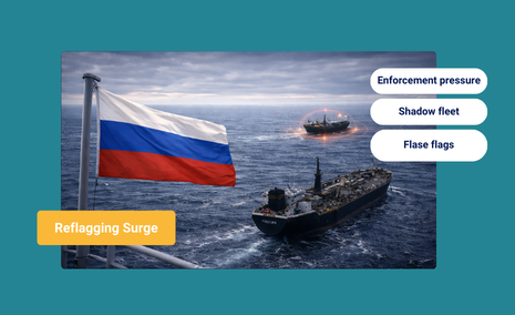
Enforcement Shock Accelerates Dark Fleet Reflagging to Russia


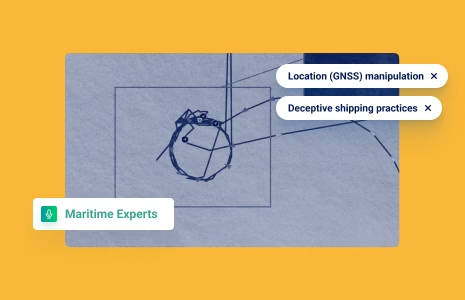
How to Be Proactive in the Location (GNSS) Manipulation Cat-and-Mouse Game
What’s inside?
Location Global Navigation Satellite System (GNSS) manipulation, often referred to as Automatic Identification System (AIS) spoofing, has challenged the maritime industry. This cat-and-mouse game between offenders and tracking technology quickly evolves and is not only frustrating, but also costly (in human resources and financially).
Windward recently integrated advanced deep learning technology into our Location (GNSS) Manipulation Risk model, so you can stay on top of this morphing deceptive shipping practice (DSP). But first, some very brief history…
From Old and Simple to New and Complex
Dror Salzman started noticing strange vessel behavior in 2021. Windward’s Product Manager and other members of the Windward team started seeing vessel anomalies, often near the Caribbean Sea.
A 2022 article in The New York Times featuring Windward’s expertise described the initial investigation:
Dror “first spotted a civilian ship transmitting a fake voyage early last year, in Venezuela. A tanker called Berlina had been transmitting a strange drifting pattern for several weeks just outside the South American country’s waters.
The idle movements did not make sense – keeping such a vessel at sea costs tens of thousands of dollars each day. Berlina’s movement also defied basic physics, he said. The ship, at one point, turned its 270-meter body 180 degrees in only a few minutes; its perfectly straight drift defied the effects of the tide and the Earth’s rotation.”
That ship was actually loading oil in the eastern Venezuelan port of José.
Those were the good ole days for location (GNSS) manipulation, at least for organizations on the detection side. Illicit actors were still displaying patterns that were obviously fake.

3,000 unique location (GNSS) manipulation cases involving nearly 1,000 vessels, primarily in the Persian Gulf and West Africa. Why? Illicit actors attempting to smuggle sanctioned oil want to broadcast a route that bypasses other oil-rich countries, for cover.
But this DSP could also be used for arms smuggling, human trafficking, and illegal, unreported, and unregulated (IUU) fishing.
Today, according to Dror, “Some location (GNSS) manipulation patterns look extremely real. Most experts would think they are real.”
Why Should You Care About AIS Spoofing?
Governments, law enforcement agencies, and coast guards obviously don’t want illicit actors entering their exclusive economic zones (EEZs) with sanctioned oil, or illegal weapons. Traders and shippers should be aware that the EU’s 11th sanctions package made location (GNSS) manipulation a main behavioral target.
The Quint-Seal Compliance Note also spotlighted AIS manipulation.
The Industry’s FIRST Deep Learning Model for Location (GNSS) Manipulation Tracking
Windward’s AI-powered technology for detecting location (GNSS) manipulation has six predefined, patented typologies. This was and is the best in the industry, but it kept our detection capabilities reactive, when the dynamic nature of deceptive shipping practices requires stakeholders to be proactive.
A deep learning model was recently introduced to Windward’s GNSS spoofing solution. Deep learning is NOT confined to predefined typologies. It learns from vast amounts of historical data, which Windward has been meticulously tagging since 2021. This wealth of data gives Windward a unique edge, enabling our model to identify patterns and anomalies that other solutions cannot.
Tal Yogev, a Windward data scientist who is leading the development of this new technology, explains the difficulties involved. “Transitioning from a typology-based model to a deep learning model posed significant challenges. The model needed high-quality data to differentiate between real and fake signals, which required meticulous data cleaning and labeling.”
Windward’s model uses a neural network architecture common for AI solutions, but unique to Windward, according to Tal. “This architecture, developed in collaboration with domain experts, allows the model to detect subtle nuances that are invisible to the naked eye.”
But You Can’t Just Rely on Technology…
Dror describes Ruth Ben Chaim, a data analyst at Windward, “as the most expert person in this domain in the entire world. She’s seen the most cases.”
Ruth and her team are the “humans in the loop” charged with checking every instance of location (GNSS) manipulation flagged by Windward’s Maritime AI™ platform, or raised by our customers and industry stakeholders.
Each flagged action undergoes rigorous manual verification. Ruth and her team accurately label manipulations, a critical factor for the model’s accuracy. Her expertise ensures that the data fed into the model is precise, reducing the risk of false positives.
“The manipulations are getting harder and smarter,” says Ruth. The ‘flower-shaped’ ones (ridiculous patterns) are easy. As the offenders get better, it’s harder to detect. Each check takes between 10 minutes to half an hour, depending on the difficulty of the case. Saying ‘yes’ or ‘no’ is easier than saying when the manipulation started and ended, which is critical for the deep learning model to keep training itself on accurate data.”
What is the “Holy Grail” for Spoofing Detection???
Stay tuned, we will soon publish a more in-depth interview with Dror, Tal, and Ruth on location (GNSS) manipulation that will look at issues such as the problem with the “out of footprint” typology, the importance of high quality label data, and the future roadmap for Windward’s Location (GNSS) Manipulation model, which Tal called “the holy grail”…
We also have an AIS spoofing white paper coming that will offer a deeper dive.
I Want to See More Now
Everything you need to know about Maritime AI™ directly to your LinkedIn
Trending
- The EU’s 18th Sanctions Package Lookback Started. Trading Russian Products? You're At Risk. Nov 24, 2025
- Tanker Freight Rates Hit Five-Year High Amid Russian Oil Sanctions Shake-Out Nov 6, 2025
- Sanctioned, Stateless, and Still Sailing: Expert Insights from the Frontlines of Maritime Sanctions Nov 3, 2025
Explore more

EU-Owned Tankers Ship 35% of Russia’s Oil in January Ahead of EU Ban
EU Moves to End Maritime Workarounds EU-owned tankers shipped 35% of Russian oil in January, ahead of a planned “full maritime services ban” that will end Western marine service providers’ ability to transport crude sold to fund the Kremlin’s war in Ukraine. The ban was announced on February 6 by European Commission President Ursula von...
Read more

Venezuela’s Oil Policy Shift and the Rising Maritime Risk Landscape
At a Glance How Venezuela’s Oil Reform Is Changing Maritime Risk In late January 2026, Venezuela’s legislature approved sweeping reforms to the nation’s oil laws, effectively opening its state-dominated energy sector to private and foreign investment in a dramatic policy shift after more than two decades of socialist control. This overhaul aims to attract capital...
Read more
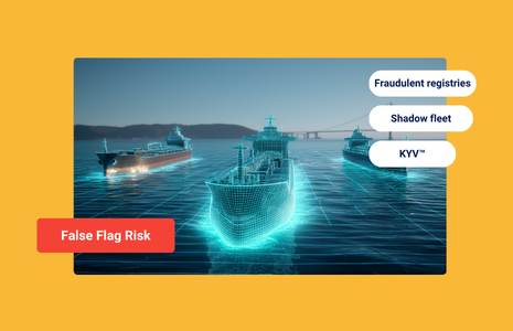
False Flags and Fraudulent Registries: The Hidden Threat to Global Shipping
At a Glance The Surge in False Flags False flagging has shifted from a niche compliance issue to a systemic risk in global shipping. As sanctions enforcement expands, an increasing number of vessels are operating without legitimate nationality while continuing to trade internationally. Rather than sailing under recognized flag states, many tankers now claim registration...
Read more
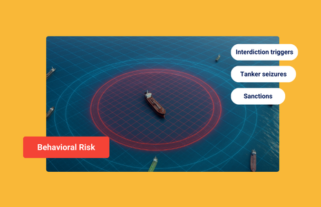
Maritime Compliance in 2026: Why Behavioral Risk Is the New Red Flag
At a Glance Strikes, Seizures, and Sanctions: Maritime Risk Heats Up in 2026 In early 2026, maritime enforcement crossed a threshold. Under Operation Southern Spear, the U.S. has launched a sustained campaign of global interdictions, extending far beyond Venezuela’s proximate waters and targeting tankers for deceptive shipping practices and sanctions evasion. U.S. forces recently seized...
Read more

What Maduro’s Fall and the EU’s 18th Sanctions Package Mean for Maritime Compliance
At a Glance Navigating the Convergence of Sanctions and Geopolitics The maritime industry has just entered one of its most volatile periods in decades. On January 3, 2026, the global energy landscape was upended by Operation Absolute Resolve. Following a coordinated strike involving over 150 aircraft, the United States successfully took the Venezuelan leader, Nicolás...
Read more