


October 20, 2026
From Dark Voyages to Defensible Claims: How Marine Insurers Are Closing the Evidence Gap


From Dark Voyages to Defensible Claims: How Marine Insurers Are Closing the Evidence Gap

What’s inside?
At a Glance
- Marine insurance claims teams own the loss investigation and the pay-or-reject decision, but their work now depends on forensic reconstruction of vessel activity in periods when AIS records are compromised or missing.
- The AIS record claims teams have historically relied on to establish what a vessel did before, during, and after a loss has been structurally compromised by GPS jamming, with 124,235 vessels affected globally in Q3 2026 and more than 3.35 million false ship-to-ship meetings recorded since Operation Epic Fury began.
- More than half of September 2026 Hormuz transits were dark convoy passages, meaning the majority of traffic through the corridor now generates no self-reported position record.
- Vessels stranded during the Hormuz closure earlier in 2026 have created a new claims environment, with constructive total loss questions, loss of hire claims, and dark period disputes all requiring reconstruction of what actually happened.
- The Court of Appeal ruling in the CATALAN SEA on May 22, 2026 clarified that the threshold for invoking sanctions clauses is a reasonable judgment of a real risk of sanctions, signaling how courts are calibrating the evidential threshold for sanctions-related decisions.
- Claims decisions based on AIS position alone are increasingly vulnerable to challenge when the AIS record operated in jamming-affected regions or included dark periods.
- All-source intelligence combines satellite imagery, radio frequency detection, behavioral intelligence, and any other source necessary to provide the sensor-verified activity record that claims investigations need to establish what a vessel actually did during a contested period.
Claims Teams Are Now Reconstructing, Not Just Investigating
Claims teams in marine insurance own two things: the loss investigation and the pay-or-reject decision. In the pre-2022 environment, both were largely a matter of establishing what happened, verifying that the loss fell within the policy’s coverage, and processing accordingly. AIS records, cargo documentation, and standard loss adjustment supported the investigation without requiring extensive forensic reconstruction.

In 2026, that has shifted. Claims investigations increasingly begin with the question of what actually happened during a defined period, because the AIS record from that period may not answer it reliably. Vessels operating in jamming-affected regions may have broadcast injected coordinates rather than actual positions. Vessels that were dark did not broadcast at all. Reconstructing the actual voyage is the analytical work claims teams now do before the pay-or-reject decision becomes possible.
Four operational realities define the environment.
1. The AIS Reliability Problem at Claims
The historical premise of AIS-based loss investigation is that AIS records reflect what vessels actually did. That premise has been under pressure since 2022 and has become materially unreliable in 2026 for specific regions and activity types.
Windward’s Q3 2026 Maritime Risk Report tracked 124,235 vessels affected by GPS jamming at least once globally, with jamming running at an average of 5,131 incidents per day across the quarter, broadly unchanged from Q2. Since Operation Epic Fury began in February 2026, Windward has recorded more than 3.35 million false ship-to-ship meetings, in which injected positioning coordinates made vessels appear to rendezvous when no meeting took place. Jamming is persistent in the Middle East Gulf, the Black Sea, the Mediterranean, and other high-exposure regions, which are exactly where marine insurance claims from the current environment concentrate.
For a claims team investigating a loss involving a vessel that operated in a jamming-affected region during the relevant period, the AIS record includes potentially injected coordinates, potentially missing intervals, and potentially false event records. A vessel that appears to have transited a specific route may have taken a different one. A vessel that appears to have made no port calls may have made calls the AIS record does not show.
The compliance evidence base that claims rely on to establish whether the vessel was engaged in sanctionable activity at the time of loss depends on this AIS record being accurate. When it is not, the compliance evidence base becomes vulnerable to challenge. When the evidence base is vulnerable, the claims decision made against it is also vulnerable.
2. The Hormuz Stranded Vessel Environment
The operational environment produced by the Hormuz closure earlier in 2026 has created a distinct claims scenario many teams are still working through.
Following the outbreak of the Iran conflict on February 28, 2026, and Operation Epic Fury the same day, vessel traffic through the Strait of Hormuz collapsed. February recorded approximately 3,750 AIS-visible monthly transits. March fell to 450. Even after a partial recovery, June remained approximately 83% below pre-conflict baselines.
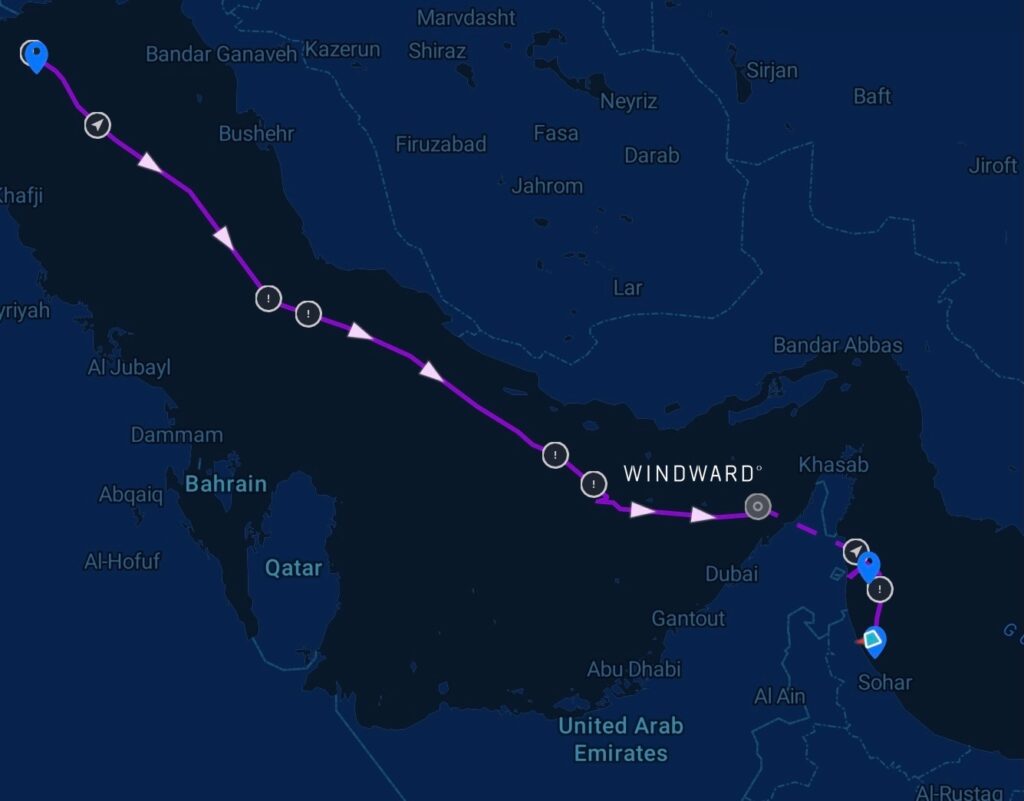
Traffic briefly rebounded following the June 17 Memorandum of Understanding between Iran and the U.S. and the formal lifting of the blockade on June 18, before Iran reimposed closure on June 20 and reinstated the Persian Gulf Strait Authority toll and clearance system. Traffic has not recovered since. Windward counted 55 AIS-visible transits between September 16 and 23, approximately 94% below pre-war levels, and attacks on shipping in the corridor continued through the quarter.
For claims teams, the Hormuz situation has generated several specific claim types.
Constructive Total Loss Questions
Many war risk clauses set a 12-month detention period before a constructive total loss can be declared, with some policies operating on a 6-month period. Vessels stranded during the closure raise the question of whether extended detention in the Middle East Gulf may qualify for constructive total loss even without sustaining physical damage. Investigating these claims requires establishing the specific detention timeline, the operational conditions during the detention, and whether the vessel is genuinely constructively total loss or eventually recoverable.
Loss Of Hire Claims
Vessels unable to complete voyages during the closure have generated loss of hire claims, though not every loss of hire policy responds without physical loss or damage. Claims teams are working through the specific policy language and operational circumstances that determine whether coverage applies.
Dark Period Disputes
Many vessels transiting the Hormuz war-risk zone did so with AIS switched off, in some cases with owner and flag state consent for safety and security reasons. This is now the majority practice rather than the exception. Windward estimates that dark convoy passages accounted for 47% of Hormuz traffic in August 2026 and 52% in September. When a loss occurred during a dark period, or when the vessel’s activity during a dark period is contested by the charterer, cargo interest, or insurer, the investigation depends on reconstructing what happened during a window when the vessel was not self-reporting.
Each of these claim types requires forensic work that goes beyond AIS records.
3. The Legal Environment Is Calibrating
The English Court of Appeal ruling in Tonzip Maritime (Singapore) Pte Ltd v 2 Rivers Pte Ltd, The CATALAN SEA, handed down on May 22, 2026, clarified how courts are approaching contested contractual terms in the current environment. The Court held that the threshold for invoking sanctions clauses is a reasonable judgment of a real risk of sanctions, not proof that a breach would probably occur.
The case is a charterparty dispute, not directly an insurance case, but the ruling has implications for how sanctions clauses in insurance policies will be interpreted. The lower evidential threshold gives insurers, owners, and their counterparties more flexibility to invoke sanctions clauses to decline coverage, refuse claims, or terminate policies. It also raises the standard for the underlying evidential basis. A sanctions clause invoked under the “reasonable judgment of real risk” threshold still requires evidence sufficient to support that judgment.
For claims teams, this means the evidence base supporting a claims decision, particularly a decision to decline a claim on sanctions-related grounds, needs to be defensible in a legal environment actively calibrating the standards. A claims decision made on AIS position data from a jamming-affected region may be vulnerable to challenge if the AIS record itself is not defensible. A claims decision made on multi-sensor reconstruction that verifies actual vessel activity is materially more defensible.
The OFAC-OFSI Comparative Overview published on June 23, 2026 documents the differences between U.S. and UK sanctions frameworks across ownership calculations, terminology, jurisdictional reach, and enforcement mechanics. Claims teams operating across multiple sanctions regimes need to structure their evidence base to satisfy the more demanding standard in each regime. Both OFAC and OFSI apply strict liability for civil penalties, meaning claims decisions that inadvertently touch sanctioned activity can create enforcement exposure even without knowledge that the transaction was prohibited.
4. What Forensic Reconstruction Actually Requires
Reconstructing vessel activity during a contested period is an all-source intelligence exercise. It draws on whatever independent evidence exists for that vessel in that window, selected for what the specific question requires rather than from a fixed list of feeds. What those sources have in common is that none of them depends on the vessel’s own broadcasts.
Satellite Imagery
Synthetic Aperture Radar (SAR) provides vessel detection regardless of weather and lighting conditions, capable of confirming vessel presence at specific locations when AIS is off or unreliable. Electro-optical (EO) imagery provides visual confirmation of vessel activity, including ship-to-ship transfers, port calls, and vessel proximity to other assets. High-resolution EO can capture visual detail down to 30 centimeters, supporting vessel identification through distinguishing features.
Radio Frequency (RF) Detection
Vessels emit RF signals from their operational systems even when AIS is off. RF detection provides an independent positioning signal that can confirm or contradict a vessel’s stated location during a period when it was not broadcasting AIS.
Documentary and Commercial Records
Terminal and berth records, charter documentation, cargo and customs paperwork, class and registry entries, and port state control inspection histories establish what was declared, by whom, and when. None of this is sensor data, and none of it arrives as a feed. It is often the most direct evidence available of what a vessel was contracted to do during the period in question, and in a dispute it is the material counsel will reach for first.
Behavioral Pattern Analysis
A vessel’s operational history across multiple voyages, ownership profile, flag history, and comparative behavior against similar vessels of similar type provide analytical context. A vessel that has gone dark in circumstances consistent with a legitimate historical operational pattern carries different risk than a vessel that has gone dark in an anomalous manner.
All-Source Intelligence Fusion
When these sources are combined, they produce a reconstructed picture of what the vessel actually did during the contested period, with the specific evidence supporting each conclusion identified and weighted.
Those four evidence types are the ones that come up most often. They are not the limit. A reconstruction reaches for whatever evidence exists for that vessel in that window, and what exists varies case by case: device presence signals in a remote anchorage, camera identification at a chokepoint transit, a bunkering record, an inspection report, the insured party’s own voyage documentation. Any of them can be the piece that settles the question.
This means that the evidence a case needs is rarely known before the case opens. A reconstruction built only from sources that happen to be connected in advance will answer the question those sources can answer, and go quiet on the one that matters.
Imagery changes what can be settled rather than argued. A SAR detection placing a vessel at a specific position at a specific time is not an inference drawn from a gap in the record. It is an observation, and it closes questions that previously stayed open through an entire dispute.
A reconstruction will not produce certainty on every point. What it produces is a step-by-step, timestamped account of the contested period, with the evidence behind each step identified and a stated level of confidence attached to it. Some steps are confirmed by direct observation. Others are assessed from behavior and context, and are presented that way.
That is what makes a decision defensible. Not that every question was answered, but that the basis for each conclusion is documented, weighted, and available for counsel, arbitrators, or regulators to examine.
How Windward Supports Marine Insurance Claims Teams
Windward’s all-source operational intelligence platform delivers the reconstruction that claims investigations increasingly require. It fuses AIS with satellite imagery, RF detection, ownership records, sanctions data, behavioral history, and whatever else the case calls for, including documentation the claims team already holds, into a single operational picture. The result establishes what a vessel actually did during a defined period, independently of what it broadcast, and gives the file a defensible evidence base for whether the vessel was engaged in sanctionable or non-compliant activity at the time of loss.
Claims teams with internal analytical capacity use it directly, running the reconstruction against the specific facts of the case in front of them.
Where a case requires expert-led investigation, the Maritime Intelligence Operations Center (MIOC) provides analyst services on behalf of the claims team. Windward’s maritime intelligence experts conduct the dark period reconstruction, apply the analytical methodology to the specific facts of the case, and produce a documented report suitable for legal or arbitration proceedings. Each MIOC report details the analytical approach, the sensor inputs relied on, the evidential basis for every finding, and the confidence level assigned to each conclusion.
For claims teams handling Hormuz-related constructive total loss questions, loss of hire claims, dark period disputes, or standard cargo and hull claims involving vessels that operated in jamming-affected regions, the operational fit is direct.
Where This Is Heading
The environment that has emerged across 2026 is not returning to the pre-2022 baseline. GPS jamming has plateaued rather than receded, holding at roughly 5,131 incidents per day through Q3, and will continue while the Iran conflict remains unresolved. Vessels stranded during the Hormuz closure will continue to produce constructive total loss and loss of hire claims. Dark period disputes will continue as long as vessels transit war-risk zones with AIS switched off. Sanctions-related claims decisions will continue to be tested against evolving case law and enforcement standards.
Claims teams who have adapted their investigation methodology to include multi-sensor forensic reconstruction are producing defensible decisions in this environment. Claims teams still relying on AIS records alone are producing decisions that may not hold up under legal or regulatory review.
The gap between the two is measurable in claim defensibility, litigation exposure, and reserving accuracy. It will continue to widen.
Written by Maya Romi, Windward Senior Content Manager. Reviewed by Angela Freeth, Product Marketing Manager, Commercial.
Trending
- The EU’s 18th Sanctions Package Lookback Started. Trading Russian Products? You're At Risk. Nov 24, 2025
- Tanker Freight Rates Hit Five-Year High Amid Russian Oil Sanctions Shake-Out Nov 6, 2025
- Sanctioned, Stateless, and Still Sailing: Expert Insights from the Frontlines of Maritime Sanctions Nov 3, 2025
Explore more

Security Worries Reshape Russia’s September Oil Exports
At a Glance Russia Holds Crude Exports Steady as Falsely Flagged Tankers Disappear Russia shipped 142.7 million barrels of crude, clean petroleum products (CPP) in September, according to Windward analysis using Vortexa data. Crude made up 110.4 million barrels, a pace of some 3.7 million barrels per day, broadly level with the prior month, which...
Read more

War-Diverted Traffic Is Reshaping NEOM’s Port. What Happens If Hormuz Reopens?
At a Glance A Port Not Behaving Like the Megacity It Was Built For By any reasonable metric, 2026 should have been a difficult year for the Port of NEOM. The megacity it was built to serve has been through a visible contraction. The Public Investment Fund wrote down the giga-projects by $8 billion at...
Read more

Forty-Five Shadow Fleet Tankers Link to a Single Hong Kong Nominee
At a Glance One Nominee, Forty-Five Companies, Forty-Five Tankers Windward’s visual link analysis has identified 45 Russia-trading shadow fleet tankers connected through 45 single-ship Hong Kong companies to one beneficial owner. All but three share 19 different ISM managers with addresses in the same industrial cluster in the Azerbaijani city of Sumqayit. 42 of the...
Read more

What Is the Shadow Fleet, and Why Is It So Hard to Count?
At a Glance There Is No Official Shadow Fleet List The shadow fleet, also called the dark fleet, refers to tankers and support vessels that rely on deceptive shipping practices to move sanctioned or high-risk commodities while concealing their true origin, ownership, or destination. That definition is broadly recognized in practice. It has no standing...
Read more