


August 2, 2026
Marine Insurance in 2026: The Coverage Process in a Changed Operating Environment


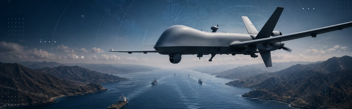
Unmanned Aerial Vehicle (UAV)
What Is an Unmanned Aerial Vehicle (UAV)?
An Unmanned Aerial Vehicle (UAV) is an aircraft that operates without a pilot on board, controlled either remotely by a human operator or autonomously through onboard systems. UAVs range from small inspection quadcopters to long-endurance fixed-wing platforms used for intelligence, surveillance, and reconnaissance (ISR). The term is often used interchangeably with “drone,” though “Unmanned Aircraft System (UAS)” is the broader regulatory term covering the aircraft, ground control station, and data link.
Across maritime, defense, and commercial operations, UAVs extend the sensing perimeter of ports, naval units, and offshore assets. They do so by supporting vessel surveillance, persistent ISR, dark activity investigation, emissions monitoring, search and rescue, and inspection of platforms and pipelines.
Key Takeaways
- An Unmanned Aerial Vehicle (UAV) is a pilotless aircraft flown remotely or autonomously, used across commercial, defense, and government operations.
- UAV, drone, and UAS are related but not identical — UAS refers to the full system (aircraft, control station, data link), while UAV refers specifically to the airframe.
- In maritime operations, UAVs extend visual and sensor range beyond the bridge wing, supporting port security, emissions monitoring, and at-sea surveillance of vessels of interest.
- In defense, UAVs perform persistent ISR, target acquisition, and strike missions; naval forces increasingly deploy them from surface combatants and forward operating bases.
- In commercial operations, UAVs inspect offshore platforms, subsea pipeline corridors, wind turbines, and flare stacks, replacing dangerous rope-access and helicopter inspections.
- UAV data is most useful when fused with other sources — AIS, satellite imagery, RF intelligence — rather than treated as a standalone feed.
The History of Unmanned Aerial Vehicles (UAVs)
The idea of an unmanned aircraft predates powered flight itself, but the modern UAV emerged from military experimentation in the early 20th century and matured into a mainstream defense, commercial, and maritime tool over the following hundred years.
Early Experiments (1910s–1940s)
The first recognizable UAVs were radio-controlled target drones developed during and after the First World War. The Aerial Target, a British radio-controlled aircraft designed by Dr Archibald Low, became the first drone to fly under control when it was tested in March 1917.

By the Second World War, target drones such as the Radioplane OQ-2 were produced in the thousands for U.S. anti-aircraft gunnery training.

Cold War Reconnaissance (1950s–1980s)
UAVs found their first sustained operational role as reconnaissance platforms. First flown in 1962, the reconnaissance Firebee saw extensive service in Southeast Asia during the Vietnam War. The Tadiran Mastiff and the IAI Scout, the first Israeli battlefield UAVs, introduced in the 1970s, proved that small, real-time-video UAVs could deliver tactical intelligence at a scale that crewed aircraft could not, shaping subsequent Western tactical UAV development, most directly the U.S. Navy’s Pioneer, which became the U.S. military’s first widely deployed tactical UAV.

The Predator Era (1990s–2000s)
The General Atomics RQ-1 Predator entered U.S. service in 1995 and became the platform that normalized armed, long-endurance UAVs in defense operations. Its armed variant, the MQ-1, conducted the first UAV strike missions in the early 2000s and established the medium-altitude, long-endurance (MALE) category as a core ISR capability for modern militaries.

Maritime and Naval Adoption (2000s–2010s)
Naval forces began deploying UAVs from surface combatants and shore bases for maritime patrol, fisheries enforcement, and anti-piracy operations during this period. The U.S. Navy’s MQ-8 Fire Scout — a vertical-takeoff UAV deployed from littoral combat ships — marked the shift toward UAVs becoming standard maritime ISR equipment rather than a specialist asset, with operational deployment continuing on the larger MQ-8C variant.

Commercial and Consumer Normalization (2010s–present)
The release of the DJI Phantom 1 in 2013 brought UAVs into commercial inspection, media, agriculture, and energy markets, with civil aviation authorities building dedicated UAS regulatory frameworks in parallel. Recent conflicts have also demonstrated that low-cost UAVs can now hold high-value commercial and naval vessels at risk: from late 2023, Houthis launched attacks, using drones, missiles, and small boats on commercial shipping and naval warships in the Red Sea, one of the world’s most important waterways for international commerce, with hundreds of vessels targeted in the months that followed.

The Difference Between UAVs, Drones, and UASs
The three terms are used loosely in news coverage but carry specific meanings in operational and regulatory contexts:
| Term | What It Refers To | Typical Use Context |
| UAV (Unmanned Aerial Vehicle) | The aircraft itself — airframes, engines, and onboard sensors. Pilotless, controlled either remotely or autonomously. | Defense, engineering, and operational discussions where the focus is on the platform and its capabilities. |
| UAS (Unmanned Aircraft System) | The full system of the aircraft, the ground control station, the operator, and the data link connecting them. | Civil aviation regulation, procurement documents, and certification frameworks (FAA, EASA, ICAO). |
| Drone | An informal, broad term for any unmanned aircraft, from consumer quadcopters to long-endurance military platforms. | Media coverage, consumer markets. |
In practice, “drone” covers the widest range and is what most non-specialists will say. “UAV” is the right term when the focus is on the aircraft itself. “UAS” is the term to reach for when the operator, control station, and data link are part of what’s being discussed, which is most regulatory, procurement, and operational planning contexts.
Types of UAVs
UAVs are typically classified by airframe configuration, size, and endurance, with different categories suited to different maritime, defense, and commercial missions. The most common groupings used across the industry are:
- Multirotor UAVs: Helicopter-style aircraft with four or more rotors, capable of vertical takeoff and hovering. Common in port security, vessel hull inspection, and offshore platform surveys, where the UAV needs to hold position rather than cover ground.
- Fixed-wing UAVs: Airplane-style aircraft with rigid wings, offering long endurance and range but unable to hover. Used for maritime patrol, fisheries enforcement, and pipeline surveys across large distances.
- VTOL fixed-wing UAVs: Hybrid platforms that take off vertically and transition to fixed-wing flight for cruise. Well suited to shipboard operations and remote sites, and the U.S. Navy’s MQ-8 Fire Scout is the best-known maritime example.
- Single-rotor UAVs: Helicopter-style platforms with a single main rotor, capable of heavier payloads and longer flight than multirotors. More expensive and mechanically demanding, so less common outside specialist roles.
UAVs are also often categorized by endurance and altitude:
- Tactical UAVs: Short to medium endurance (a few hours), typically operating below 10,000 feet to support a specific unit, vessel, or site.
- MALE (Medium-Altitude Long-Endurance): 24+ hours on station above 15,000 feet, supporting theater-level ISR. The General Atomics MQ-9 Reaper is the most widely operated example.
- HALE (High-Altitude Long-Endurance): Strategic platforms operating above 50,000 feet for extended reconnaissance. The Northrop Grumman RQ-4 Global Hawk is the best-known example.
Challenges and Limitations of UAVs
For all their operational advantages, UAVs come with real constraints that shape where and how they can be deployed:
- Weather sensitivity: Most UAVs cannot operate safely in high winds, heavy precipitation, or icing, which is a meaningful constraint in maritime environments where sea state and weather windows often dictate when a UAV can fly.
- Endurance and range: Outside long-endurance military platforms, most commercial and tactical UAVs have flight times measured in minutes to a few hours, limiting their useful coverage area.
- Communications and GPS vulnerability: UAVs rely on data links and GPS, both of which can be jammed or spoofed in contested environments. GPS denial has become a central concern for defense UAV operators.
- Regulatory restrictions: Civil aviation authorities tightly restrict beyond-visual-line-of-sight (BVLOS) operations, night flying, and flight over populated areas, with specific waivers required for most long-range maritime surveys.
- Payload trade-offs: Carrying heavier sensors, such as high-resolution EO/IR turrets, SAR, or methane detection equipment, reduces flight time and may require larger, more expensive airframes.
- Counter-UAV risk: UAVs operating in contested maritime environments increasingly face jamming, kinetic intercept, and drone-on-drone engagement, limiting where and how they can be used in active conflict zones.
- Data fusion bottlenecks: UAV imagery is only as useful as the analyst’s ability to correlate it with AIS, satellite, and behavioral intelligence. Without integration, UAV feeds produce sightings rather than decisions.
How Governments and Navies Use UAVs
Governments and naval forces use UAVs to support maritime surveillance, ISR operations, border security, infrastructure protection, and search-and-rescue missions across large maritime areas.
Because UAVs can operate for extended periods without placing crews at risk, they provide persistent operational awareness in environments where deploying manned aircraft may be costly, complex, or operationally sensitive.
Maritime UAVs are frequently deployed to monitor shipping lanes, track suspicious vessel activity, support interdiction operations, and observe high-risk regions such as the Red Sea and Persian Gulf. Their ability to rapidly collect and transmit real-time intelligence makes them valuable tools for maritime domain awareness and operational decision-making.
Modern government UAV operations are increasingly integrated into broader intelligence ecosystems that combine aerial surveillance with satellite imagery, AIS vessel tracking, radar systems, RF intelligence, and maritime analytics platforms.
What are the operational benefits of UAV monitoring in high-risk maritime zones?
UAVs let governments and navies maintain real-time awareness in contested or sanctions-affected waters, such as the Red Sea, the Black Sea, and the Strait of Hormuz, without exposing aircrew or surface vessels to threats. A long-endurance UAV can loiter for hours over a vessel of interest while ships stay outside threat range, producing continuous coverage where satellite revisit or short crewed sorties would be the only alternative.
How are UAVs used in maritime surveillance and ISR operations?
UAVs provide persistent aerial surveillance, reconnaissance, and monitoring capabilities that support maritime domain awareness, border security, naval operations, and threat detection. It is most useful when fused with AIS, satellite, and behavioral data rather than read in isolation.
What advantages do UAVs provide over manned reconnaissance aircraft?
UAVs provide three core advantages over manned reconnaissance aircraft: endurance, cost, and acceptable loss. Long-endurance UAVs can stay on station for 20–40 hours, far beyond the limits of crewed platforms, at a fraction of the cost per flight hour, and their loss in a contested environment carries no risk to aircrew. The trade-off is reduced payload, slower speeds, and vulnerability to capable air defenses, which is why crewed and unmanned platforms typically operate together rather than as substitutes.
How do governments use UAVs for maritime border security?
Governments use UAVs for maritime border security by monitoring coastal areas, detecting suspicious vessel activity, supporting interdiction operations, and improving maritime situational awareness. UAVs are particularly effective for monitoring large maritime areas with limited resources, since one long-endurance platform can cover hundreds of nautical miles in a single sortie.
How Commercial Maritime Organizations Use UAVs
For the commercial side of maritime, UAVs are a source of independent visual evidence that supports financial and risk decisions. A sanctions compliance officer investigating a suspicious ship-to-ship transfer wants imagery to confirm what is actually happening on the water; an underwriter pricing a hull policy wants confirmation of vessel condition; a claims investigator after a spill wants overhead footage of the incident scene. UAV imagery typically reaches commercial users through third-party data providers, port authority feeds, or coast guard sources rather than direct commissioning.
How are UAVs used in commercial maritime operations?
Commercial operators use UAVs for infrastructure inspection, environmental monitoring, port and terminal security, offshore operations, pre-underwriting due diligence, claims investigation, and sanctions and trade compliance evidence for operational awareness. Most commercial UAV use is event-driven rather than continuous — a UAV pass is commissioned or sourced when a specific question needs to be answered. The exception is port and terminal security, where some operators maintain tethered or scheduled UAV coverage as a routine perimeter measure.
Can UAVs improve offshore platform and port security monitoring?
Yes. UAVs can provide rapid aerial visibility over ports, offshore assets, and restricted areas without requiring manned aircraft deployment. The biggest gains come from pairing UAV feeds with radar and AIS, so security operators investigate confirmed anomalies rather than every contact.
How do shipping companies use UAVs for infrastructure inspection?
Shipping companies use UAVs to inspect hulls, cranes, offshore rigs, pipelines, storage facilities, and other maritime infrastructure more effectively and safely. For example, a UAV survey of a bulk carrier’s hull can identify corrosion, coating failures, and damage in hours rather than the days a rope-access inspection would require.
How UAVs Support Maritime Intelligence
Modern UAVs have evolved beyond simple aerial surveillance platforms. In maritime environments, they function as mobile intelligence collection systems that help governments, navies, and commercial operators maintain operational awareness across large and often difficult-to-monitor areas.
Maritime UAVs can capture electro-optical imagery, infrared and thermal observations, radar data, RF emissions, and live video feeds in real time, enabling operators to maintain real-time awareness across maritime environments.
What makes UAVs particularly valuable in maritime intelligence workflows is their ability to complement other sensor systems rather than operate independently. UAV data is increasingly fused with satellite imagery, AIS vessel tracking, radar systems, RF intelligence, and behavioral analytics platforms to build a more complete operational picture.
For example, satellite imagery may detect unusual vessel behavior or identify a vessel operating in a high-risk area. AIS data may provide declared routing information, while UAVs can then be deployed to visually verify vessel activity, confirm ship-to-ship interactions, monitor infrastructure, or assess conditions on the water in near real time.
This multi-source fusion approach improves attribution, reduces ambiguity, and strengthens maritime domain awareness. Instead of relying on a single data source, analysts can correlate independent observations across multiple systems to better understand vessel behavior and operational risk.
As UAV autonomy and sensor capabilities continue to advance, these systems are becoming increasingly important within modern maritime intelligence ecosystems, supporting faster detection, verification, and operational decision-making across complex maritime environments.
How do UAVs integrate into maritime intelligence and surveillance systems?
UAVs provide airborne sensor data that can be fused with AIS, satellite imagery, RF intelligence, radar, and analytics platforms. The value comes from correlation across sources, not from any single feed.
How do autonomous UAV navigation and detection systems work?
Autonomous UAV systems use onboard navigation software, sensors, GPS, AI-assisted flight management, and obstacle detection technologies to operate with limited operator input.
What types of data can UAVs collect in maritime environments?
UAVs can collect EO imagery, thermal imagery, radar data, RF signals, video feeds, and environmental observations.
How is UAV data fused with satellite imagery, AIS, and RF intelligence?
Multi-source intelligence platforms correlate UAV observations with vessel tracking, imagery, and signal intelligence to improve attribution and operational awareness. The result is a single vessel record that combines what was seen, what was broadcast, and what was inferred, which is what turns a UAV sighting into an actionable decision.
How Unmanned Aerial Vehicles Relate to Windward
UAVs are increasingly integrated into broader maritime intelligence ecosystems that combine satellite imagery, AIS, RF intelligence, behavioral analytics, and operational monitoring platforms.
Windward’s Maritime AI™ platform helps fuse multi-source maritime intelligence into a unified operational picture, enabling governments and maritime organizations to detect anomalies, monitor vessel behavior, and maintain situational awareness across complex maritime environments.
As UAV deployments continue to expand across maritime security, ISR, and commercial operations, integrating airborne intelligence with broader maritime data systems becomes increasingly important for effective decision-making.
Explore more

The Suez Canal
What Is the Suez Canal? The Suez Canal is a 193-kilometer (120-mile) artificial waterway in Egypt that connects the Mediterranean Sea at Port Said to the Red Sea at Suez, providing the only direct maritime route between Europe and Asia without circumnavigating Africa. The canal runs north-to-south across the Isthmus of Suez, crossing several natural...
Read more

Barnacles
What Are Barnacles? Barnacles are small marine crustaceans that permanently cement themselves to hard surfaces underwater, including the hulls, propellers, and sea chests of ships. Once attached, they form rough, calcified colonies that disrupt the smooth flow of water along a vessel’s hull, increasing hydrodynamic drag and forcing the engine to burn more fuel to...
Read more

EMCON (Emissions Control)
What Is EMCON? EMCON, short for emissions control, is the naval discipline of deliberately silencing or restricting a ship, submarine, aircraft, or task force’s electromagnetic emissions to avoid detection. Under EMCON, units shut down or limit radar, radio, AIS, IFF, and other emitters while still receiving outside signals, turning a vessel that is physically present...
Read more

Decision Intelligence
What Is Decision Intelligence? Decision intelligence is the discipline of combining data, analytics, and artificial intelligence to support better human decision-making in complex, high-stakes environments. It goes beyond traditional business intelligence — which focuses on reporting what has happened — by modeling causes, predicting outcomes, and recommending actions, while keeping the human decision-maker in the...
Read more

Territorial Waters
What Are Territorial Waters? Territorial waters are the belt of sea extending up to 12 nautical miles from a coastal state’s baseline, over which that state exercises sovereignty subject to the rules of international law. Within this zone, the coastal state has full legal authority over the water, seabed, subsoil, and airspace above, with the...
Read more