


August 2, 2026
Marine Insurance in 2026: The Coverage Process in a Changed Operating Environment


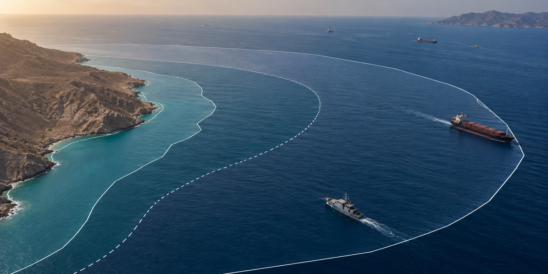
Territorial Waters
What Are Territorial Waters?
Territorial waters are the belt of sea extending up to 12 nautical miles from a coastal state’s baseline, over which that state exercises sovereignty subject to the rules of international law. Within this zone, the coastal state has full legal authority over the water, seabed, subsoil, and airspace above, with the important exception of innocent passage, which allows foreign vessels to transit the territorial sea provided their passage is continuous, expeditious, and not prejudicial to the peace, good order, or security of the coastal state. The 12-nautical-mile limit and the rules that govern it are codified in the United Nations Convention on the Law of the Sea (UNCLOS), specifically Article 3.
Across naval operations, commercial shipping, and maritime intelligence, territorial waters mark one of the most consequential boundaries in maritime law. They define where a coastal state can enforce its own laws against foreign vessels, where naval forces must observe rules of innocent passage, where sanctions and trade controls apply with full force, and where AIS gaps or unusual vessel behavior take on heightened significance for intelligence analysts.
Key Takeaways
- Territorial waters extend up to 12 nautical miles from a coastal state’s baseline and fall under the full sovereignty of that state, subject to international law.
- The modern 12 nautical mile limit emerged from centuries of disputed practice, from the 18th-century cannon-shot rule, to a long-contested three-mile limit, to the UNCLOS framework adopted in 1982.
- Foreign vessels can transit territorial waters under the right of innocent passage, but the rule places real limits on how warships, submarines, and vessels carrying sensitive cargo can operate — limits with direct consequences for naval operations and freedom of navigation.
- Coastal states use their authority in territorial waters to enforce sanctions, fisheries laws, customs and immigration controls, and environmental protections, making this zone central to maritime trade compliance.
- Navies operate under different rules inside territorial waters than on the high seas, with implications for freedom of navigation operations, hot pursuit, and counter-piracy missions.
- For maritime intelligence analysts, vessel behavior at and near territorial water boundaries — AIS gaps, course deviations, loitering, ship-to-ship transfers just outside the limit — is among the highest-value signals of sanctions evasion and illicit activity.
A Brief History of Territorial Waters
The idea that a coastal state has authority over a strip of the sea adjacent to its shore is centuries old, but the specific boundary at which that authority ends has shifted dramatically over time. At first, it was driven by the range of coastal artillery, then by the pressures of 20th-century resource and security politics, and finally by the codification of UNCLOS.
The Cannon-Shot Rule (17th–18th Centuries)
The earliest workable definition of territorial waters came from the Dutch jurist Cornelius van Bynkershoek, whose 1703 treatise De Dominio Maris Dissertatio argued that a coastal state’s authority should extend only as far as its weapons could reach from shore. The principle — captured in the maxim terrae potestas finitur ubi finitur armorum vis (“the power of the land ends where the power of arms ends”) — became known as the cannon-shot rule and reflected the practical reality that a state could only enforce control over waters it could physically defend.
The Three-Mile Limit (18th–20th Centuries)
Over the 18th century, the cannon-shot rule gradually crystallized into a fixed three-nautical-mile limit, corresponding to the typical range of coastal artillery at the time. The United States adopted the three-mile limit in 1793 through a diplomatic note from Secretary of State Thomas Jefferson, and the standard held across most of the maritime world for nearly two centuries. As naval technology advanced and the link to cannon range became meaningless, states began claiming wider belts of territorial sea — six miles, twelve miles, and in some cases far more — creating a patchwork of competing claims that disrupted shipping and triggered diplomatic disputes throughout the 20th century.
The Path to UNCLOS (1958–1982)
The first United Nations Conference on the Law of the Sea (UNCLOS I) in 1958 produced four conventions on maritime law, but failed to settle the breadth of the territorial sea. A second conference in 1960 also collapsed without agreement. The breakthrough came with UNCLOS III, which ran from 1973 to 1982 and involved more than 150 countries negotiating a comprehensive framework for ocean governance. The resulting United Nations Convention on the Law of the Sea was adopted on 10 December 1982 at Montego Bay, Jamaica, and entered into force in 1994 after the 60th state ratified it.
The Modern 12 Nautical Mile Standard
UNCLOS Article 3 established the 12-nautical-mile territorial sea as the universal standard, alongside a 24-nautical-mile contiguous zone and a 200-nautical-mile Exclusive Economic Zone. The 1982 framework remains in force today, with 170 parties as of late 2024, and is widely treated as customary international law — including by non-party states such as the United States, which has formally claimed a 12-nautical-mile territorial sea since 1988 in line with UNCLOS, despite not having ratified the convention.

Territorial Waters in Context: The Maritime Zones
Territorial waters are one of several maritime zones defined under UNCLOS, each carrying different levels of coastal state authority. Understanding where territorial waters end and other zones begin is essential to understanding what a coastal state can and cannot do at sea:
- Internal waters: All waters landward of the baseline, including ports, bays, rivers, and lakes. The coastal state has full sovereignty here, with no right of innocent passage for foreign vessels.
- Territorial sea (0–12 nm): The 12-nautical-mile zone where the coastal state exercises full sovereignty, subject to the right of innocent passage.
- Contiguous zone (12–24 nm): A buffer beyond the territorial sea where the coastal state can enforce customs, immigration, fiscal, and sanitary laws but does not exercise full sovereignty.
- Exclusive Economic Zone (up to 200 nm): A zone where the coastal state has sovereign rights over natural resources — fisheries, oil and gas, seabed minerals — but freedom of navigation and overflight apply.
- Continental shelf: The seabed and subsoil extending beyond the territorial sea, where the coastal state has exclusive rights to seabed resources.
- High seas: All waters beyond 200 nm, open to all states for navigation, overflight, fishing, and scientific research, subject to international law.
The baseline from which all these zones are measured is normally the low-water line along the coast, with special rules for bays, river mouths, and archipelagic states.
Territorial Waters cs. Exclusive Economic Zones
Territorial waters and Exclusive Economic Zones (EEZs) are the two most commonly confused maritime zones, and the difference between them matters operationally — what a coastal state can do, what foreign vessels can do, and what laws apply all change depending on which zone a vessel is in.
| Dimension | Territorial Waters | Exclusive Economic Zone (EEZ) |
| Distance from baseline | Up to 12 nautical miles. | Up to 200 nautical miles. |
| Coastal state authority | Full sovereignty over water, seabed, subsoil, and airspace. | Sovereign rights over natural resources only, such as fisheries, oil and gas, and seabed minerals. |
| Foreign vessel rights | Right of innocent passage, with restrictions. | Full freedom of navigation and overflight. |
| Foreign vessel activities allowed | Continuous and exxepitious transit; no fishing, weapons exercises, or intelligence collection. | Navigation, overflight, laying of submarine cables and pipelines, and other lawful uses of the sea. |
| Enforcement scope | All coastal state laws apply (sanctions, customs, immigration, criminal, and environmental). | Limited to resource-related laws and specific environmental protections. |
| UNCLOS basis | Articles 2-32. | Articles 55-57. |
The simplest way to remember the distinction: in territorial waters, the coastal state controls the space itself, while in the EEZ, the coastal state controls the resources within it.
A foreign warship transiting an EEZ has the same navigational freedom it would have on the high seas. The same warship inside territorial waters is subject to the rules of innocent passage and cannot conduct exercises, intelligence collection, or any non-transit activity without the coastal state’s consent.
This distinction matters for sanctions enforcement, fisheries disputes, freedom of navigation operations, and intelligence work alike. A vessel anchored 50 nautical miles off a sanctioned coast is in that state’s EEZ but not its territorial waters, meaning the coastal state can enforce fishing laws against it but not customs or immigration laws. A vessel anchored 10 nautical miles off the same coast is inside territorial waters and subject to the full reach of the coastal state’s legal authority.
How Innocent Passage Works in Territorial Waters
The right of innocent passage is what distinguishes territorial waters from internal waters, and what makes the global shipping system workable. Without it, a coastal state could close its territorial sea to foreign traffic, severing the world’s busiest trade routes through chokepoints like the Strait of Malacca, the Strait of Hormuz, or the English Channel. UNCLOS Articles 17–26 codify the right and define its limits.
Passage is “innocent” if it is continuous, expeditious, and not prejudicial to the peace, good order, or security of the coastal state. UNCLOS lists 12 categories of activity that make passage non-innocent, including the threat or use of force, weapons exercises, intelligence collection, propaganda, the launching or recovery of aircraft, fishing, and any act of willful pollution.
The right does not extend to internal waters, archipelagic waters in some cases, or the airspace above the territorial sea. Aircraft have no equivalent right of innocent overflight, which is why naval aviation cooperation across territorial waters depends on bilateral or multilateral agreements rather than the default rules of UNCLOS.
How Governments and Navies Use Territorial Waters
For governments and naval forces, territorial waters define the outer edge of sovereign enforcement and the inner edge of broader freedom of navigation. Coastal states use the 12-nautical-mile zone to enforce a wide range of national laws — sanctions, customs, immigration, fisheries, environmental protection, narcotics interdiction — and to assert control over critical infrastructure such as ports, undersea cables, and pipelines. Navies operate under one set of rules inside their own territorial waters, where they exercise full authority, and under quite different rules when transiting or operating in foreign territorial seas, where the right of innocent passage and the limits it imposes shape every aspect of the mission.
The most consequential government activity at the territorial water boundary is freedom of navigation. The United States and other major naval powers regularly conduct Freedom of Navigation Operations (FONOPs) to challenge what they regard as excessive maritime claims by other states. Typically, claims that restrict innocent passage, require prior notification for warships, or extend territorial sea limits beyond UNCLOS allowances. The South China Sea, the Black Sea, and the Strait of Hormuz are among the most active arenas for these operations.
How do navies operate inside foreign territorial waters?
Navies operating inside foreign territorial waters do so under the right of innocent passage, which permits transit but restricts a wide range of operational activities — no weapons exercises, no intelligence collection, no launching or recovering aircraft, no surveying. Submarines must surface and show their flag. Any activity that falls outside innocent passage requires either the coastal state’s consent or a legal basis under another framework, such as a status of forces agreement or wartime belligerent rights.
What are Freedom of Navigation Operations (FONOPs)?
FONOPs are deliberate transits or operations by naval forces designed to challenge maritime claims that exceed what UNCLOS allows. A FONOP might involve a warship transiting through claimed territorial waters without prior notification, or operating in an Exclusive Economic Zone in ways the coastal state contests. The legal point is to prevent excessive claims from hardening into customary practice.
How do coastal states enforce their authority in territorial waters?
Coastal states enforce territorial water authority through coast guards, naval auxiliaries, fisheries patrols, and customs services, supported by radar, AIS monitoring, satellite surveillance, and increasingly UAV patrols. Enforcement actions range from radio warnings and boardings to seizure, arrest, and prosecution under domestic law. Hot pursuit — the right to chase a fleeing vessel from territorial waters into the high seas — is permitted under UNCLOS Article 111, provided the pursuit begins inside the territorial sea or contiguous zone and continues without interruption.
How does the right of hot pursuit work?
Hot pursuit allows a coastal state’s authorities to continue chasing a foreign vessel beyond the territorial sea into the high seas when the vessel is suspected of violating the coastal state’s laws inside the zone. The pursuit must begin while the vessel is still in internal waters, the territorial sea, or the contiguous zone, must be continuous, and must end as soon as the vessel enters another state’s territorial sea. It is the legal mechanism that allows coastal states to pursue smugglers, illegal fishers, and sanctions evaders who try to reach international waters.
How Commercial Maritime Organizations Engage with Territorial Waters
For commercial maritime organizations, territorial waters are where the legal and reputational risk of a voyage is highest. A vessel inside a coastal state’s territorial waters is subject to that state’s full legal authority, which means sanctions enforcement, customs inspection, port state control, and criminal jurisdiction all apply. A vessel that strays into territorial waters where it shouldn’t be — whether through navigational error, evasive routing, or deliberate sanctions-busting behavior — can trigger immediate consequences ranging from detention to insurance cover voidance.
Underwriters and compliance teams pay close attention to territorial water boundaries when assessing voyage risk. Routing through or near the territorial waters of sanctioned states, conflict zones, or jurisdictions with aggressive enforcement records changes the risk calculus on a hull, cargo, or P&I policy. The same applies to behavior just outside territorial waters, including ship-to-ship transfers, loitering, or AIS gaps in adjacent international waters, which often signal an attempt to receive cargo from inside a restricted zone without formally entering it.
What rules apply when commercial vessels enter territorial waters?
When a commercial vessel enters another state’s territorial waters, it becomes subject to the full body of that state’s law, in addition to the rules of innocent passage under UNCLOS. The flag state retains some jurisdiction over the vessel and crew, but the coastal state has primary enforcement authority for incidents that occur in its territorial sea. Most commercial transits proceed under innocent passage without active engagement, but the legal framework changes the moment the coastal state decides to act.
How do territorial waters affect shipping route planning?
Territorial waters affect shipping route planning by determining which laws and inspection regimes apply along a voyage, where a vessel can and cannot operate freely, and where prior notifications or permits may be required. Operators routing through chokepoints such as the Strait of Hormuz, the Bab el-Mandeb, or the Taiwan Strait need to account for which states’ territorial waters they will transit, what restrictions those states impose, and what political and military risks apply at each segment.
How can territorial waters influence port access and customs enforcement?
Territorial waters are the legal gateway to port access, and a coastal state’s authority over its 12-nautical-mile zone allows it to inspect, divert, or refuse entry to vessels before they reach the dock. Port state control inspections typically begin at or near the territorial water boundary, with customs, immigration, and safety authorities able to board and inspect any vessel seeking entry. Vessels with sanctions exposure, unresolved deficiencies, or unusual prior routing often face delays or refusal of entry before they even reach internal waters.
What risks arise when vessels operate near disputed territorial waters?
Disputed territorial waters — including parts of the South China Sea, the eastern Mediterranean, and the Strait of Hormuz — carry compounded operational and legal risk, because more than one state may attempt to enforce its claimed authority over the same waters. The ongoing 2026 Strait of Hormuz crisis illustrates the stakes: Iran has blocked the strait, boarded and seized commercial vessels, and laid sea mines in the waterway, citing its territorial sea rights over the narrow passage. The strait’s narrowest point, 21 nautical miles, falls entirely within the territorial waters of Iran and Oman, which Iran has used as the legal basis for restricting traffic. Commercial operators in disputed waters face the prospect of interception, boarding, or detention by competing coastal states, with no single clear legal regime to appeal to. Charter parties, insurance cover, and trade finance terms increasingly include explicit clauses around transit of disputed waters, and war risk insurance for the Strait of Hormuz was withdrawn within days of the crisis, effectively closing the waterway to most commercial shipping.
How do territorial waters affect sanctions compliance?
Territorial waters affect sanctions compliance by defining where a coastal state’s sanctions enforcement applies with full force, and where commercial activity by a vessel — port calls, transshipment, even temporary anchoring — can constitute a sanctions violation. Vessels seeking to evade sanctions often manipulate AIS, conduct ship-to-ship transfers in international waters just outside the 12-nautical-mile limit, or use intermediate ports in third countries to disguise the true origin of cargo. Compliance teams investigate these patterns by combining AIS history, satellite imagery, and ownership data.
What happens if a vessel enters territorial waters without permission?
If a vessel enters territorial waters without permission and the entry does not qualify as innocent passage, the coastal state can intercept, board, detain, fine, or arrest the vessel and its crew under domestic law. Consequences depend on the coastal state and the circumstances. For example, navigational error in good weather is treated very differently from a vessel discovered conducting unauthorized activity. For commercial operators, even an inadvertent incursion can trigger insurance disputes, charter party disputes, and reputational damage with port authorities and counterparties.
How Territorial Waters Inform Maritime Intelligence
For maritime intelligence platforms, territorial water boundaries are among the highest-value reference points in the global vessel picture. Vessel behavior at and near these boundaries — AIS gaps, sudden course changes, loitering, ship-to-ship transfers, unexplained slowdowns — carries far more analytical weight than the same behavior in open ocean, because the legal stakes of crossing the line are so high. Intelligence platforms ingest AIS, satellite imagery, RF intelligence, ownership data, and behavioral analytics, then surface anomalies relative to maritime zone boundaries that an analyst would otherwise have to identify manually.
A vessel that goes dark on AIS 15 nautical miles off a sanctioned coast, loiters for six hours, and reappears with a deeper draft is telling a specific story, one that depends entirely on the geometry of the surrounding territorial waters and the legal regime that applies. Maritime intelligence platforms exist to make that geometry legible at scale.
What technologies are used to monitor territorial waters in real time?
Real-time monitoring of territorial waters combines vessel tracking systems (AIS, LRIT), satellite imagery (electro-optical, synthetic aperture radar, RF detection), coastal radar networks, UAV patrols, and increasingly AI-driven analytics that fuse these inputs into a single operational picture. Coastal states typically operate national maritime surveillance systems built around radar and AIS, while commercial and intelligence users layer in satellite and behavioral analytics for wider coverage. The technology stack varies by user, but the consistent requirement is the ability to detect, identify, and assess vessel activity across the 12-nautical-mile zone in near real time.
How are AIS, satellite imagery, and radar combined to monitor territorial waters?
AIS, satellite imagery, and radar are combined through data fusion platforms that correlate vessel positions, timestamps, and identities across sources to build a single track for each vessel. AIS provides declared positions and identities; radar provides independent detection of vessels regardless of AIS status; satellite imagery — electro-optical, SAR, and RF — fills coverage gaps and verifies what AIS and radar are reporting. The fusion layer flags discrepancies, such as a radar contact with no AIS broadcast inside a territorial sea, which is often the first indicator of a vessel attempting to evade detection.
How do maritime intelligence platforms use territorial water boundaries?
Maritime intelligence platforms use territorial water boundaries as a baseline reference layer against which vessel behavior is evaluated. Behaviors that would be unremarkable on the high seas — AIS gaps, loitering, course changes — become high-priority signals when they occur at or near a territorial water boundary, particularly the boundary of a sanctioned or high-risk state. Platforms can combine UNCLOS-defined zones with custom risk geographies (sanctioned ports, contested waters, fishing exclusion zones) to score and surface vessel activity.
How are AIS gaps near territorial waters analyzed?
AIS gaps near territorial waters are analyzed by combining the timing and duration of the gap, the vessel’s last known position and heading, satellite or RF detections during the gap, and the legal status of the adjacent waters. A gap that begins just outside a sanctioned state’s territorial sea and ends after a duration consistent with a port call or ship-to-ship transfer is treated as a strong indicator of illicit activity. Intelligence analysts and compliance teams use this kind of analysis to flag vessels for enhanced due diligence.
Can AI models detect territorial water incursions automatically?
AI models can detect territorial water incursions automatically by ingesting vessel position data, comparing it against precise maritime zone boundaries, and flagging incursions that do not match expected innocent passage patterns. This is enhanced by satellite imagery for confirmation of self-reported AIS transmissions. The technical challenge is less the geometric detection than the interpretation: distinguishing legitimate transit from suspicious presence requires the model to weigh vessel type, ownership, recent history, the coastal state’s sanctions and enforcement profile, and the broader behavioral pattern across the voyage.
Why is multi-source intelligence important near disputed maritime boundaries?
Multi-source intelligence is essential near disputed maritime boundaries because no single data source is reliable enough on its own to support high-stakes decisions in contested waters. AIS can be spoofed or switched off; satellite revisit cadences leave gaps; radar coverage is limited by range and geography; and competing coastal states often broadcast contradictory information about vessel activity in the same waters. Combining AIS, satellite imagery, RF detection, and behavioral analytics allows analysts to verify what is actually happening, distinguishing legitimate transit from incursion, identifying the responsible state for an enforcement action, and producing evidence that holds up in legal or diplomatic disputes.
How Territorial Waters Relate to Windward
Territorial water boundaries are one of the most important reference layers in any maritime intelligence picture, because so much of what matters operationally — sanctions enforcement, navigation rights, fisheries compliance, incursion detection — depends on which side of the line a vessel is on.
Windward’s Maritime AI™ platform fuses AIS, satellite imagery, RF intelligence, ownership data, and behavioral analytics into a single operational view, with maritime zones built in as a baseline geography. Governments, navies, insurers, commodity traders, and compliance teams use the platform to detect incursions, monitor vessel behavior near sensitive boundaries, and surface the patterns that turn a position report into a decision.
As maritime enforcement, sanctions regimes, and contested-zone activity continue to expand, the ability to read vessel behavior against the legal geography of the world’s oceans is what separates a list of vessel positions from actionable maritime intelligence.
Frequently Asked Questions (FAQs)
How far do territorial waters extend?
Territorial waters extend up to 12 nautical miles (22.2 kilometers) from a coastal state’s baseline, as established by Article 3 of the United Nations Convention on the Law of the Sea (UNCLOS).
Who owns territorial waters?
Territorial waters belong to the adjacent coastal state, which exercises full sovereignty over the water, seabed, subsoil, and airspace within the 12-nautical-mile zone, subject to the right of innocent passage for foreign vessels.
Are territorial waters the same as international waters?
No. Territorial waters fall under the sovereignty of the coastal state, while international waters (the high seas) lie beyond 200 nautical miles and are open to all states for navigation, fishing, and overflight under international law.
What is the difference between territorial waters and an Exclusive Economic Zone (EEZ)?
Territorial waters extend up to 12 nautical miles and fall under the full sovereignty of the coastal state. An EEZ extends up to 200 nautical miles and grants the coastal state sovereign rights only over natural resources, while foreign vessels retain full freedom of navigation.
Can foreign ships enter territorial waters?
Yes. Foreign vessels can enter territorial waters under the right of innocent passage, which permits continuous and expeditious transit but prohibits activities such as fishing, weapons exercises, intelligence collection, and any conduct prejudicial to the coastal state’s security.
Why are territorial waters important?
Territorial waters define where a coastal state can enforce its laws over foreign vessels, including sanctions, customs, immigration, and environmental regulations. The 12-nautical-mile boundary is one of the most consequential lines in maritime law for shipping, naval operations, and trade compliance.
Explore more

The Suez Canal
What Is the Suez Canal? The Suez Canal is a 193-kilometer (120-mile) artificial waterway in Egypt that connects the Mediterranean Sea at Port Said to the Red Sea at Suez, providing the only direct maritime route between Europe and Asia without circumnavigating Africa. The canal runs north-to-south across the Isthmus of Suez, crossing several natural...
Read more

Barnacles
What Are Barnacles? Barnacles are small marine crustaceans that permanently cement themselves to hard surfaces underwater, including the hulls, propellers, and sea chests of ships. Once attached, they form rough, calcified colonies that disrupt the smooth flow of water along a vessel’s hull, increasing hydrodynamic drag and forcing the engine to burn more fuel to...
Read more

EMCON (Emissions Control)
What Is EMCON? EMCON, short for emissions control, is the naval discipline of deliberately silencing or restricting a ship, submarine, aircraft, or task force’s electromagnetic emissions to avoid detection. Under EMCON, units shut down or limit radar, radio, AIS, IFF, and other emitters while still receiving outside signals, turning a vessel that is physically present...
Read more

Decision Intelligence
What Is Decision Intelligence? Decision intelligence is the discipline of combining data, analytics, and artificial intelligence to support better human decision-making in complex, high-stakes environments. It goes beyond traditional business intelligence — which focuses on reporting what has happened — by modeling causes, predicting outcomes, and recommending actions, while keeping the human decision-maker in the...
Read more