

February 10, 2026
Enforcement Shock Accelerates Dark Fleet Reflagging to Russia


Beyond AIS: Why Maritime Visibility Now Depends on Remote Sensing Intelligence

What’s inside?
At a Glance
- AIS was designed for safety, not sanctions, security, or deception detection.
- Modern threats exploit AIS gaps through spoofing, cloning, and dark activity.
- Remote Sensing Intelligence verifies activity using SAR, EO, RF, and behavioral analytics.
- Multi-sensor fusion reveals what vessels do, not just what they declare.
- Windward unifies all sensors and analytics into one operational picture for a verified maritime reality.
The Shift From AIS-Only to Verified Maritime Visibility
The Automatic Identification System (AIS) was never meant to be the single source of truth for maritime visibility. Designed as a collision-avoidance tool, it was built for safety – not sanctions, security, or global risk monitoring. Yet AIS still underpins how most organizations understand vessel movement.
In 2025, that gap has become a strategic blind spot. More than 24,000 vessels experienced GPS jamming across Q1-Q3, as per Windward data, with AIS “jumps” averaging 6,300km. False flagging surged from 223 to more than 370 vessels, and the dark fleet reached over 1,900 active tankers, supported by more than 1,200 gray fleet vessels. These trends exploit AIS’s cooperative nature, creating a widening divide between what AIS displays and what is actually happening at sea. Remote Sensing Intelligence closes that gap. By fusing synthetic aperture radar (SAR), electro-optical (EO) imagery, radio frequency (RF) detections, and behavioral analytics, organizations can verify activity independently of what a vessel chooses to broadcast.
AIS Was Built for Safety, Not for Today’s Maritime Threats
AIS works when vessels transmit honestly. But modern threats depend on the opposite.
Ships can switch AIS off, alter their identity, clone another vessel’s MMSI, or broadcast false locations. Coverage limitations, especially in congested or remote areas, create additional blind spots. Paperwork can be inconsistent or deliberately misleading. When compliance and security depend on accuracy, relying on AIS alone creates risk rather than reducing it.
A Brief History of AIS
The Automatic Identification System (AIS) emerged in the early 1990s as a maritime safety tool, but as a practical answer to a long-standing problem: ships need a reliable way to identify one another in poor visibility. Once GPS became globally available for civilian use, engineers began combining GSO time-and-position data with VHF radio technology, creating the foundation for modern AIS.
A major turning point came in 2000, when the IMO amended the SOLAS Convention, making AIS mandatory on all passenger vessels and commercial ships over 300 GT. By 2002-2004, around 100,000 ships were equipped with Class-A AIS transceivers, and global adoption continued to expand as unit costs fell and voluntary uptake increased.

AIS’s biggest leap came almost by accident: satellites discovered they could receive AIS signals from over 400 km above the Earth, transforming what was meant to be a short-range identification tool into a system with global reach. This breakthrough introduced new challenges, including enormous data volumes and difficult signal separation in congested areas, since AIS uses a TDMA format supporting only about 4,500 transmission time slots per minute.
The system continued to evolve through international coordination between IALA, IMO, ITU, and IEC. But its foundations never changed. AIS was built for safety, not sanctions enforcement, not intelligence missions, and not deception detection. It remains extremely valuable when paired with other sources, yet fundamentally cooperative, self-reported, and prone to manipulation.
This is why AIS alone cannot meet the visibility demands of today’s maritime environment, and why Remote Sensing Intelligence has become essential for verifying what is actually happening at sea.
The Modern Visibility Problem: Manipulation at Scale
Dark activity and AIS manipulation are now core tactics embedded in sanctions evasion, illicit trading, and gray-zone maritime behavior. Windward’s Q1–Q3 2025 Risk Reports show how these tactics increasingly appear across regions and commodities, often in repeatable patterns designed to evade detection. New spoofing and jamming hubspots in the Baltic Sea, Arabian Gulf, and Eastern Mediterranean have created persistent visibility blind spots, where AIS reporting diverges sharply from real-world vessel activity.
Tankers linked to Russian and Iranian crude routinely disable AIS before entering known STS hotspots, then reappear hundreds of miles away with implausible voyage histories. Across these networks, 91% of sanctions-related dark activities were tied to Russia- and Iran-aligned fleets, underscoring how AIS gaps are now systematically leveraged.
In jurisdictions such as the UAE, Hong Kong, and the Marshall Islands, Windward has documented a sharp rise in vessels using false flag declarations, fraudulent registries, and rapid ownership changes to obscure accountability. Fishing vessels operating illegally near EEZ boundaries often “go dark” when crossing into protected waters before reactivating AIS as they exit.
These behaviors are engineered to exploit AIS’s cooperative nature. AIS alone cannot confirm where a vessel actually is, what it is doing, or whether its identity is legitimate, and in today’s environment, that gap is what high-risk actors use to operate undetected.
How Remote Sensing Intelligence Closes the Gap
Modern maritime visibility requires data that doesn’t rely on vessel cooperation. Each sensor adds a different layer of truth.
SAR provides detection continuity, revealing vessels in darkness, cloud cover, or restricted waters. EO imagery brings visual confirmation, the ability to see positioning, activity, and vessel characteristics with clarity. RF detection uncovers communication and radar emissions, showing where vessels operate even when AIS is silent. Behavioral analytics turns those detections into understanding by comparing patterns against known risk behaviors. AI models accelerate this process, correlating movement, signals, and historical patterns to surface anomalies automatically and recommend next steps in seconds.
Together, these layers create a verified operational picture grounded in reality, not declarations.
How Multi-Sensor Intelligence Solves Real Maritime Problems
Sanctions Evasion
Sanctions teams face a growing challenge: deceptive actors now design their operations around AIS’s weaknesses. Hidden STS transfers, false port calls, identity laundering, and mid-voyage course changes are deliberately timed to occur under cloud cover or during AIS gaps – creating layers of ambiguity that paperwork and AIS alone cannot resolve.
AIS-only screening can’t prove where a vessel actually was, whether a transfer occurred, or whether the entity behind the operation is authentic. That creates risk exposure for traders, insurers, and compliance teams who must make decisions quickly and defensibly. Multi-sensor intelligence bridges that gap.
SAR detects the physical presence of tankers during undeclared meetings, RF emissions highlight where vessels operate when AIS is off, and EO verifies the activity visually. Combined with behavioral analytics, analysts can map suspicious routing patterns, reconstruct hidden supply chains, and validate or refute declarations with confidence.
Trade and Chartering Risk
Commercial teams operate under tight timelines and significant financial exposure. A single misleading AIS transmission – a phantom port call, a falsified delay, or a vessel misrepresenting its position – can cascade into demurrage costs, missed laycans, and compliance breaches.
AIS alone cannot verify whether a vessel followed its declared voyage, whether congestion is real, or whether cargo movements align with contractual obligations.
With multi-sensor fusion, traders can validate vessel locations independently of AIS, confirm loading and discharge activity, and correlate SAR or EO detections with behavioral indicators such as loitering, dark activity, or evasive routing. This reduces uncertainty, strengthens counterparty trust, and prevents operational surprises.
Border and Maritime Security
Enforcement agencies must monitor vast maritime areas where small craft, smugglers, and unregistered vessels intentionally avoid AIS or manipulate their identity. Limited patrol resources and geographically complex coastlines make continuous visibility nearly impossible using AIS or patrol assets alone.
AIS-only tracking leaves large portions of the picture blank, especially for small vessels, non-cooperative craft, or threats that exploit night or weather conditions. Remote Sensing Intelligence fills these gaps.
RF emissions flag active vessels long before they are visible. SAR offers day-night detection of small craft in motion. EO imagery confirms intent or suspicious behavior. Behavioral analytics then connect detections across time, helping agencies prioritize interdictions, uncover smuggling networks, and monitor sensitive maritime zones without relying on cooperation.
Supply Chain and Port Visibility
Ports and supply chains operate under immense pressure, where delays, congestion, or unreported disruptions can immediately impact throughput and global schedules. AIS-based reporting often lags real conditions – vessels may anchor outside AIS range, misreport delays, or switch off transmissions during repositioning.
On AIS alone, operators cannot fully validate congestion levels, vessel flow, or the root cause of delays.
By combining SAR detections, EO imagery, RF cues, and historical behavioral models, operators gain a real-world view of port conditions. They can quantify anchorage buildup, verify cargo movement, understand actual vessel flow, and detect disruptions before they escalate. Multi-sensor fusion turns fragmented information into early warning, strengthening resilience across the entire supply chain.
The Shift: From Declared Visibility to Verified Visibility
AIS will always be part of maritime operations. But AIS alone cannot meet the demands of sanctions enforcement, global trade oversight, compliance, or maritime security.
The industry is moving toward a model where visibility no longer depends on cooperation, honesty, or good weather. It depends on verification. Remote Sensing Intelligence provides that foundation.
Organizations that embrace this approach gain clarity and control. Those that rely on AIS alone operate with partial awareness at best, and operational risk at worst.
See How Windward Verifies Maritime Reality
Windward sits at the center of multi-sensor maritime intelligence, synthesizing SAR, EO, RF, AIS, and behavioral analytics to reveal vessel activity with clarity and confidence. Instead of piecing together data streams manually, analysts work from a unified operational picture where every detection is validated, contextualized, and ranked by relevance.
This is where Windward adds value that individual sensors alone cannot:
- Multi-sensor correlation: SAR detections are automatically checked against AIS tracks, EO collections, and RF emissions.
- Behavioral intelligence: Proprietary models identify routing anomalies, dark activity, cargo risk indicators, and sanctioned network exposure.
- Real-time verification: Discrepancies between reported and observed behavior are surfaced instantly.
- Operational recommendations: MAI Expert™ guides teams on which sensors to task, which events to investigate, and what actions to prioritize.
For sanctions enforcement, Windward exposes concealed STS transfers, identity laundering, and deceptive port calls.
For commercial operators, it validates vessel positions, anticipates port congestion, and highlights operational risks before they escalate.
For border and maritime security, it enables non-cooperative detection across large, dynamic areas of interest.
Windward delivers the intelligence layer that modern maritime missions require, converting raw detections into insight and insight into confident, accountable decisions.

Frequently Asked Questions (FAQs)
Why isn’t AIS enough for maritime visibility anymore?
AIS was built for collision avoidance, not for detecting deception. Modern threats – spoofing, identity laundering, dark activity, and falsified routes – exploit AIS’s cooperative nature. Multi-sensor intelligence verifies what AIS cannot.
How does Remote Sensing Intelligence detect dark vessels?
Dark vessels can hide their AIS, but not their physical presence or emissions. SAR detects them through darkness and clouds, RF captures their communications and radar use, and EO imagery visually confirms activity. Behavioral analytics ties it all together.
What is multi-sensor fusion in maritime intelligence?
Multi-sensor fusion combines SAR, EO, RF, AIS, and behavioral analytics into one operational picture. It reveals discrepancies, validates activity, and exposes high-risk behavior that would remain invisible in single-sensor systems.
How does Windward use AI to strengthen maritime visibility?
Windward’s AI models analyze voyage patterns, detect anomalies, flag inconsistencies, and assess risk in real time. MAI Expert™ helps determine which sensor to task and when, ensuring fast, accurate decision-making.
Can Remote Sensing Intelligence support sanctions compliance?
Yes. Remote sensing detects undeclared STS transfers, hidden port calls, deceptive routing, and identity manipulation – all key indicators of sanctions evasion. It provides verified visibility that complements and validates AIS and documentation.
Which organizations benefit most from multi-sensor maritime intelligence?
Compliance teams, traders, charterers, insurers, government agencies, border forces, port authorities, and security organizations all rely on non-cooperative detection and verified visibility to mitigate operational, regulatory, and security risks.
Everything you need to know about Maritime AI™ directly to your LinkedIn
Explore more

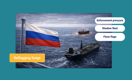
Enforcement Shock Accelerates Dark Fleet Reflagging to Russia
At a Glance A Structural Shift in Russia’s Shadow Fleet At least 120 falsely flagged, sanctioned tankers are likely to reflag to Russia’s registry in the coming months, as Western interdictions of stateless shadow fleet vessels accelerates a structural shift in Russia’s oil export logistics. All ships fit the profile and trading pattern of tankers...
Read more

Maritime Defense Weekly: Enforcement Tightens Across Global Shipping
The Week in Focus Maritime Enforcement Is Shifting From Designation to Constraint Maritime enforcement is increasingly focused on restricting how vessels operate in practice, not just on whether they appear on a sanctions list. Rather than relying solely on designations, recent actions are targeting the services and access that make maritime trade possible, including insurance,...
Read more

Tracking RAIDER: How Long-Term Vessel Behavior Uncovered a Pacific Drug Operation
At a Glance How a Dormant Vessel Triggered a Major Seizure In January 2026, French naval forces interdicted the MV RAIDER, a 41-meter pontoon vessel, in French Polynesian waters, seizing nearly five tonnes of cocaine, with an estimated value of nearly $150 million. Although the vessel was released without charges, its risk profile illustrates how...
Read more

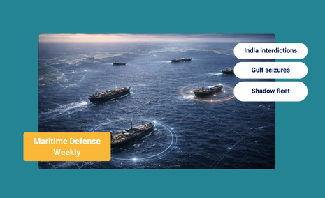
Maritime Defense Weekly: Maritime Enforcement Accelerates Across Global Energy Routes
The Week in Focus Enforcement Is Expanding Beyond a Single Theater Western maritime enforcement is no longer confined to designation, monitoring, or administrative friction. Recent activity indicates a growing reliance on physical constraints at sea, including boardings, safety-based interventions, and access denial, applied across multiple regions rather than within a single sanctions theater. This approach...
Read more

How the 2026 U.S. National Defense Strategy Reframes Maritime Access
Key Takeaways Why Maritime Access Can No Longer Be Taken for Granted For decades, maritime access was treated as a given. Shipping lanes remained open, chokepoints functioned, and infrastructure disruption was framed as an exception, something to manage during conflict or crisis. The 2026 U.S. National Defense Strategy challenges that assumption. It treats maritime routes,...
Read more