

January 7, 2026
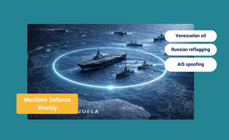
Maritime Defense Weekly: U.S. Intervention in Venezuela and Maritime Risk


An Iranian-Linked Tanker Fleet Is Operating Off the U.S. Coast Right Now

What’s inside?
At a Glance
- Windward identified 116 vessels conducting 130+ area visits to the Caribbean Sea over the past 30 days.
- Every vessel is linked to Iran, Russia, or Venezuela, with many carrying multiple risk associations.
- 19 vessels are sanctioned, while 81 are high-risk, and 16 are moderate-risk.
- Of the 116 vessels, 14 are flying fraudulent flags.
- The pattern of repeated Caribbean activity by sanctioned and high-risk tankers, including vessels using fraudulent flags, creates a direct challenge for maritime attribution, enforcement prioritization, and sanctions execution near U.S. waters.
What the Data Shows
Over the past month, Windward detected an unusual concentration of tankers in and around the Caribbean Sea with elevated sanctions and compliance risk.
In Q4 2024, WIndward recorded 119 area visits by vessels with similar risk profiles. In Q4 2025 to date, that number has already reached 233, a 95% increase year-over-year. The growth reflects not just higher traffic volume, but repeated regional presence by vessels carrying overlapping risk associations tied to Iran, Russia, and Venezuela.
December activity so far appears lower compared to December last year. While it’s too early to draw conclusions, this timing coincides with the U.S. seizure of the Iran-linked tanker Skipper, and warrants close monitoring as the month progresses.
| Windward Risk Category | Vessel Count |
|---|---|
| Sanctioned | 19 |
| High Risk | 81 |
| Moderate Risk | 16 |

The most common flags among these vessels, the Marshall Islands, Panama, and Malta, also appear widely in legitimate global tanker traffic. However, the presence of 14 vessels currently flying fraudulent flags points to deliberate identity concealment within this activity set.
Why This Matters
The Caribbean Sea sits adjacent to U.S. territorial waters and within U.S. enforcement reach. It is a critical corridor for energy flows, refined products, and regional trade.
This is not about a single vessel or isolated transit. It is about the density and recurrence of visits by tankers carrying stacked risk indicators, sanctioned status, high-risk behavioral patterns, and fraudulent identities, all operating in close proximity to U.S. interests.

Everything you need to know about Maritime AI™ directly to your LinkedIn
Explore more

Maritime Defense Weekly: U.S. Intervention in Venezuela and Maritime Risk
The Week in Focus Venezuela: Intervention, Transition, and Maritime Risk Operation Absolute Resolve, the U.S. operation against Venezuela, has created a fragile interim environment. Following January 3 strikes on military infrastructure in Caracas and the port of La Guaira, Nicolás Maduro was removed, leaving a power vacuum with direct implications for global energy flows. The...
Read more

The Gray Zone at Sea: How Adversaries Disrupt Without Firing a Shot
At a Glance What Is the Maritime Gray Zone? The maritime gray zone describes state or state-aligned actions that fall between routine presence and open conflict. These operations are intentionally deniable, often unattributable, and designed to achieve strategic gains without crossing the threshold of armed escalation. Gray-zone maritime activity includes behaviors that look routine on...
Read more

Maritime Defense Weekly: Trade Friction, Maritime Pressure Points
The Week in Focus Black Sea: Shadow Fleet Seeks Coastal Cover Following Ukrainian maritime drone strikes in late November and December, Russia’s shadow fleet has begun altering its operating patterns in the Black Sea. Instead of transiting directly across open water, tankers are increasingly hugging the coastlines of Georgia and Türkiye, in some cases operating...
Read more

Russian Dark Fleet Tankers Seek Shelter Along Turkish Coast from Ukrainian Drone Strikes
At a Glance The Black Sea has become increasingly treacherous for Russia’s shadow fleet of oil tankers. Following a wave of Ukrainian maritime drone strikes in late November and December, vessels transporting Russian crude have abandoned their traditional direct routes across open water. Instead, they’re taking a dramatically longer path — hugging the coastlines of...
Read more
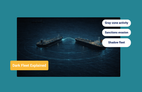
What Is the Dark Fleet? How Shadow Tankers Fund Sanctioned Regimes
At a Glance What Is the Dark Fleet? The dark fleet is a loose but increasingly well-defined group of oil tankers and cargo vessels that engage in deceptive shipping practices to transport sanctioned oil and other restricted commodities. These vessels continue trading globally while deliberately complicating detection, attribution, and enforcement under international maritime regulation. Unlike...
Read more