


June 2, 2026
Why Customs Enforcement Is Moving from Document Screening to Behavioral Intelligence


Hormuz Tightens as Iran’s Dark Fleet Stalls and Enforcement Widens
What’s inside?
At a Glance
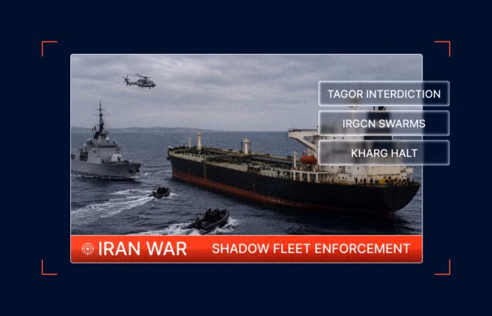
- ~73 IRGCN small craft surrounded a stationary container vessel in East Hormuz on May 31, the most direct kinetic engagement against commercial tonnage in the current cycle.
- ~201 IRGCN small craft massed at Larak Island on May 30, the densest single-day footprint ever recorded over the corridor.
- A 280-meter cargo vessel was observed using stacked containers as hull shielding, a first-of-its-kind physical adaptation in this environment.
- Kharg Island entered day 12 without crude loading, with both terminals empty, and the tanker waiting queue breaking up.
- A dark Panamax tanker’s full 19-day cycle points to floating storage, not export.
- The French Navy boarded Russia-linked TAGOR off Brest, marking the tenth Russia-linked interdiction by European forces in 2026.
- Iran-to-Houthi maritime logistics through Hodeida did not slow after the October 2025 ceasefire, with 19 sanctioned vessels operating freely throughout.
A Parallel Enforcement Track Takes Shape in the Atlantic
On the enforcement side, pressure on both Iranian and Russian shadow tonnage intensified across the same reporting cycle.
The U.S. Department of the Treasury issued a new Operation Economic Fury action targeting Iranian maritime extortion, expanding the cumulative enforcement track against Iranian shadow fleet logistics and complementing the prior 28-vessel designations issued since April 15. Following the U.S. Navy interdiction of the LIANSTAR, Windward identified four additional vessels operating in the same area with similar static and dynamic characteristics. All four called at Iranian ports after February 28, 2026, and all four are operating under fraudulent registries.

On June 1, in European waters, the French Navy, with UK support, boarded the falsely flagged Aframax tanker TAGOR (IMO 9282481) off Brest. The vessel had departed the Russian Arctic port of Murmansk. Upon boarding, French authorities identified an irregularity of the flag, effectively a false-flagging violation.
Windward analysis shows that on May 26, mid-voyage, TAGOR changed its MMSI and broadcast flag from Madagascar to Cameroon and continued south toward Brest under the new identity. The pre-switch broadcast had indicated the vessel was sailing in ballast. Vortexa data indicates TAGOR was, in fact, laden with approximately 700,000 barrels of Arco crude loaded at Murmansk, exposing the gap between declared posture and actual cargo state.

TAGOR’s original Madagascar registration was already invalid. Madagascar does not operate a ship registry. Under Article 110 of UNCLOS, stateless vessels can be boarded on the high seas by warships of any nation. The June 1 boarding is the tenth Russia-linked vessel interdicted by UK or European military forces in 2026, and the thirteenth across the past 18 months. France has previously detained BORACAY, GRINCH, and DEYNA under comparable circumstances.
The legal basis, statelessness under Article 110, has been consistent across every Russia-linked tanker boarding tracked by Windward in this enforcement series.
Iran’s Dark Fleet Is Stalling Inside the Strait
At 03:48 UTC on May 31, EO imagery captured a stationary approximately 220-meter container vessel in East Hormuz surrounded by approximately 73 IRGCN small craft clustered against the hull, and along its perimeter in a pattern. Windward assesses this behavior as consistent with boarding or harassment activity rather than transit escort.
The vessel showed no wake, no underway turbulence. Its heading pointed north, consistent with an inbound bearing, but it was not moving. Its decks were empty, with no visible container stacks, indicating it was running in ballast, which is unusual for an inbound East Hormuz transit. No AIS correlation was identified.
This is the most direct observable kinetic engagement against a commercial vessel recorded in the current reporting cycle. It did not happen in isolation.
IRGCN Small Craft Are Massing at Larak at Record Scale
On May 30, at 06:46 UTC, EO imagery captured approximately 201 IRGCN small craft massed across the northern area of the Strait. The bulk of the formation was concentrated north and south of Larak Island, with a south-to-north surge feeding the Larak concentration through the central approach and a northern picket holding the corridor mouth. It is the densest single-day IRGCN small-craft footprint ever recorded over the corridor.

Windward assesses the Larak basing as giving the IRGCN overlapping coverage of the choke point and the northern approaches, straddling both inbound and outbound deep-draft transit lanes simultaneously. Three dark vessels transited the Strait during the same collection window, consisting of one inbound container vessel, one outbound 336-meter VLCC-class tanker, and one outbound 100-meter product tanker. All three were operating without AIS.

The Larak posture is not new. EO imagery on May 28 had already identified a 15-vessel dark cluster stationary in the channel between Hormuz and Larak Islands — the highest count recorded in that corridor — with the holding pattern continuous since at least May 11. What changed on May 30 was the scale.
By June 1, over 30 IRGCN high-speed craft were observed at speed heading westbound along the shoreline of Hormuz Island, with an additional 10 or more operating between the stationary tankers in the fleet area to the east. A separate dark tanker, approximately 126 meters long, was observed heading northeast into the Persian Gulf with a small high-speed craft trailing directly behind it, positioning and track consistent with escort behavior. Three consecutive collection windows show IRGCN small-craft presence at scale across the corridor.
A Vessel Is Using Its Own Cargo as Armor Against Strike Damage
On June 1 at 06:55 UTC, EO imagery identified something that had not been documented before in this operating environment.
A dark 280-meter cargo vessel, stationary in the Hormuz-Larak waterway, had containers stacked along the full length of its starboard side, forming a continuous wall along the hull. The vessel was first observed in this configuration on May 11. By June 1, that was a minimum of 21 consecutive days.
Scorch marks visible on the hull are assessed as consistent with prior missile or drone strike damage, though the cause is not confirmed. The container wall is assessed as a physical shielding response constructed from the ship’s own cargo, a countermeasure against a kinetic threat environment that, until now, had produced AIS suppression and route changes rather than structural modification of the vessel itself.
This is a new category of adaptation. When operators begin using their own cargo as armor, the threat environment has crossed a threshold that logistics and navigation adjustments alone cannot address.
Separately, EO imagery on June 1 identified approximately 42 small craft around a stationary vessel in the operating area, with activity consistent with active looting. The vessel is tentatively assessed as the CMA CGM SAN ANTONIO, attacked near Abu Dhabi on May 5. Damaged, immobile, and now being stripped, it represents the end-state of what happens to commercial tonnage abandoned to this environment.
Kharg’s Loading Infrastructure Is Degrading Across Both Terminals
The damage has not been confined to the waterway.
On May 28, EO imagery confirmed an oil spill at Kharg Island’s eastern wing. The first collection at 07:14 UTC showed no spill. By 07:31 UTC, 17 minutes later, a 2.5-kilometer oil stain had appeared. Analysis indicated the spill would likely reach the Iranian coastline near Bushehr within 6 to 10 hours.

The eastern terminal had recorded its last confirmed crude load on May 20. The western terminal had been offline since at least May 7, following a separate oil spill at the western wing. By June 1, Kharg Island had entered its twelfth consecutive day without crude loading across either terminal. Both the T-pier and eastern crude jetty remained empty.
The degradation is bilateral and compounding. A prior EO collection had identified a small stain in the eastern wing on May 27, indicating that the spill on May 28 was not an isolated rupture but the culmination of gradual infrastructure damage. Kharg is experiencing escalating operational degradation across both loading platforms simultaneously.
The downstream consequence is visible in the waiting area. Approximately 14 tankers were stationary east of the island on May 31, all operating dark. At least 7 of the 14 were riding high (visually confirmed empty) with tankers observed departing the Kharg waiting area on May 29 on a heading toward the Strait of Hormuz exit.
Three tugs were also observed working close around a cluster of seven dhows south of the main port area, outside the cargo terminal zone, and centered on small craft rather than large tankers, and the function was unclear from imagery. Windward assesses the waiting queue as breaking up without loading to justify the wait, with the anchorage less dense than at its mid-to-late May peak. When the dhows are the most active vessels off Kharg, the loading picture has fundamentally changed.

Iran Is Routing Logistics Through Small-Craft as Large-Vessel Access Tightens
With Kharg’s terminals offline and large-vessel access constrained, Iran is sustaining commercial logistics through a parallel small-vessel network operating across the eastern wing of the Strait.
EO imagery on May 29 over the Bandar Abbas coast identified elevated concentrations of dhows and landing craft across three separate locations. The Bandar Abbas commercial terminal was occupied exclusively by 14 dhows, with no commercial vessels at berth. More than 50 dhows and several landing craft were observed beached or berthed along the shoreline, and more than 30 within the Bandar Abbas Marina. An additional 20 commercial cargo vessels were observed at anchor off the port, assessed as likely ballasted, consistent with a port lacking sufficient facilities to offload them. Windward’s most probable interpretation is that offloading is being conducted via dhows and landing craft acting as lightening assets.
The pattern extends along the coastline. EO imagery over East Hormuz at Seerik on May 29 identified a dense cluster of approximately 82 small craft in the near-shore zone, which is consistent with IRGC patrol or speedboat activity, alongside a single 103-meter general cargo vessel and a 56-meter coastal tanker assessed as a bunker supply or fuel distribution vessel.
By May 31, EO imagery over the Musandam Peninsula identified two consolidated high-speed-craft swarms off the western coastline: 14 craft transiting westward on an Iran-bound vector, and a second group of 6 split between inbound Omani and outbound Iran-bound headings, a two-way shuttle pattern across the eastern wing of the Strait.

Windward assesses the combined Bandar Abbas, Seerik, and Musandam observations as reflecting a sustained small-vessel logistics network sustaining Oman-Iran goods trade under conditions that have constrained large-vessel access.
Iran’s Dark Fleet Is Loading at Kharg and Holding in the Strait
Windward’s multi-collection imagery tracked the complete operational cycle of a 183-meter dark Panamax across 19 days:
- May 13: Bunkering near the Strait of Hormuz.
- May 14: Inbound transit through Hormuz, fully dark, no visible IMO or flag, severe hull corrosion along the bow.
- May 20: Alongside the T-pier at Kharg Island, with a flexible loading hose connected to the pier loading arm, crude transfer actively in progress. The first confirmed Kharg crude load since the terminal went inactive around May 7.
- May 28: Stationary, laden, and dark north of Larak Island.
- June 1: Same position, same visual profile, still stationary.
This is the clearest end-to-end documentation of the Iranian dark fleet operating profile under Operation Epic Fury to date. What it shows is not an export run. The 8-day round trip from Kharg to Hormuz, combined with the Panamax-class capacity of approximately 400,000 to 550,000 barrels, is too small and too short-haul for a direct export destination. The vessel loaded, transited out, and stopped. It has been stationary in the Larak waterway since May 28.
Windward now assesses the pattern as consistent with floating storage or pre-positioning for downstream transfer, not continued shuttle activity. Iranian crude is being moved out of Kharg but not into export markets. It is accumulating in the strait.
The 13 dark tankers stationary in the Hormuz-Larak waterway on June 1 — a mix of laden and ballasted hulls at various points in a load-and-hold cycle — indicate the corridor is functioning as a sequencing zone. Vessels move in, load, and wait. The question of what they are waiting for remains open.
Meanwhile, BARAKAH (IMO 9902615) illustrates how long that wait can last. EO imagery on June 1 confirmed the vessel was stationary in the eastern Strait of Hormuz, marking day 21 of continuous hold without AIS transmission, dark since approximately May 11. A dark trail observed extending from BARAKAH in SAR imagery on May 25, previously assessed as possibly consistent with an oil or fuel leak from prior damage, is no longer visible in the June 1 collection. The cause was not confirmed in open sources. Windward assesses the combination of prolonged immobility and the May 25 trail observation as consistent with a vessel that has sustained damage and is unable to transit, though this assessment is not confirmed.
Two Sanctioned Vessels, Two Concealment Methods
While the physical picture in the strait was taking shape, Windward’s satellite imagery analysis was exposing activity that the AIS record was designed to hide.
The OFAC-designated Iran-flagged Aframax crude tanker ATLANTIS II (IMO 9257503) was confirmed at anchor in the eastern Strait of Hormuz, matched against a May 16 AIS-on image at the same anchorage. Despite a 4-day AIS blackout at the time of observation, Windward confirmed 21 or more days of continuous loitering at the same coordinates. The vessel had departed Shahid Rajai on May 7 after a 143-hour port call and had not moved since.

The OFAC-sanctioned Iran-flagged container vessel ARTAM (IMO 9284154) presented a different method. EO imagery identified it alongside the Chabahar container terminal on May 26 during a 49.8-hour AIS-dark window. Concurrent AIS posted a false anchor position 20 to 30 kilometers west of the actual berth, a spoofed position specifically designed to mask the port call. ARTAM’s 2026 trade pattern on AIS shows India-to-UAE-to-Iran rotations, with Iranian calls conducted exclusively under dark windows and offshore spoofed positions.

A third method was observed at Kharg itself. EO imagery on May 27 identified a dark VLCC of approximately 333 meters stationary in the Kharg waiting area displaying a false hull name, a Nigerian indigenous exploration and production operator with no registered vessels and no Iran nexus. The vessel was not transmitting AIS. Windward assesses the hull inscription as a false flag, consistent with documented shadow fleet practice of applying rough hull repaintings before sensitive port calls or transits to degrade satellite identification. The technique mirrors cases documented in the Russian shadow fleet, including a UK-sanctioned tanker that transited the Bosporus in August 2024 with its name crudely painted over and a false name hand-applied to the bow.
Different vessels, different techniques, the same result — imagery confirms what AIS omits.
Iran’s Houthi Supply Chain Did Not Stop When the Ceasefire Did
Windward’s analysis of 164 vessels passing through the Hodeida and Saleef approach zone between November 2025 and May 2026 confirms that the Iran-to-Houthi maritime supply chain did not slow when the October 2025 ceasefire began. Nineteen actively sanctioned vessels continued operating in Houthi-controlled port areas throughout the assessment period without interruption. The supply chain runs through multiple layers:
- Iran-Syria-Yemen corridor transits, with cargo consolidated at Tartous and Lattakia before final delivery to Houthi-controlled Yemen.
- A Djibouti transshipment line, transferring cargo to vessels with cleaner AIS histories before the final Hodeida leg.
- Extended sanctioned tanker operations at Ras Issa, with average terminal stays of 7 to 17 days against a commercial norm of 1 to 3.
Sixty or more vessels in the dataset use frequent MMSI and name changes. Nine have no listed registered owner, consistent with shell company dissolution to complicate enforcement. All nine continue to receive port access and cargo in Hodeida.

The ceasefire changed the political framing. The logistics did not change at all.
The Operating Picture
Taken together, the May 28 to June 1 data describes an operating environment that has stopped escalating and started consolidating.
IRGCN small-craft posture is concentrating around Larak Island and the northern corridor at a scale that now constitutes the operating norm rather than an escalatory gesture. Commercial vessels are modifying their own hulls to survive in a waterway where AIS suppression is no longer sufficient protection. Kharg Island’s loading infrastructure is degrading across both terminals, with no observable recovery in progress. The dark fleet is not exporting Iranian crude, but rather staging it in the strait, in stationary laden hulls, waiting for conditions that have not yet arrived.
Alongside all of this, two parallel enforcement tracks are operating simultaneously, including Operation Epic Fury targeting Iranian-affiliated shadow tonnage in the Gulf, and Article 110 UNCLOS interdictions targeting Russia-linked vessels in European waters. Both tracks are identifying the same operational signature — falsely flagged, stateless vessels moving sanctioned cargo under fabricated identities — in different geographies.
The broader kinetic environment is also widening beyond the corridor itself. Ukrainian authorities reported that Russian drones attacked the Vanuatu-flagged cargo vessel ANT off the Ukrainian coast. The vessel has made six consecutive dark activity port calls to waters off Romania and Ukraine over the past 12 months. Windward assesses an emerging pattern of escalation in attacks on commercial shipping in the Black Sea and Mediterranean theaters.

Closer to Hormuz, a warning was issued for a suspected floating mine approximately 12.9 nautical miles north-northeast of Khasab, Oman, on May 30, consistent with the broader pattern of kinetic risk to commercial shipping in the Hormuz operating area throughout the current cycle.

The gap between what AIS reports and what imagery confirms is the operating signature of this entire environment.
Explore more

Three Months Into Operation Epic Fury: How Iran Restructured Hormuz Instead of Closing It
At a Glance Operational Overview Hormuz transits remain at approximately 6% of their pre-conflict baseline, and the residual flow is increasingly Iranian-flagged, dark, or hugging Iranian territorial waters. IRGC small-craft counts have moved decisively off the Iranian shore and into the open strait body, with the swarm now positioned within visual range of every commercial...
Read more

Trump Says Hormuz Will Open: A Deal Takes Shape as Iran Expands the PGSA
At a Glance Operational Overview The Hormuz operating environment moved through one of its most consequential five-day windows of the conflict between May 20 and May 24, with Iranian administrative escalation, sustained U.S. enforcement, partial export recovery, and the first publicly announced diplomatic framework all advancing in parallel. Iran’s PGSA extended its claimed zone to...
Read more

Iran Loads East of Hormuz: A New Export Node, a Live Toll Regime, and U.S. Enforcement at Sea
At a Glance Operational Overview The Iranian export environment shifted on two axes across May 19 and May 20, including an offshore crude loading node that has been activated on Iran’s Gulf of Oman coast outside the Strait of Hormuz, and U.S. enforcement has broadened into a parallel campaign across at-sea seizures, OFAC designations, and...
Read more

Hormuz Becomes a Holding Queue: Iran’s Toll Regime, Bilateral Carve-Outs, and a Bifurcating Strait
At a Glance Operational Overview The Strait of Hormuz has structurally shifted from a transit corridor with disrupted flow to a tanker holding queue with administrative governance layered on top. Two developments across May 17 and May 18 define the phase change: Iran’s move to formalize a sovereign transit-toll regime under the Persian Gulf Strait...
Read more