


June 10, 2026
LPG Flows Test the Blockade as Hormuz Tightens


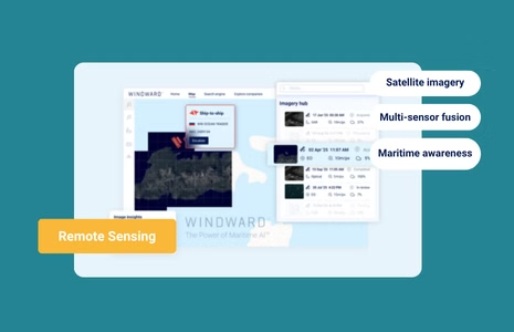
Remote Sensing Intelligence: From Satellite Imagery to Real-Time Maritime Awareness
What’s inside?
At a Glance
- Remote sensing collects data about Earth’s surface without physical contact, using satellites, aircraft, or drones.
- Satellite imagery — from optical to radar — is the most visible form of remote sensing, providing continuous Earth observation.
- Combined with AI, remote sensing transforms raw data into real-time maritime awareness, supporting defense, trade, and environmental monitoring.
- Multi-sensor fusion — integrating SAR, EO, RF, and AIS data — delivers verified, actionable insights.
- Within Windward’s Remote Sensing Intelligence solution, these capabilities work together to detect dark vessels, monitor infrastructure, and analyze global maritime behavior.
What Is Remote Sensing?
Remote sensing is the science of gathering information about the Earth’s surface without making direct contact. It measures how energy — usually in the form of electromagnetic radiation — interacts with terrain, water, or objects.
In practice, remote sensing satellite imagery captures reflected sunlight, emitted heat, or radar returns to reveal what’s happening across the planet in near real time. These sensors observe the oceans, atmosphere, and land continuously, allowing analysts to detect change, track movement, and assess risk.
The definition of remote sensing has evolved since the 1960s, when early satellites like TIROS and Landsat-1 demonstrated that space-based imagery could support weather forecasting and environmental monitoring. Today, remote sensing encompasses hundreds of active satellites — optical, radar, and radio — all contributing data to government, commercial, and humanitarian missions. The result is a global web of visibility – from environmental shifts and shipping routes to urban growth and disaster impact.
The Evolution of Satellite Imagery
When the first satellite imagery of Earth was transmitted in 1959, it marked the beginning of a revolution in how humanity perceives the planet. Through decades of technological progress, satellite imaging has grown from grainy black-and-white photos to ultra-high-resolution color imagery capable of identifying individual vessels at sea.
- 1960s–1980s: Programs like Landsat and SPOT pioneered systematic Earth observation, making optical imagery available for agriculture, forestry, and land use.
- 1990s–2000s: Commercial satellites such as IKONOS and QuickBird introduced one-meter imagery to the market, enabling private-sector mapping and defense intelligence.
- 2010s–present: The emergence of small satellite constellations made real-time satellite imagery possible. Dozens of compact platforms now provide daily coverage of oceans, ports, and trade lanes.
Today’s latest satellite imagery combines electro-optical (EO) color views with synthetic aperture radar (SAR) and radio frequency (RF) detection to ensure constant coverage, even through clouds, darkness, or storms. For maritime operations, this means decision-makers no longer wait for clear skies – visibility is available on demand.

From Remote Sensing Data to Maritime Intelligence
Raw satellite data alone isn’t intelligence — it becomes valuable only when analyzed and contextualized.
Through satellite data analysis, remote sensing is transformed into operational awareness.
In maritime applications, analysts process and fuse multiple data layers to detect change and verify behavior. A radar reflection may indicate a vessel’s presence, but pairing it with EO or RF signals reveals whether that vessel is transmitting, rendezvousing, or attempting to stay hidden.
Artificial intelligence (AI) now accelerates this process. Algorithms trained on millions of maritime events can identify patterns — such as loitering, dark activity, or port congestion — in seconds. This is how AI in satellite imagery and artificial intelligence in remote sensing convert global sensor coverage into timely, relevant insight.
How Multi-Sensor Fusion Powers Real-Time Awareness
No single sensor tells the full story.
Multi-sensor fusion integrates data from different sources to produce a verified, 360-degree maritime picture.
| Sensor Type | Strengths | Limitations | Primary Uses |
| Synthetic Aperture Radar (SAR) | Detects metal structures through clouds and darkness. | Grayscale imagery; requires interpretation. | Dark vessel detection, infrastructure monitoring. |
| Electro-Optical (EO) | High-resolution color imagery for visual confirmation. | Requires daylight and clear weather. | Vessel identification, port operations. |
| Radio Frequency (RF) | Detects emission without cooperation. | Limited visual context. | Tracking non-reporting or deceptive vessels. |
| Automatic Identification System (AIS) | Provides declared vessel ID, course, and intent. | Can be spoofed or disabled. | Navigation safety, baseline verification. |
Together, these sensors provide real-time satellite imagery and remote sensing data that can confirm vessel identity, detect deception, and monitor maritime zones.
When fused within Windward’s Remote Sensing Intelligence platform, these layers are enriched with behavioral analytics — transforming static detections into actionable insights. Behavioral analytics identifies and highlights risk behaviors such as repeated dark activity, course anomalies, or STS patterns long before they escalate into compliance exposure.

Applications Across Defense and Trade
Government & Defense
For government and defense agencies, remote sensing intelligence enables persistent awareness, faster detection, and more confident decision-making across their maritime domain.
Dark Vessel Detection & Tracking
Remote sensing helps agencies identify vessels that have disabled or manipulated AIS. SAR reveals the vessel’s physical presence in any weather, while RF signals expose ongoing transmissions that contradict AIS silence or reported routes. EO imagery then provides visual verification to classify the vessel and assess nearby activity, and AIS patterns over time help distinguish normal gaps from deliberate concealment. This layered approach turns a single detection into a confirmed enforcement lead.
IUU Fishing Detection
Illegal, unreported, and unregulated (IUU) fishing often occurs at night or under cloud cover, making optical monitoring unreliable on its own. SAR detects vessels in restricted zones, AIS reveals gaps, route patterns, or suspicious identity changes, and RF emissions help identify the types of equipment in use. EO imagery captured during daylight provides visual confirmation of fleet formations, proximity to protected zones, or potential transshipment. Together, these sources support both real-time interdiction and long-term pattern-of-life analysis.
Maritime Border Surveillance
Remote sensing strengthens coastal protection by revealing irregular movements near territorial waters, including small craft that traditional monitoring may miss. SAR offers wide-area, all-weather detection, while AIS provides declared identity, course, and speed for cooperative vessels. EO imagery brings visual clarity on vessel type and behavior, and RF emissions add an extra layer by exposing active communications or radar use in sensitive areas. This fusion enables earlier detection and more informed response planning.
Critical Maritime Infrastructure Protection
Infrastructure such as pipelines, rigs, LNG terminals, and subsea cables requires persistent monitoring to detect interference or unauthorized activity. SAR identifies changes, wakes, or vessel presence around assets regardless of weather, while AIS data shows which vessels report being in the area, or conspicuously avoid doing so. EO imagery validates activity patterns and structural conditions, and RF activity helps indicate whether nearby vessels are actively operating navigation or radar systems. This combined picture helps agencies act before disruptions occur.
Maritime Area Monitoring & Surveillance
Government teams use remote sensing to understand long-term patterns across wide maritime zones, monitor traffic density, and detect anomalies. SAR provides consistent baselines for vessel presence and movement, AIS supplies detailed tracks and behavioral profiles, and EO imagery highlights deviations such as new routes, formations, or infrastructure changes. RF data reveals transmission behavior that may indicate coordination, covert activity, or emerging hotspots. This layered view informs patrol planning, resource allocation, and strategic risk assessments.
Commercial & Trade
For commercial stakeholders, remote sensing enables smarter, faster, and safer operations.
Wet Bulk Commodity Trading: Dark Ship-to-Ship Transfer Intelligence
Remote sensing validates ship-to-ship (STS) operations in high-risk regions by detecting vessels meeting without reliable AIS reporting or showing signs of coordinated movement. SAR identifies the vessels and geometry of the encounter, AIS data reveals gaps, spoofing, or suspicious route changes, and RF emissions confirm onboard activity despite “silent” positions. EO imagery then captures the visual evidence that traders and compliance teams need to assess exposure and document risk. This reduces the likelihood of engaging with deceptive flows linked to sanctions evasion.
Dry Bulk Commodity Trading: Stockpile & Port Monitoring
Optical imagery provides clear views of stockpile size, yard layout, and loading activity, offering traders real indicators of supply and demand. SAR complements EO by maintaining visibility during poor weather or at congested ports, while AIS tracks vessel arrivals, departures, and waiting times at anchor. Monitoring historical imagery and AIS trends together helps identify meaningful changes — shifts in stockpile volume, vessel queues, or cargo handling rates. These insights improve price forecasting, market intelligence, and operational planning.
Offshore Platform & Rig Security
Remote sensing offers a reliable way to track vessel activity around offshore installations, where unauthorized approaches pose operational, environmental, and safety risks. SAR provides early detection of vessels entering exclusion zones, AIS shows which vessels are legitimately present and which are not reporting, and RF signals indicate whether ships are actively navigating, communicating, or potentially targeting infrastructure. EO imagery helps classify the approaching vessel and confirm behavior. This multi-sensor view reduces uncertainty and strengthens defensive decision-making.
Port Activity & Supply Chain Intelligence
Satellite imagery and radar data reveal anchorage buildup, berth occupancy, and cargo operations, giving logistics teams a clear view of emerging bottlenecks. EO imagery helps quantify container yards, terminal activity, and yard utilization, while SAR maintains continuity in poor weather and at night. AIS adds detailed vessel-level context — arrivals, ETAs, dwell times, and routing choices — across the full supply chain. By combining these layers, organizations can flag delays sooner, optimize routing, and anticipate downstream disruptions.
How AI Transforms Remote Sensing Intelligence
AI has redefined what’s possible in remote sensing data analysis. Where analysts once reviewed images manually, AI models now identify changes, classify objects, and predict behavior automatically.
This evolution allows for:
- Automated image classification: Distinguishing between vessel types or infrastructure.
- Anomaly detection: Recognizing dark activity or pattern deviations.
- Predictive analytics: Forecasting risk and recommending sensor tasking.
- Behavioral analytics: Interpreting multi-sensor detections in context, correlating AIS gaps, RF emissions, SAR signatures, and historical patterns to determine intent, not just location.
Windward’s MAI Expert™ applies this intelligence layer across all sensors, ensuring that the right technology is used for each mission and that insights are delivered instantly, not after the fact. By combining AI with behavioral modeling, the platform turns raw detections into meaningful assessments of risk, deception, and operational significance.
Why Remote Sensing Matters for Maritime Decision-Making
The oceans generate immense volumes of data every hour — more than any single sensor can process alone. Remote sensing brings clarity to that complexity, connecting dots across time, sensors, and intent.
For defense and enforcement agencies, it means detecting illicit activity before it reaches territorial waters. For traders and operators, it ensures operational continuity, compliance, and safety. For global intelligence teams, it provides the verified, multi-layered awareness needed to act with confidence in a volatile maritime environment.
In an era where every decision depends on visibility, remote sensing and satellite imagery have become the world’s most powerful navigation tools.
Frequently Asked Questions (FAQs)
What is remote sensing?
Remote sensing is the collection of data about Earth’s surface using sensors that measure reflected or emitted radiation — typically from satellites or aircraft.
How is remote sensing used?
It’s used for mapping, environmental monitoring, defense surveillance, and maritime intelligence — from tracking ships to assessing port congestion.
What is the difference between satellite imagery and remote sensing?
Satellite imagery is one form of remote sensing that provides visual data. Remote sensing also includes radar, thermal, and radio measurements.
What is real-time satellite imagery?
It refers to near-instant access to satellite data through high-frequency constellations and automated processing, often supported by AI.
How does AI improve remote sensing intelligence?
AI automates image interpretation, anomaly detection, and cross-sensor fusion — enabling faster, more accurate maritime insights.
Explore more

Why Russia’s Sanctioned Shadow Fleet Is Bypassing the English Channel
At a Glance Russian Tankers Repeatedly Bypass the English Channel Western-sanctioned tankers loading oil at Russian Baltic ports normally transit the English Channel as part of standard voyage routing. In the past 30 days, Windward tracked 84 Western-sanctioned tankers through the Channel — 44% flagged with Sierra Leone, 19% with Cameroon, and 18% with Russia....
Read more

Why Customs Enforcement Is Moving from Document Screening to Behavioral Intelligence
At a Glance The Screening Model Customs Was Built On No Longer Holds For most of the last twenty years, customs enforcement has operated on a screening model. Cargo manifests arrive ahead of port call, risk scores are calculated against the declared origin, shipper, and route, and anomalies trigger inspection. The model worked while the...
Read more

Why Behavioral Intelligence Now Defines Subsea Cable Protection
At a Glance From Monitoring to Prevention For most of the past decade, cable protection meant monitoring. Operators watched the screen, generated alerts when a vessel of concern appeared near a cable, and responded after the fact when damage occurred. The threat landscape has shifted in ways that existing tools and protocols were not designed...
Read more

Maritime Defense Weekly: Energy Flows and Infrastructure Risk
Week in Focus Russian Diesel Cargo Signaling Arrival in Cuba A Hong Kong-flagged medium-range tanker is signaling arrival in Cuba on March 2 after multiple AIS destination revisions. The vessel initially broadcast Havana, then shifted to “Caribbean Sea,” and later to “Gibraltar for orders,” despite already transiting the strait. Windward’s assessment indicates the tanker likely...
Read more

Maritime Defense Weekly: Offshore Enforcement and Baltic Exposure
Week in Focus Sanctions Enforcement Moves Further Offshore The United States intercepted and boarded Aquila II (IMO 9281152) in the Indian Ocean, nearly 1,000 nautical miles from where it fled a Venezuelan quarantine zone in January. The 22-year-old Suezmax had falsely broadcast under the Panamanian flag and has a history of extended dark activity and...
Read more