

February 10, 2026
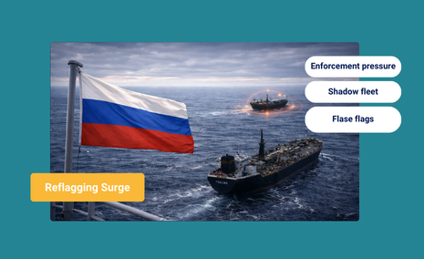
Enforcement Shock Accelerates Dark Fleet Reflagging to Russia


Reports
How Remote Sensing Intelligence Enhances Caribbean Enforcement
What’s inside?
Closing the Operational Gap Between Detection and Prevention
On November 15, 2025, U.S. military forces conducted the 21st known strike on a vessel in the Eastern Pacific, killing three individuals as part of Operation Southern Spear, a SOUTHCOM-led initiative targeting narco-terrorists across the Western Hemisphere. By late November, the cumulative toll from U.S. counternarcotics operations exceeded 80 deaths across multiple strikes.
On Nov. 15, at the direction of Secretary of War Pete Hegseth, Joint Task Force Southern Spear conducted a lethal kinetic strike on a vessel operated by a Designated Terrorist Organization. Intelligence confirmed that the vessel was involved in illicit narcotics smuggling,… pic.twitter.com/iM1PhIsroj
— U.S. Southern Command (@Southcom) November 16, 2025
The USS Ford, a nuclear-powered supercarrier with 5,500 sailors and approximately 75 aircraft, joined roughly 10,000 troops already positioned in Puerto Rico. This deployment represents dramatic military concentration in the Caribbean theater. But military presence alone cannot solve the core operational problem facing SOUTHCOM commanders: the detection lag that separates threat identification from threat prevention.

The maritime evasion challenge reflects a fundamental asymmetry. Traditional detection methods depend on sequential observation: a vessel appears on radar, generates AIS signals, enters port, or passes within range of coastal sensors. Each detection point offers an interdiction opportunity, but only if enforcement teams can respond faster than adversaries can move. Yet narco-maritime operators have systematized evasion into routine practice. Ships deliberately disable AIS transponders to hide locations. Transfers occur in international waters beyond coastal surveillance. Documentation is falsified using generative AI tools. Dark vessel activity and deliberate non-cooperation with tracking systems are now routine among sanctions evaders and smugglers, and much of the traffic in this region is carried out by non-transmitting speedboats, making AIS effectively irrelevant as a detection method.
The operational consequence is enforcement occurring hours too late. Coast Guard analysts, relying on traditional surveillance infrastructure, spend hours or even days reconstructing a suspected vessel’s true route after activity is complete. By that time, cargo has transferred, proceeds have moved through financial networks, and enforcement encounters an empty vessel. This detection lag defines the enforcement window: measured not from when surveillance detects activity, but from when enforcement could have prevented it from occurring.
Case Study: New Power (IMO 9266853)
A current example illustrates just how sophisticated these evasion tactics have become. New Power (IMO 9266853) has engaged in the full trifecta of deceptive shipping practices since arriving in Venezuelan waters in early September 2025.
Over the past 11 weeks, the tanker’s AIS track has shown clear and repeated spoofing. (In the image below) Squiggled and looped pathways, tightly packed trajectories, and erratic jumps across the Caribbean indicate consistent GNSS manipulation. Windward detected the spoofing as soon as it began on September 2 — patterns common among dark fleet tankers calling in Venezuela.

In a Windward Remote Sensing Intelligence electro-optical satellite image from November 24 (below), New Power‘s AIS-reported route does not match its actual position. The vessel does not appear anywhere in the frame where its AIS signal claimed it to be. This is precisely the kind of deception that integrated SAR, EO, and RF detection can expose.

The Structural Problem: Why Traditional Detection Cannot Match Systematic Evasion
The Caribbean theater compounds this operational challenge through geographic and technical constraints. The region’s vast maritime expanse creates persistent coverage gaps. Commercial maritime reporting depends on vessel cooperation and AIS transmission, both voluntary among legitimate operators, both deliberately disabled by those conducting illicit activity. Covert maritime activity generates RF emissions that remain unintegrated into enforcement decision cycles. The result is intelligence fragmentation that sophisticated operators exploit systematically.
The operational problem is not insufficient military capability but insufficient real-time visibility. The USS Ford and supporting forces represent overwhelming kinetic capacity. What remains unresolved is advance warning, the ability to detect where illicit activity will occur before it reaches completion.
This gap between deployed capability and available intelligence represents the strategic vulnerability facing SOUTHCOM. Despite massive military investment and enforcement commitment, detection remains fundamentally reactive. Vessels complete their illegal transfers before enforcement assets arrive. Dark vessel activity proceeds unmonitored. RF emissions from covert operations remain invisible to current decision cycles. The detection infrastructure that governs tactical response was designed for a simpler maritime environment where vessels declared their movements and complied with tracking systems. Today’s illicit operators exploit this designed-in lag systematically.
Remote Sensing Intelligence: Integrated Sensor Fusion for Operational Advantage
Remote Sensing Intelligence addresses this gap through systematic fusion of three complementary sensor technologies, each capturing different layers of maritime activity. Together, they deliver the detail, consistency, and coverage required for complete operational awareness.
Synthetic Aperture Radar (SAR) operates through cloud cover and darkness using radar pulses to detect metal objects such as vessels. Unlike optical satellites dependent on clear weather and daylight, SAR maintains coverage in all conditions, day or night. SAR imagery shows vessel positions, sizes, and movement patterns with precision sufficient to distinguish between legitimate shipping and anomalous behavior. Applied to Caribbean enforcement, SAR enables all-weather monitoring where traditional radar cannot provide coastal coverage. When a vessel deliberately disables AIS to hide its position, SAR detections continue tracking it. When transfers occur during storms that blind optical satellites, SAR maintains detection. This all-weather persistence transforms what appears as surveillance blind spots into sources of actionable intelligence.

Electro-Optical (EO) imagery captures visual confirmation through visible and near-infrared spectrum. EO provides the visual clarity needed for vessel identification, port analysis, and event confirmation; it verifies what SAR detects and documents activity for legal proceedings. EO is limited by weather and daylight but remains the most intuitive form of imagery for human interpretation. Applied to Caribbean enforcement, EO imagery documents ship-to-ship transfers, captures cargo movement, and verifies vessel identifications. When combined with SAR detections, EO transforms fragmented observations into evidence-grade documentation. A suspected transfer detected by SAR can be confirmed and photographed by EO, creating admissible records for prosecution and establishing patterns for repeat offenders.

Radio Frequency (RF) sensors detect electromagnetic emissions from ships, radar transmissions, satellite communications, navigation signals. Unlike AIS, which depends on vessel cooperation, RF detection triangulates emissions across multiple satellites to locate covert operations. Vessels disabling AIS still emit RF signatures as they navigate, communicate, and use radar. RF detections reveal those emissions, locating vessels that appear invisible to traditional tracking. Applied to Caribbean enforcement, RF sensors expose vessels deliberately operating without AIS, confirming intentional non-cooperation and revealing their true positions. A vessel going dark ceases AIS transmission but cannot eliminate its electromagnetic signature without ceasing navigation entirely, an operationally impossible requirement.
These three technologies are not alternatives; they are complementary. SAR provides all-weather persistence. EO provides visual confirmation and evidence documentation. RF provides detection of non-cooperative vessels. When fused together with vessel ownership records and behavioral models, they create a unified operational picture that traditional detection cannot achieve. Detection becomes continuous. Deception is exposed. Non-cooperation is revealed. The detection lag compresses from hours to minutes.
From Detection Lag to Prevention Windows
The shift from traditional maritime detection to Remote Sensing Intelligence-based operations creates several operational advantages with direct application to Caribbean enforcement.
Advance Warning
Remote Sensing Intelligence, through continuous monitoring and pattern recognition across all three sensor types, identifies vessels exhibiting pre-evasion behavior before transfers occur. Geographic loitering at known transfer coordinates. Timing patterns that correlate with historical smuggling operations. Vessel ownership networks that link multiple ships to coordinated activity. RF emissions inconsistent with legitimate maritime operations. These signals, analyzed collectively, generate 12-48 hour advance warning before anticipated transfer activity occurs. This is not prediction; this is pattern recognition based on known evasion signatures.
Resource Concentration
Instead of distributing enforcement assets across disputed maritime zones hoping to encounter detected activity, Remote Sensing Intelligence focuses limited resources on high-probability targets. Behavioral models identify which vessels are highest-probability based on observed patterns. Satellite tasking concentrates collection on anticipated transfer zones. Coast Guard positioning anticipates where enforcement presence generates maximum interdiction probability. The operational mathematics shift dramatically: enforcement no longer depends on chance detection but on systematic targeting.
Operational Evidence
SAR and EO detections create evidence-grade records admissible in legal proceedings. A vessel’s true position documented by SAR, verified by EO, and cross-referenced against declared AIS position creates an objective record of deception. Ship-to-ship transfers photographed by EO with timing documented by RF provide incontestable evidence. Dark vessel activity tracked across multiple sensors over weeks creates patterns that establish systematic non-cooperation. This evidence supports sanctions designations, prosecution, and deterrence.
Applied to November’s operational environment, the impacts would be concrete. The vessels struck on November 15 would have been identified and interdicted during transit phase before reaching transfer zones. The pattern of ongoing strikes, each representing detected and neutralized threats, would compress into preventive interceptions based on behavioral pattern recognition. Advance warning would enable pre-positioning of boarding teams, satellite tasking to document evidence, and legal preparation. By the time vessels attempted their operations, enforcement presence would already be established, not arriving after activity succeeded.
The strategic benefit extends beyond individual interdictions. When narco-maritime operators understand that enforcement not only responds to detected activity but pre-positions assets based on pattern recognition, the risk calculation for smuggling operations changes. The operational viability of established routes declines when enforcement has advance warning. The window for successful evasion narrows when boarding teams position based on behavioral prediction. The probability of undetected transfers drops when three complementary sensor types provide continuous coverage and multiple detection vectors.
Command Decision-Making and Strategic Positioning
Remote Sensing Intelligence fundamentally alters the information environment available to SOUTHCOM command. Traditional maritime intelligence requires commanders to respond to incidents as they unfold. Briefings document what happened yesterday, vessels detected, operations interdicted, casualties reported. Intelligence becomes a historical record.
Remote Sensing Intelligence offers a different briefing paradigm. Commanders receive intelligence on which vessels are exhibiting high-probability narco-maritime patterns within the next 72 hours, ranked by behavioral probability scores. Which geographic areas are likely transfer zones based on historical pattern analysis. Which ownership networks are coordinating current operations. Which specific vessels present highest-probability for interdiction within defined time windows.
This integration creates operational positioning advantage. Commander-level decision-making shifts from responding to threats detected through chance or routine monitoring to proactively allocating limited assets where engagement probability is highest. The troops positioned in Puerto Rico deploy with intelligence confidence rather than geographic guessing. The USS Ford’s aircraft task is to patrol zones where Remote Sensing Intelligence indicates highest-probability smuggling activity rather than conducting broad-area surveillance.
The operational clarity also enables coalition coordination. When Remote Sensing Intelligence identifies vessels exhibiting narco-maritime patterns, this intelligence is shared across allied commands for coordinated interdiction. Multiple enforcement agencies converge on identified threats rather than conducting independent operations. Enforcement probability increases through asset concentration. Operational risk to individual assets decreases through coordinated presence.
The Strategic Choice
The USS Ford deployment and Operation Southern Spear formalize Washington’s commitment to Caribbean maritime enforcement. But military capability without predictive intelligence leaves the fundamental operational problem unresolved: the gap between threat detection and threat prevention.
Remote Sensing Intelligence addresses this gap. By fusing SAR, EO, and RF detections into continuous monitoring, identifying vessel patterns that correlate with smuggling activity, and generating advance warnings of anticipated transfers, it enables SOUTHCOM to convert military deployment into systematic enforcement advantage. The operational return is concrete: advance warning that creates interdiction windows before operations begin, sensor fusion that provides complete coverage where traditional detection leaves gaps, integrated networks that reveal coordination structures, and decision-grade briefings that enable strategic positioning rather than tactical response.
The strategic choice before maritime enforcement leadership is whether current posture, high-tempo military presence with reactive interdiction generating tactical successes but leaving strategic vulnerabilities — remains acceptable, or whether Remote Sensing Intelligence infrastructure becomes a priority that enables deployed capability to operate at full effectiveness. The USS Ford is en route. The troops are positioned. Operation Southern Spear is underway. What remains is ensuring that military and Coast Guard teams have the intelligence advantage that enables advance warning, asset pre-positioning, and operational effectiveness that transforms deployment into sustained enforcement advantage.
Assess RSI Against Your Operational Requirements