


March 22, 2026
March 22, 2026: Iran War Maritime Intelligence Daily


Synthetic Aperture Radar (SAR) Imagery
What is Synthetic Aperture Radar (SAR) Imagery?
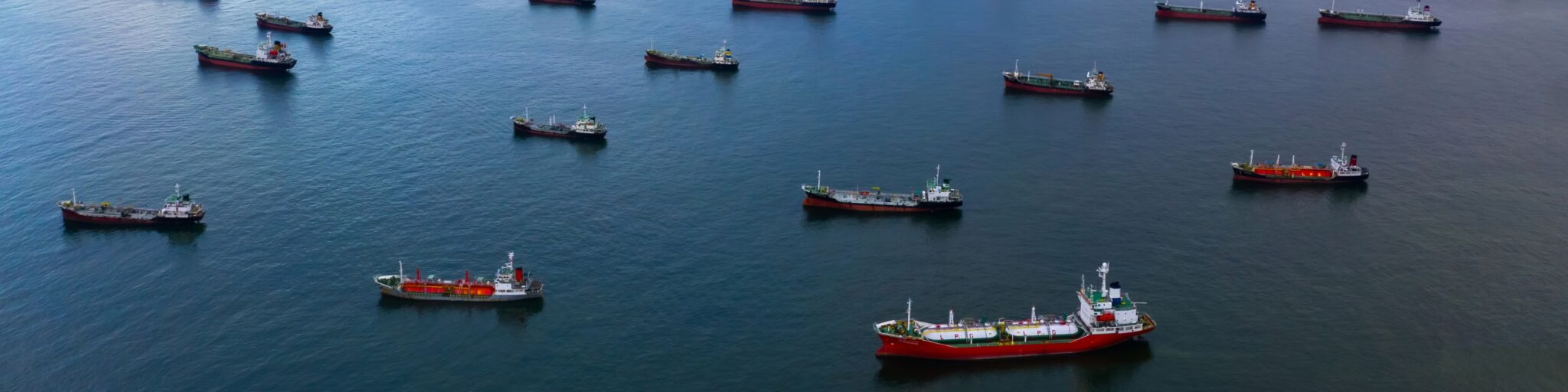
Synthetic Aperture Radar (SAR) is a satellite-based imaging technology that uses radar signals, rather than light, to capture detailed images of the Earth’s surface. Unlike traditional optical imagery, SAR imagery works in all weather conditions – day or night, through clouds, haze, or darkness. This makes it one of the most reliable tools for continuous maritime monitoring and intelligence.
In practice, SAR satellites send microwave pulses toward the Earth and record the signals that bounce back. The strength and timing of these reflections reveal surface details: metal structures like ships, oil platforms, or ports appear as bright spots, while calm water appears dark. By processing thousands of radar returns, SAR builds high-resolution images that reveal both physical objects and subtle surface changes invisible to the human eye.
In the maritime domain, SAR imagery helps detect dark vessels, monitor port congestion, track ship-to-ship (STS) transfers, and protect critical infrastructure through continuous, all-weather monitoring and change detection. It complements electro-optical (EO) imagery, radio frequency (RF) data, and AIS transmissions to create a verified, always-on view of global maritime activity.
Key Takeaways
- Synthetic Aperture Radar (SAR) captures imagery using radar signals instead of light, providing 24/7, all-weather visibility.
- It’s essential for dark vessel detection, sanctions monitoring, port and infrastructure protection, and logistics management.
- SAR complements EO and RF data for multi-sensor fusion, creating a full operational picture for maritime intelligence.
- Governments, traders, and logistics operators rely on SAR to verify vessel behavior when optical imagery or AIS data is unreliable.
- Integrated with Windward’s platform, SAR becomes part of an AI-driven maritime intelligence ecosystem.
How SAR Imagery Works
SAR uses microwave radar pulses to measure distance and reflectivity. When a satellite orbits the Earth, it sends a series of pulses toward the surface. The reflected signals are captured by the radar antenna, and through a process called synthetic aperture, the satellite combines data from multiple positions to create a much higher-resolution image than a single radar pass could achieve.
Because radar energy can penetrate clouds and does not rely on sunlight, SAR imagery can capture activity continuously, whether at night, during storms, through fog or smoke, or across vast ocean regions and specific points of interest.
SAR satellites operate at different resolutions and frequencies, balancing coverage area with detail. Modern systems can detect vessels as small as 10-30 meters and monitor broad ocean regions within hours.
SAR Imagery for Maritime Surveillance and National Security
For governments, defense agencies, and coast guards, Synthetic Aperture Radar imagery is a cornerstone of maritime domain awareness (MDA). It enables round-the-clock visibility over exclusive economic zones (EEZs), high-traffic trade corridors, and sensitive maritime borders where optical satellites or patrols fall short.
Because SAR operates independently of daylight and weather, it provides consistent intelligence for missions involving border protection, illegal, unreported, and unregulated (IUU) fishing enforcement, smuggling detection, and critical infrastructure monitoring.
By comparing historical radar collections with recent passes, agencies can track change over time, spotting new structures, vessels, or anomalies near restricted zones long before they escalate into threats.
Key Government Use Cases for SAR Imagery
| Use Case | Description | SAR Contribution |
| Dark Vessel Detection & Tracking | Identifying vessels operating without AIS or spoofing locations. | Detects metal ships in any conditions, verifying real positions. |
| IUU Fishing Detection | Monitoring illegal, unreported, or unregulated fishing in EEZs. | Reveals vessel presence and clustering even at night or under clouds. |
| Maritime Border Surveillance | Tracking small craft or illicit crossings near national boundaries. | Wide-area radar coverage ensures persistent coastal awareness. |
| Critical Maritime Infrastructure Monitoring | Protecting offshore platforms, cables, and pipelines. | Detects proximity, new construction, or interference over time. |
| Maritime Area Monitoring & Surveillance | Maintaining situational awareness across ports and sensitive zones. | Baseline mapping and anomaly detection of highly unusual activity. |
How do navies and coast guards use SAR imagery to detect non-reporting vessels?
Defense and enforcement agencies use SAR to locate ships operating without AIS transmissions. When radar reflections appear in an area where no vessel is broadcasting its position, it indicates concealed activity. By cross-referencing these detections with RF data and behavioral models, analysts can classify likely intent and trigger targeted inspections or imagery tasking.
How does radar imagery penetrate clouds and darkness to monitor restricted areas?
SAR operates in the microwave spectrum, which means its signals are unaffected by sunlight and can pass through clouds, fog, and haze. This allows consistent, high-resolution imaging of restricted zones and coastal regions, day or night, ensuring uninterrupted surveillance even in poor weather conditions.
How can SAR data support border protection and infrastructure security missions?
SAR imagery offers persistent visibility over maritime borders and offshore infrastructure, detecting small craft, unauthorized construction, or unusual activity near pipelines and platforms. By comparing current and archived radar collections, agencies can spot changes or intrusions early and coordinate targeted patrols or responses with confidence.
SAR Imagery in Global Trade and Sanctions
In the trading and shipping sectors, Synthetic Aperture Radar imagery plays a vital role in sanctions compliance, cargo verification, and maritime risk management. It provides visibility when traditional tracking methods, such as AIS or documentation, are unreliable, incomplete, or intentionally falsified.
Because SAR operates independently of light or weather, it can capture evidence of STS transfers, AIS manipulation, and shadow fleet operations that often occur at night or under cloud cover. By fusing SAR detections with AIS, EO, and RF data, compliance teams gain verifiable proof of vessel behavior that supports due diligence and enforcement.
In 2024, SAR satellite imagery confirmed a series of ship-to-ship oil transfers in the Mediterranean involving Russia’s shadow fleet. The analysis combined radar and optical data to verify AIS gaps, identify spoofed locations, and confirm tanker pairings, providing clear evidence of sanctions evasion activity. This example illustrates how SAR delivers independent verification and accountability in high-risk trading environments where traditional data sources are easily manipulated.
SAR Applications in Trading & Shipping
| Use Case | Description | SAR Contribution |
| Wet Bulk Commodity Trading & Ship-to-Ship Transfer Intelligence | Detects and verifies mid-sea cargo exchanges that may conceal the true origin of oil or refined products. | Primary – SAR imagery captures vessel proximity and transfer duration in all weather and lighting conditions, providing proof of covert STS activity. |
| Dry Bulk Commodity Trading & Port Stockpile Monitoring | Measures port-side stockpiles of commodities like coal, grain, or ore and monitors terminal throughput. | Secondary – SAR provides consistent coverage during clouded or nighttime conditions, complementing EO imagery for continuous stockpile visibility. |
| Offshore Platform & Rig Security | Tracks unauthorized vessel approaches near offshore rights, terminals, and exclusion zones. | Primary – SAR’s ability to detect metal objects through clouds or darkness enables continuous surveillance around high-value infrastructure. |
| Port Activity & Supply Chain Intelligence | Monitors port congestion, vessel queues, and anchorage conditions to support supply chain efficiency. | Secondary – SAR augments AIS and EO data by revealing real-time vessel density during poor visibility or adverse weather. |
How can SAR imagery identify ship-to-ship (STS) transfers linked to sanctions evasion?
SAR detects the radar signatures of two vessels in close proximity, revealing potential mid-sea transfers even when AIS signals are missing or falsified. This imagery provides concrete evidence of vessel-to-vessel interactions and helps verify suspicious movements related to sanctioned entities or cargo.
How reliable is SAR imagery for tracking shadow fleet tankers operating under false identities?
SAR data provides an independent record of a vessel’s position that cannot be spoofed. Because radar detects physical presence rather than self-reported data, it’s one of the most dependable methods for confirming the location and activity of tankers operating under false flags or hidden ownership structures.
How do compliance teams combine SAR data with AIS and EO imagery for verification?
SAR detections are cross-referenced with AIS transmissions and electro-optical imagery to confirm vessel activity. If a vessel’s AIS position does not match its SAR-detected location, that discrepancy signals possible manipulation or concealment. When EO imagery later aligns visually with radar detections, it provides verifiable proof of the vessel’s behavior.
SAR Imagery in Maritime Container Logistics
In container logistics, Synthetic Aperture Radar imagery helps maintain supply chain visibility when optical sensors or AIS data are disrupted. It provides consistent, weather-independent coverage of vessel traffic, port congestion, and anchorage conditions, ensuring logistics teams can monitor operations even in poor visibility or darkness.
SAR imagery is especially useful for:
- Port congestion monitoring, when optical views are blocked by cloud cover or limited to daylight hours.
- Disruption management, providing situational awareness during storms or system outages.
- ETA forecasting, by verifying vessel positions and anchorage times in real time.
By integrating SAR detections with AIS and EO data, logistics teams can validate reported activity, optimize scheduling, and respond faster to changing operational conditions.
How can radar imagery reveal vessel congestion when optical sensors are blocked by clouds?
Radar signals emitted by SAR satellites reflect off vessel surfaces regardless of weather, enabling consistent detection even through heavy clouds. This allows operators to accurately map congestion levels, monitor anchorage density, and anticipate potential port delays when optical imagery isn’t available.
How does SAR help ports monitor maritime traffic during storms or night operations?
SAR’s ability to capture radar reflections in all conditions provides uninterrupted awareness of vessel movement and port activity. Ports can monitor vessel arrivals, departures, and anchorage use around the clock, maintaining operational efficiency when traditional monitoring tools are limited by visibility.
How can SAR data improve ETA forecasting and disruption management?
By verifying vessel locations during poor weather or AIS outages, SAR enhances the accuracy of ETA predictions and helps identify developing disruptions earlier. Combined with AIS and predictive analytics, SAR imagery gives logistics teams a verified operational picture that supports proactive planning and faster recovery from delays.
How SAR Imagery Powers Maritime AI Systems
In maritime technology and data-driven intelligence systems, SAR imagery plays a crucial role in building accurate, continuous models of vessel behavior. Unlike optical sensors, which depend on daylight and clear skies, SAR delivers a consistent data stream for AI and analytics platforms that require full coverage of maritime activity.
Integrated into multi-sensor fusion environments, SAR imagery provides the radar detections that power:
- AI-driven anomaly detection, identifying unusual or high-risk vessel behavior patterns.
- Predictive analytics, improving classification and intent modeling for vessel operations.
- Contextual maritime intelligence, linking radar data with EO, RF, and AIS sources to create a complete, verified operational view.
This persistent, sensor-agnostic visibility makes SAR a cornerstone of AI-enabled maritime monitoring and decision support.
How does SAR data integrate with AI systems to detect maritime anomalies?
SAR imagery provides consistent radar detections that feed AI models trained to identify abnormal vessel behavior, such as loitering, rendezvous, or unreported transfers. The data helps algorithms distinguish between routine operations and potential risk indicators, supporting faster, more accurate anomaly detection across large ocean areas.
What features or patterns in SAR imagery indicate vessel activity or construction at sea?
SAR detects strong radar reflections from metallic structures, making vessels, rigs, and infrastructure appear as bright points in the imagery. Patterns such as repeated reflections, linear wakes, or new bright clusters can indicate vessel movement, ongoing construction, or changes in offshore activity zones.
Why is SAR imagery crucial for detecting non-reporting vessels when AIS data is unavailable?
Because SAR measures physical reflections rather than self-reported data, it detects vessels even when AIS transmissions are turned off or falsified. This independent verification ensures continuous awareness of maritime activity, filling the visibility gaps left by AIS and optical systems.
How SAR Imagery Strengthens Windward’s Remote Sensing Intelligence
Within Windward’s Remote Sensing Intelligence framework, SAR imagery is one of the core sensor types driving continuous maritime awareness. SAR data ensures 24/7, all-weather visibility, providing a verified layer of detection that supports compliance, security, and operational decision-making across all maritime domains.
By fusing SAR detections with EO imagery, RF signals, and AIS data, Windward transforms radar reflections into actionable maritime intelligence. This multi-sensor integration eliminates blind spots and gives users a unified, verified picture of global vessel activity, even when ships attempt to hide or manipulate their location.
Windward’s platform enhances SAR data through:
- AI-powered behavioral analytics, identifying patterns like ship-to-ship transfers, loitering, or spoofing that signal operational risk.
- Automated tasking and analysis, allowing users to request new satellite collections directly within the platform and receive processed, contextualized results in hours.
- Bring Your Own Imagery (BYOI) capabilities, enabling customers to upload and analyze their own SAR or EO collections within Windward’s environment.
- Multi-sensor fusion, combining SAR’s radar coverage with EO visual context and RF signal intelligence to validate every detection.
This integration turns raw radar data into reliable, explainable maritime insight. It allows governments, traders, and logistics operators to see through concealment, confirm vessel behavior, and act on verified intelligence, all within one collaborative workspace.
Explore more

The Strait of Hormuz
What Is the Strait of Hormuz? The Strait of Hormuz is a narrow maritime passage connecting the Persian Gulf to the Gulf of Oman and the Arabian Sea, forming the primary gateway between Gulf energy exporters and global shipping routes. Located between Iran to the north and Oman and the United Arab Emirates to the...
Read more

Sanctions Enforcement
What Is Sanctions Enforcement? Sanctions enforcement refers to the implementation and monitoring of economic and trade restrictions imposed by governments or international bodies. These measures may target states, companies, vessels, individuals, or sectors to influence political behavior, restrict financial flows, or respond to security threats. In the maritime domain, sanctions enforcement focuses on detecting and...
Read more

Intelligence, Surveillance, and Reconnaissance (ISR)
What Is Intelligence, Surveillance, and Reconnaissance (ISR)? Intelligence, Surveillance, and Reconnaissance (ISR) refers to the coordinated collection, processing, and analysis of information to support military and security decision-making. ISR operations integrate multiple sensors, platforms, and intelligence disciplines to build situational awareness, detect threats, and guide operational response. In maritime security environments, ISR combines satellite imagery,...
Read more

Bring Your Own Imagery (BYOI)
What Is Bring Your Own Imagery (BYOI)? Bring Your Own Imagery (BYOI) refers to the ability to ingest externally sourced imagery into an intelligence platform for integrated analysis. Rather than reviewing satellite images or sensor outputs in standalone tools, BYOI enables users to upload and analyze third-party imagery directly within an existing analytical environment. BYOI...
Read more

Explainable AI (XAI)
What Is Explainabe AI? Explainable AI (XAI) refers to artificial intelligence systems designed to make their reasoning transparent and understandable to human users. Instead of generating a risk score or anomaly alert without context, explainable artificial intelligence exposes the factors that influenced the outcome. In machine learning systems, this means connecting predictions to identifiable behavioral...
Read more