


March 22, 2026
March 22, 2026: Iran War Maritime Intelligence Daily


Electro-Optical (EO) Imagery
What is Electro-Optical (EO) Imagery?
Electro-Optical (EO) imagery refers to satellite or airborne images captured using visible and infrared light reflected from the Earth’s surface. Unlike radar-based systems, EO sensors rely on sunlight, making them ideal for daylight, clear-sky observation. EO imagery provides detailed, true-color visuals that help analysts and AI models identify vessels, infrastructure, and activities across ports, coasts, and open-ocean environments.
In the maritime domain, EO imagery delivers the visual confirmation needed to validate vessel behavior, verify port activity, and monitor environmental changes. When combined with synthetic aperture radar (SAR), radio frequency (RF), and automatic identification system (AIS) data, it provides a complete operational picture, blending visual evidence with behavioral and signal-based intelligence.
Key Takeaways
- EO imagery captures visible and infrared light to create high-resolution visual data for identifying vessels and maritime infrastructure.
- It offers clear visual confirmation that complements SAR’s all-weather coverage and RF’s signal detection.
- In maritime operations, EO imagery supports vessel classification, cargo verification, and environmental monitoring.
- Integrated with AI, EO imagery enables automated object detection, activity recognition, and visual evidence generation.
- As part of Windward’s multi-sensor ecosystem, EO imagery strengthens confidence and clarity in maritime decision-making.
How EO Imagery Works
EO sensors detect sunlight reflected or emitted by surfaces on Earth. Each pixel contains information about brightness and color, allowing analysts and algorithms to identify physical characteristics such as ship outlines, wake trails, port infrastructure, or oil slicks.
EO satellites typically operate in optical and near-infrared wavelengths, producing imagery that can distinguish between metal, vegetation, water, and oil. However, because they rely on sunlight and clear skies, EO systems are limited during nighttime or heavy cloud cover.
With a resolution as fine as 30 centimeters or better, EO satellites can clearly distinguish different vessel types, cargo operations, and changes in maritime infrastructure. Combined with SAR and RF, EO imagery ensures high-confidence situational awareness in any conditions.

How EO Imagery and the Future of AI-Driven Maritime Intelligence
In the maritime technology domain, electro-optical imagery plays a central role in powering next-generation, AI-driven analytics. Its high-resolution, daylight visuals provide the raw material that machine learning models use to detect, classify, and understand vessel activity across global waters.
By training AI on thousands of optical images, systems can automatically recognize vessel shapes, identify behavioral patterns such as loitering or ship-to-ship (STS) transfers, and track port operations with precision. When fused with SAR, RF, and AIS data, EO imagery becomes part of a unified intelligence network, connecting visual clarity with behavioral and signal-based insight.
This multi-sensor fusion enables:
- Automated vessel detection and classification, improving accuracy and speed in identifying ship types and activities.
- Anomaly detection, allowing algorithms to flag suspicious behaviors and request further SAR or RF confirmation.
- Environmental and infrastructure monitoring, supporting assessments of port expansion, oil spills, or construction at sea.
- Contextual validation, providing the visual proof analysts need to confirm what AI models detect.
How can AI automatically analyze EO imagery to detect vessels or port activity?
AI models interpret EO imagery by learning to recognize geometric and spectral patterns typical of ships, wakes, and infrastructure. These algorithms can detect vessel presence, classify ship type, and identify changes in port activity, automating what once required hours of manual review.
Why is it important to combine EO data with SAR or RF signals for maritime monitoring?
EO data provides unmatched visual detail but depends on daylight and clear weather. SAR and RF, which work in all conditions, ensure continuous detection. When integrated, they create a complete, verified operational picture, where EO confirms what radar or signal data detects.
What factors affect the resolution and interpretability of EO satellite images?
Resolution is determined by sensor design and orbit altitude. Leading commercial systems, such as Maxar’s WorldView-3, capture imagery at roughly 30 centimeters, enabling analysts to identify vessel type and orientation. However, factors like cloud cover, haze, or surface glare can reduce interpretability, which is why multi-sensor fusion remains essential for maritime AI systems.
Enhancing Maritime Security with EO Imagery
For governments, defense organizations, and maritime enforcement agencies, EO imagery provides critical daylight confirmation and situational awareness across sensitive maritime zones. It helps identify vessel types, assess intent, and visually confirm activities first detected by radar or RF sensors.
EO imagery is especially valuable for monitoring Exclusive Economic Zones (EEZs), high-traffic corridors, and areas around critical offshore infrastructure. Its visual clarity supports faster validation, stronger evidence for enforcement actions, and better coordination across agencies and partners.
In 2024, investigators used electro-optical imagery from the Sentinel-2 constellation and commercial providers to monitor a series of oil spills linked to maritime incidents and attacks in the Middle East, Southeast Asia, and the Caribbean. One investigation combined EO and radar imagery to map oil slicks from tanker accidents and targeted strikes, including a 200-kilometer-long spill caused by a missile hit on the Liberia-flagged tanker Chios Lion.
The report demonstrated how satellite imagery helps verify pollution events, support accountability, and guide rapid response by government agencies and environmental authorities.
Key Government Use Cases for EO Imagery
| Use Case | Description | EO Contribution |
| Visual Confirmation of Dark Vessel Detections | When radar or RF systems detect non-reporting vessels, EO imagery provides visual verification of vessel type, size, and location. | Offers daylight, high-resolution confirmation of detections, and helps classify vessels for enforcement. |
| Maritime border & EEZ Monitoring | Governments and coast guards use EO imagery to observe activity near national boundaries and within EEZs. | Provides contextual, visual intelligence for operations when weather and daylight permit. |
| Illegal Fishing & Smuggling Detection | EO imagery enables the identification of small vessels and behavior patterns associated with IUU fishing or trafficking. | Detects vessel clusters, nets, or surface traces in daylight, supporting targeted enforcement. |
| Critical Infrastructure & Offshore Site Assessment | EO data helps agencies monitor offshore platforms, pipelines, or naval bases for unauthorized activity or damage. | Delivers visual situational awareness for threat assessment and environmental safety. |
| Environmental Incident Response | High-resolution EO imagery supports rapid mapping of oil spills, leaks, and other marine pollution events. | Tracks spill spread and verifies environmental damage, enabling faster, evidence-based intervention. |
How do enforcement agencies use EO imagery to confirm dark vessel detections?
After SAR or RF sensors detect a non-reporting vessel, EO imagery provides visual validation by identifying vessel shape, color, and orientation. Analysts can confirm if it’s a ship and determine what activity is taking place, from loitering to cargo transfer.
How reliable is EO imagery for detecting small vessels or illegal fishing in daylight?
Modern EO satellites can identify vessels smaller than 15 meters in favorable conditions, enabling agencies to detect small craft or illegal, unreported, and unregulated (IUU) fishing operations within EEZs and restricted areas.
How do analysts use EO imagery to provide visual evidence for enforcement reports?
EO imagery offers high-resolution visual proof that can be annotated and archived. When integrated with AIS tracks and radar detections, these visuals form part of comprehensive enforcement reports, supporting legal and diplomatic action.
EO Imagery in Global Trade and Sanctions Monitoring
In trading, shipping, and compliance operations, electro-optical imagery provides the daylight visual evidence needed to verify vessel activity, document port calls, and support sanctions due diligence.
EO imagery helps confirm STS transfers, identify manipulation in AIS data, and validate whether cargo movements align with declared routes.
By combining EO visuals with SAR detections and RF signals, compliance teams gain a verified record of vessel behavior, essential for tracing sanctioned cargo, confirming ownership, or detecting deceptive practices.
In 2020, analysts used a combination of radio frequency detections and electro-optical satellite imagery to uncover a network of Iranian tankers smuggling crude into Syria. EO imagery revealed multiple Iranian-flagged vessels anchored near the Baniyas Refinery, despite no AIS transmissions in the area. Simultaneously, RF data geolocated maritime communication signals nearby, confirming vessel activity that had been concealed through AIS manipulation.
This fusion of visual and signal intelligence demonstrated how combining sensor types can expose sanctioned tanker operations and provide enforcement agencies with actionable evidence of illicit trade activity.
Key Trading & Shipping Use Cases for EO Imagery
| Use Case | Description | EO Contribution |
| Ship-to-Ship (STS) Transfer Verification | Confirms STS transfers detected by SAR or AIS anomalies, providing visual evidence for sanctions investigations. | Daylight imagery captures vessels positioned side by side, confirming transfer activity and vessel identity. |
| Port Call & Cargo Verification | Monitors vessel arrivals, departures, and loading/unloading operations to validate trade declarations. | Provides clear visual confirmation of port activity and infrastructure interaction. |
| AIS Manipulation & Identity Fraud Detection | Detects discrepancies between reported AIS positions and actual vessel presence. | Visually validates suspicious locations or vessel identity when paid with SAR/RF detections. |
| Commodity Flow & Stockpile Monitoring | Observes visible cargo movements and stockpile levels at terminals or storage facilities. | Tracks stockpile growth or reduction when cloud-free daylight conditions allow. |
| Sanctions Compliance & Investigation | Supports due diligence with visual evidence of vessel behavior, ownership markings, or operational patterns. | Supplies verifiable imagery for compliance documentation and investigative reporting. |
How can EO imagery verify suspicious ship-to-ship transfers or port visits?
EO imagery captures daylight visuals of vessels operating in proximity, providing direct evidence of mid-sea cargo exchanges or undeclared port calls. Combined with AIS and SAR data, it helps verify whether a vessel’s reported journey aligns with its real movements.
How does EO imagery help compliance teams identify manipulated AIS signals?
When a vessel’s reported AIS position conflicts with its physical location, EO imagery offers visual proof. By matching timestamps and coordinates, analysts can confirm AIS spoofing or non-reporting behavior.
How often can traders or insurers access new EO collections over the same region?
Most commercial EO satellites revisit key maritime regions every 1-3 days, depending on tasking and cloud conditions. High-priority zones, such as major ports or known transfer hubs, are imaged more frequently, ensuring near-continuous visibility for compliance and trade monitoring.
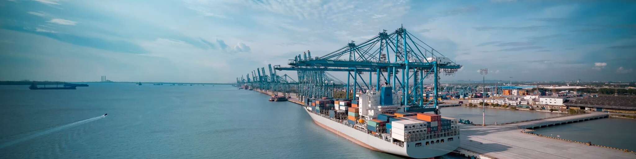
How EO Imagery Keeps Maritime Container Logistics Moving
In container logistics and port management, electro-optical imagery provides daylight visibility into vessel flow, berth utilization, and yard activity.
Its high-resolution visuals help logistics operators and port authorities verify operations, measure throughput, and anticipate delays, especially when AIS data or ground systems are incomplete.
By integrating EO imagery with SAR and RF detections, logistics teams can maintain situational awareness across terminals and anchorages, ensuring continuity even during peak congestion or disruption events.
EO imagery supports:
- Port congestion monitoring, offering visual confirmation of vessel queues and anchorage density.
- Container yard utilization tracking, mapping throughput, and identifying idle space.
- Operational performance assessment, correlating port activity with capacity.
- Disruption management, enabling decision-making when on-ground visibility is limited.
How can EO imagery help monitor and predict port congestion?
By capturing daylight visuals of vessel queues and terminal activity, EO imagery provides quantifiable insight into congestion levels and turnaround times. Combined with AIS and SAR data, it enables operators to forecast bottlenecks and reroute cargo proactively.
What insights can EO imagery provide about container yard utilization?
High-resolution EO imagery supports detailed assessment of container fill rates, truck flow, and berth occupancy. This helps logistics teams optimize loading schedules and improve terminal efficiency.
How are logistics companies integrating EO imagery with live AIS and operational data?
Modern platforms combine EO imagery with AIS tracks and port analytics to create a unified operational view. This integration allows faster, evidence-based decisions, ensuring that every movement from anchorage to yard is visible, verified, and aligned with demand.
How EO Imagery Strengthens Windward’s Remote Sensing Intelligence
Within Windward’s Remote Sensing Intelligence solution, electro-optical imagery serves as the visual foundation of maritime insight. Its daylight, high-resolution imagery brings context and confirmation to detections made by SAR and RF sensors, turning raw satellite data into explainable, verified intelligence.
When integrated into Windward’s AI-driven maritime intelligence platform, EO imagery enhances detection accuracy, supports compliance verification, and delivers actionable evidence across missions, from national security to trade and logistics.
Windward leverages EO imagery to:
- Validate detections from SAR and RF sensors, providing visual proof of vessel activity or infrastructure change.
- Automate visual analysis, using AI models to detect vessels, infrastructure, and environmental events in optical data.
- Enrich investigations, combining visual context with behavioral analytics, AIS patterns, and RF emissions.
- Support compliance and operational workflows, enabling users to view, annotate, and share EO imagery directly within collaborative investigations.
Through this integration, EO imagery becomes a source of ground truth that helps governments, traders, and logistics operators see, verify, and act with confidence.
Windward’s multi-sensor fusion connects these visuals to real-time behavioral data, enabling users to move from detection to decision within a single, unified platform.
Explore more

The Strait of Hormuz
What Is the Strait of Hormuz? The Strait of Hormuz is a narrow maritime passage connecting the Persian Gulf to the Gulf of Oman and the Arabian Sea, forming the primary gateway between Gulf energy exporters and global shipping routes. Located between Iran to the north and Oman and the United Arab Emirates to the...
Read more

Sanctions Enforcement
What Is Sanctions Enforcement? Sanctions enforcement refers to the implementation and monitoring of economic and trade restrictions imposed by governments or international bodies. These measures may target states, companies, vessels, individuals, or sectors to influence political behavior, restrict financial flows, or respond to security threats. In the maritime domain, sanctions enforcement focuses on detecting and...
Read more

Intelligence, Surveillance, and Reconnaissance (ISR)
What Is Intelligence, Surveillance, and Reconnaissance (ISR)? Intelligence, Surveillance, and Reconnaissance (ISR) refers to the coordinated collection, processing, and analysis of information to support military and security decision-making. ISR operations integrate multiple sensors, platforms, and intelligence disciplines to build situational awareness, detect threats, and guide operational response. In maritime security environments, ISR combines satellite imagery,...
Read more

Bring Your Own Imagery (BYOI)
What Is Bring Your Own Imagery (BYOI)? Bring Your Own Imagery (BYOI) refers to the ability to ingest externally sourced imagery into an intelligence platform for integrated analysis. Rather than reviewing satellite images or sensor outputs in standalone tools, BYOI enables users to upload and analyze third-party imagery directly within an existing analytical environment. BYOI...
Read more

Explainable AI (XAI)
What Is Explainabe AI? Explainable AI (XAI) refers to artificial intelligence systems designed to make their reasoning transparent and understandable to human users. Instead of generating a risk score or anomaly alert without context, explainable artificial intelligence exposes the factors that influenced the outcome. In machine learning systems, this means connecting predictions to identifiable behavioral...
Read more