

March 6, 2026
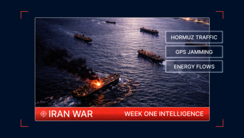
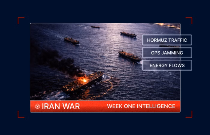
One Week Into the Iran War: A Maritime Intelligence Breakdown


One Week Into the Iran War: A Maritime Intelligence Breakdown
What’s inside?
At a Glance
- Operation Epic Fury triggered immediate disruption across maritime chokepoints in the Gulf.
- Commercial tanker traffic through the Strait of Hormuz collapsed as strikes, threats, and insurance withdrawal drove operators out of the corridor.
- At least eight commercial vessels have been struck since the start of the conflict across the Gulf, Gulf of Oman, and nearby waters, including a missile incident near Khasab involving a salvage tug.
- More than 1,100 vessels experienced GPS and AIS interference, degrading navigational reliability across the region.
- Cape of Good Hope diversion traffic surged as operators rerouted around Gulf transit routes while Red Sea and Suez activity fluctuated.
- Port disruption indicators began rising across major Gulf hubs, including Jebel Ali and Khalifa.
- Energy markets began showing supply stress as Gulf oil cargo departures dropped sharply and shadow fleet activity continued, including a semi-dark STS transfer by the sanctioned tanker M/V TRUST.
- The maritime conflict expanded geographically after a U.S. submarine sank the Iranian frigate IRIS Dena near Sri Lanka, extending risk into the Indian Ocean and exposing major importers such as India to supply disruption.
The First Week of the Iran War at Sea
On February 28 at 01:15 ET, the U.S. and Israel launched coordinated strikes against Iranian military targets under Operation Epic Fury, marking the start of the current conflict.
The operation targeted Islamic Revolutionary Guard Corps command facilities, missile and drone launch sites, air defense systems, and military airfields, while also aiming to degrade elements of Iran’s missile infrastructure and nuclear development network. The strikes were framed by U.S. and Israeli officials as an effort to eliminate immediate threats to regional security and prevent Iran from advancing toward a nuclear weapons capability.
Within hours, Iran launched retaliatory missile and drone attacks across the region. Targets included U.S. military bases and allied facilities in Qatar, Kuwait, Bahrain, the United Arab Emirates, and other Gulf states, while air raid sirens sounded in Israel as Iranian projectiles targeted Israeli territory. The escalation rapidly expanded the conflict beyond bilateral confrontation. Hezbollah entered the fighting soon after, launching rockets and drones toward Israel, while Israeli forces responded with strikes against Hezbollah-linked positions in Lebanon.
For maritime operators, the immediate consequence was the transformation of the Strait of Hormuz and surrounding Gulf shipping lanes into an active conflict environment.
Within hours, vessel behavior began to change.
Tankers and LNG carriers paused voyages or reversed course before entering the Strait, while routing decisions, vessel visibility, and navigational reliability across the region began shifting sharply.

Seven days later, the maritime operating picture reflects a system under sustained stress: collapsing transit volumes through Hormuz, vessel strikes across multiple maritime zones, electronic interference affecting navigation systems, and global shipping flows adjusting in real time.
Hormuz Traffic Collapses
In the days following the initial strikes, commercial behavior in the Strait of Hormuz shifted rapidly.
Early on, tankers and LNG carriers began pausing voyages or reversing course before entering the Strait. Western-linked vessels were disproportionately represented among these deviations, reflecting immediate reassessment of transit risk.

Within 48 hours, tanker traffic had effectively halted, with hundreds of vessels holding position in the Gulf of Oman or drifting outside the Strait awaiting further clarity.
By March 2, only seven vessels crossed the corridor, dramatically below the typical daily average of roughly 70–80 crossings. That same day, senior officials from Iran’s Islamic Revolutionary Guard Corps warned that vessels attempting to transit the Strait could be targeted, reinforcing earlier declarations that the corridor would be closed in response to U.S. and Israeli strikes.
Traffic fell even further over the following days. On March 3, only four vessels crossed the Strait of Hormuz, followed by five crossings on March 4, keeping volumes dramatically below typical daily levels. By March 5, transit activity remained extremely limited, confirming that routine commercial movement through the corridor had effectively collapsed.
These extremely low transit numbers reflect a combination of factors, including IRGC threats against vessels attempting transit, direct vessel strikes in regional waters, the withdrawal of war-risk insurance coverage, and a broader collapse in commercial confidence in safe passage through the corridor.
Although the Strait has not formally closed, the result has been a functional shutdown of routine tanker traffic.
Missile Strike Near Khasab
On March 5, a tug operating approximately 18 nautical miles northeast of Khasab, Oman, was reportedly struck by two missiles while attempting to tow an abandoned merchant vessel that had previously been hit. The merchant vessel had been adrift following an earlier strike and abandoned by its crew. The status of the tug and its crew has not yet been confirmed.

UKMTO subsequently advised merchant vessels not to transit the Strait of Hormuz, recommending that vessels within the Gulf designate a Safe Muster Point and seek shelter if air raid sirens are activated.
This incident reinforces the continued kinetic threat to vessels operating near the Strait of Hormuz approaches, including vessels engaged in salvage or recovery operations.
Insurance Market Reaction Accelerated the Collapse
The insurance market’s response further accelerated the halt in traffic.
Following the strikes, many protection and indemnity (P&I) clubs — which cover third-party liabilities for roughly 90% of the global merchant fleet — issued 72-hour notices cancelling certain war-risk extensions for vessels trading in the Middle East after reinsurers withdrew support for those risks.
These extensions cover liabilities arising from war-related incidents and sit alongside separate hull war-risk policies that insure physical damage to vessels.
At the same time, the Lloyd’s Joint War Committee expanded its list of high-risk waters across the Gulf. Additional voyage premiums reportedly rose from around 0.2% of vessel value to as much as 1%.
Without adequate war-risk cover, vessels cannot be chartered or financed, effectively preventing voyages from proceeding even if the waterway remains physically open.
Vessel Strikes Spread Across the Region
Commercial shipping quickly became exposed to kinetic risk.
Within the first days of escalation, several vessels were reportedly struck across the Gulf and Gulf of Oman, including:
- MKD Vyom (IMO 9284386): Crude tanker struck off Oman.
- Skylight (IMO 9330020): Sanctioned chemical tanker hit during regional military activity.
- Hercules Star (IMO 9916135): Tanker struck near the UAE.
- Sea La Donna (IMO 9380532): Incident associated with GPS spoofing indicators.
The pattern expanded further over the following days. Additional confirmed incidents include:
- Stena Imperative (IMO 9666077): U.S.-flagged tanker struck while moored in Bahrain.
- Athe Nova (IMO 9188116): Vessel hit near Khor Fakkan.
- Ocean Electra (IMO 9402782): Strike reported in regional waters.
- Safeen Prestige (IMO 9593517): Additional confirmed vessel incident.
- Sonangol Namibe (IMO 9325049): Crude tanker struck by an explosion, while anchored southeast of Kuwait, triggering a cargo tank breach and oil leak.
These incidents now form a broad geographic arc across the maritime environment rather than clustering around a single chokepoint. The distribution suggests a strategy designed to create widespread disruption across the regional shipping environment rather than targeting specific national affiliations.

GPS Jamming and AIS Disruption Spread Across the Gulf
At the same time, the electronic environment around Gulf shipping lanes degraded sharply.
Windward detected more than 1,100 vessels affected by GPS and AIS interference within the first 24 hours following the launch of Operation Epic Fury.
AIS signals were falsely projected onto UAE airports, over the Barakah nuclear facility, into inland locations inside Iran, and into circular “crop-pattern” distortions across Gulf waters.
Windward also identified at least 35 jamming clusters between February 28 and March 2.
Two distinct interference patterns emerged when examining the GPS jamming landscape:
- Denial zones: Areas where AIS transmissions are not received despite vessels likely operating normally.
- Injected signal zones: Locations where AIS signals are manipulated, causing vessels to appear in incorrect positions, sometimes even on land.

A March 4 analysis identified 44 injected signal zones and 92 denial areas across the Persian Gulf.
These disruptions complicate both navigation and compliance monitoring, increasing reliance on multi-source intelligence methods to reconstruct accurate vessel positioning.
Multi-Source Intelligence Reveals the Reality Behind AIS Jamming
A recent example illustrates why jamming environments demand a multi-source intelligence approach.
Two Windward visualizations from the same area near Port Khalid in Sharjah on March 3 highlight the difference between AIS signals and physical vessel presence.
The regional heat map of GPS interference shows the jamming landscape across the Gulf.

Red hexagons represent injection zones, where manipulated signals cause vessels to broadcast incorrect positions. Yellow hexagons represent denial zones, where AIS transmissions disappear entirely.
This next visualization, based on synthetic aperture radar (SAR) satellite imagery, captures the same area at the same time.

In injection zones, SAR detects far fewer vessels at the AIS-reported coordinates, confirming that manipulated GPS signals are placing ships on the map where they physically are not. In denial zones, SAR detects vessels that transmit no AIS signal at all. The ships are physically present but invisible to anyone relying on AIS alone.
The example illustrates a critical operational reality: in jamming-affected environments, AIS data still provides valuable signals about interference patterns. What AIS cannot reliably provide is the true physical location of vessels.
Alternative data sources — including SAR imagery, RF detection, and behavioral analytics — are required to reconstruct ground truth when electronic interference degrades conventional vessel tracking.
Red Sea and Suez Traffic Become Unstable
While Hormuz traffic collapsed, other corridors also experienced volatility.
Bab el-Mandeb
Traffic initially dropped to extremely low levels, with only two crossings recorded on March 3. Activity rebounded the following day, with 21 crossings on March 4, representing a dramatic increase relative to the recent weekly average.
By March 5, traffic through the corridor remained above recent baseline levels, suggesting temporary corridor utilization and repositioning movements across the Red Sea approach, even as the security environment remains unstable.
Bulk carriers accounted for the largest share of movements during the surge, followed by general cargo vessels and vehicle carriers.
However, continued Houthi threats across the Red Sea region mean the stability of traffic through the Bab el-Mandeb corridor remains uncertain.
Suez Canal
Suez Canal activity moved in the opposite direction.
Traffic surged to 49 crossings on March 3, before falling sharply to 23 crossings on March 4, well below the seven-day average.
By March 5, throughput remained below typical baseline levels, reinforcing the uneven redistribution of global shipping flows as operators adjust routing strategies across multiple maritime chokepoints.
These fluctuations highlight how global trade lanes are responding dynamically to the conflict environment, with operators balancing the risks of Red Sea transit, Gulf exposure, and long-haul diversions around southern Africa.
Global Rerouting Around the Cape of Good Hope
One of the clearest structural shifts has been the rise in Cape of Good Hope diversion traffic.
On March 3, a total of 94 vessels transited around southern Africa, far above recent averages. Traffic remained elevated the following day with 87 transits on March 4, reinforcing the sustained rerouting of global shipping away from Gulf transit routes.
By March 5, diversion traffic remained broadly in line with these elevated levels, confirming that many operators continue to commit to long-haul rerouting strategies as uncertainty around Gulf transit persists.
Bulk carriers and container vessels dominated these movements, reflecting mainstream commercial operators adjusting voyage plans rather than shadow fleet activity.
Wet Cargo Flows Reveal Emerging Energy Market Shock
Beyond vessel movements and chokepoint disruption, cargo-level data also points to growing stress across global energy markets.
Since the launch of Operation Epic Fury on February 28, tanker activity across the Arabian Gulf has dropped sharply. Windward tracked 314 tankers above 16,000 DWT operating in the Gulf during the six days following the strikes, compared with 442 tankers during the six days prior, highlighting a significant contraction in regional tanker activity.

Cargo export volumes show a similar pattern. Gulf oil cargo departures fell to 8.4 million barrels per day on March 6, marking the lowest level of the week and a sharp contraction from volumes above 30 million barrels per day at the start of the period.
The decline was driven primarily by a complete halt in Iraqi exports, alongside significant reductions from Kuwait and Saudi Arabia, while only modest volumes from the United Arab Emirates, Oman, and Qatar provided limited offset.
The total sits dramatically below the ~30.2 million barrels per day seasonal 12-month baseline, highlighting the scale of the disruption now affecting regional export flows.

At first glance, crude flows still appear active. Large cargoes continue loading from the Middle East Gulf, including the PLATA CARRIER lifting roughly 1.94 million barrels chartered by Indian Oil and the AL YARMOUK loading more than 2.16 million barrels of Kuwait Export crude.
However, operators are increasingly relying on ship-to-ship transfer hubs such as the Dubai STS zone to move cargo through fragmented supply chains rather than exposing large tankers to high-risk transit routes.
At the same time, refined product and gas flows appear increasingly fragile. Cargoes currently on the water were largely loaded before the conflict began, while early-March departures from Ras Laffan LPG and condensate terminals may represent some of the final shipments before production disruptions begin to affect supply.
Venezuela Export Patterns Reflect Structural Market Stress
Outside the Gulf region, tanker activity linked to Venezuelan exports also shows signs of contraction.
AIS-verified tanker voyages within the Venezuelan EEZ have been declining following two major geopolitical shocks.
- Pre-blockade baseline (March–Dec 15, 2025): ~32.18 verified voyages per week.
- U.S. maritime blockade (Dec 16, 2025): activity fell to 15.70 voyages per week, a 51% reduction as legitimate tonnage exited the EEZ.
- Post-February 28 Iran war: activity dropped further to 10.50 voyages per week.
This represents a 67% decline from the 2025 baseline, indicating that legitimate international tanker participation in Venezuelan exports has sharply contracted.

At the same time, dark fleet participation increased slightly, rising from 1.04 to 1.17 voyages per week following the outbreak of the Iran conflict. This AIS-based analysis likely underrepresents actual dark-fleet activity, as vessels engaged in sanctioned oil trades frequently employ non-transmitting practices such as AIS shutdowns or spoofing.

Verified Venezuelan cargo destinations have also shifted geographically since February 28. Rather than long-haul shipments toward Asia, most visible voyages are now concentrated within Latin America and the Caribbean, including Brazil (Itaqui), Colombia (Covenas), and Panama.
Some dark fleet vessels are increasingly using Colon and Cristobal in Panama as transit points, likely enabling Panama Canal passage while bypassing the now-volatile Middle Eastern chokepoints.
Satellite Imagery Shows Stable Vessel Presence at José Terminal
Satellite imagery analysis provides additional insight into how these changes are unfolding on the ground.
Remote Sensing Intelligence analysis comparing imagery from January 28, 2026 (pre-conflict) and March 3, 2026 (post-conflict) indicates no meaningful change in tanker presence at Venezuela’s José Terminal, the country’s primary crude export hub.


The comparison highlights an important operational distinction. While AIS-verified trade volumes are declining and legitimate tanker participation is falling, physical vessel presence at key export terminals can remain stable due to dark-fleet activity and non-transmitting vessels.
Taken together, these signals indicate that verified trade visibility may fall faster than actual cargo movements, as sanctioned supply chains increasingly rely on opaque maritime logistics.
Shadow Fleet Activity Exploits the Conflict
On March 3, 2026, the Russian-flagged crude tanker M/V TRUST, a known component of the Russian shadow fleet, executed a high-probability semi-dark ship-to-ship transfer of approximately 325,500 barrels of Russian crude in the Gulf of Oman.

The vessel had loaded at Ust-Luga 38 days earlier and was already sanctioned across 10 lists in 8 jurisdictions, including OFAC, the UK, and the EU. Following evasive routing and multiple declared destination changes, the vessel anchored in Omani territorial waters at 09:02 UTC and conducted a stationary semi-dark transfer with a similarly sized non-transmitting vessel.
This event appears to reflect direct exploitation of the conflict environment. The vessel used the maritime noise and diverted Western surveillance created by the U.S.-Iranian escalation to mask a sanctions-evasion operation, demonstrating how shadow fleet actors can weaponize regional kinetic conflict to sustain illicit energy flows.
India’s Energy Exposure Deepens
India is emerging as one of the most exposed major importers under the current Gulf disruption scenario.
As of March 6, 15 LNG tankers were reporting India as their destination. Of these, two were already within Indian waters, two were due within two to three days from Oman and South Korea, three were stuck in the Arabian Gulf, seven were en route from the Americas and Africa with ETAs of two weeks to one month, and one was in China with a long-term ETA in June. One South Korean vessel reportedly executed a U-turn in Omani waters, likely linked to recent strikes affecting Omani ports.
Against that backdrop, the United States granted India a 30-day waiver to purchase stranded Russian oil in order to stabilize supply, reflecting growing concern over India’s reliance on Hormuz-linked energy flows.
India’s Supply Chain Pressure Is Uneven
Windward data suggests that India’s exposure is increasingly uneven across fuels.
For crude oil, approximately 10.4 million barrels are currently in transit to India across 57 tankers, with 22 already operating in Indian waters and six more expected within the next 72 hours. India’s estimated 25-day Strategic Petroleum Reserve provides a short-term buffer, although replacement supply is increasingly shifting toward long-haul cargoes from the Americas and Africa.

For LNG, the supply chain appears significantly more fragile. Of the 15 LNG tankers reporting India as their destination, only four are expected within the next several days. Three remain trapped in the Arabian Gulf, while seven others from the Americas and Africa are two to four weeks away, leaving a near-term gap that could affect power generation and fertilizer production.

For LPG, the structural risk appears most immediate. While 35 of 49 LPG tankers destined for India are already operating in Indian waters, providing a temporary floating buffer, departures from Gulf export terminals fell from 824,487 barrels on February 28 to zero on March 5, indicating a potential collapse in the inbound pipeline if disruption persists.

Infrastructure Incidents Expand Maritime Risk
The conflict has also affected maritime infrastructure and port environments.
Fujairah
A fire broke out at the Fujairah Oil Industry Zone after UAE air defenses intercepted a drone, and falling debris struck a storage tank.
At the time of the incident, 116 vessels were present in the surrounding anchorage, including product tankers, crude tankers, and supply vessels.

The event highlighted the vulnerability of dense tanker anchorages to spillover from regional military activity.
Bahrain BAPCO Refinery
On March 5, Bahrain’s BAPCO oil refinery was struck during an Iranian missile attack targeting regional energy infrastructure. The strike triggered large fires visible across the refinery complex and forced emergency response teams to contain the blaze.
BAPCO is one of Bahrain’s primary refining facilities and a critical node in the Gulf’s refined products supply chain. Although the strike occurred onshore, the incident underscores the growing exposure of maritime-linked energy infrastructure across the region.
Refineries, export terminals, and storage facilities remain tightly connected to tanker traffic across the Gulf, meaning attacks on energy infrastructure can quickly propagate into maritime logistics disruptions.
Port of Duqm
Earlier strikes damaged dry-dock infrastructure and triggered fires near the container terminal at the Port of Duqm in Oman.

Fourteen vessels were present in the port during the incident.
These attacks demonstrate that maritime risk now extends beyond transit corridors into logistics hubs and export infrastructure.
Indian Ocean Escalation
The maritime conflict expanded beyond the Middle East when the Iranian frigate IRIS Dena was struck approximately 40 nautical miles south of Sri Lanka.
A U.S. submarine reportedly torpedoed and sank the vessel while it was transiting international waters after participating in a multinational naval exercise in India.

Sri Lankan naval forces launched a search-and-rescue operation, recovering survivors and conducting ongoing recovery operations.
The strike represents a significant geographic escalation, extending the maritime security implications of the conflict into the Indian Ocean theater.
U.S. Operations Against Iranian Naval Assets
U.S. military operations continue to expand against Iranian maritime and missile infrastructure.
According to the latest CENTCOM update, U.S. forces reported that they “control the skies” and have intensified operations against Iranian mobile missile launchers and naval assets. The IRIS Shahid Bagheri, previously struck at the beginning of the war, was reported on fire again as offensive operations entered day seven.
CENTCOM also stated that more than 30 Iranian warships have now been sunk or destroyed and that nearly 200 targets inside Iran were struck in the latest wave of attacks, including missile, drone, and command infrastructure. Iranian ballistic missile attacks were reported down 90%, and drone strikes down 83%, though CENTCOM emphasized that the threat environment remains active.
These developments matter for maritime markets because they suggest Iran may be husbanding resources and adapting its strike posture rather than exhausting capabilities early. That increases uncertainty around the duration and pattern of maritime disruption.
Port Disruption Emerging Across Gulf Hubs
Operational disruptions are now appearing in major regional ports.
At Jebel Ali, the following exception indicators were recorded:
- 18 late departures.
- 5 port-of-loading rollovers.
- 9 transshipment rollovers.
- 32 transshipment-delay cases.
At Khalifa Port, disruption rose even more sharply:
- 14 late departures (1,300% increase day-on-day).
- 14 port-of-loading rollovers.
- 6 transshipment rollovers.
- 11 transshipment delays.
These patterns suggest that chokepoint disruption is now propagating into regional logistics networks, affecting cargo flows beyond the immediate conflict zone.
Outlook
One week into the Iran war, the maritime operating environment is characterized by multi-layer disruption.
Transit through the Strait of Hormuz has effectively collapsed, forcing rerouting. Vessel strikes have occurred across multiple maritime zones, while electronic interference continues to degrade navigational reliability.
At the same time, congestion indicators are emerging across Gulf ports, and global shipping patterns are adjusting to sustained uncertainty around Gulf transit.
Absent rapid de-escalation, maritime risk across the region remains elevated.
Explore more

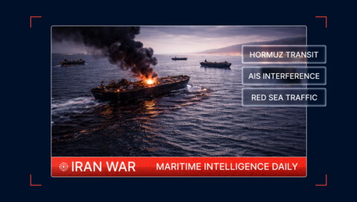
March 5, 2026: Iran War Maritime Intelligence Daily
At a Glance Operational Overview Maritime traffic across the Middle East remained deeply disrupted on March 4 as threats by Iran’s Revolutionary Guards against vessels transiting the Strait of Hormuz continued to shape the operating environment. Only five total vessel crossings were recorded through Hormuz, far below typical baseline levels and unchanged from the previous...
Read more

March 4, 2026: Iran War Maritime Intelligence Daily
At a Glance Operational Overview Maritime traffic through the Strait of Hormuz declined further on March 3 as the closure declared by Iran’s Revolutionary Guards continued to deter most commercial movement through the world’s most critical energy chokepoint. Only four vessels crossed the Strait during the day, representing a further 42.86% decline from March 2...
Read more

March 3, 2026: Iran War Maritime Intelligence Daily
At a Glance Operational Overview As of March 3, the maritime environment reflects the declared closure of the Strait of Hormuz and sustained commercial withdrawal from the corridor rather than temporary hesitation. On March 2, Iran’s Revolutionary Guards formally declared the Strait of Hormuz closed and warned that vessels attempting transit would be targeted. Traffic...
Read more

March 2, 2026: Iran War Maritime Intelligence Daily
At a Glance Operational Summary As of March 2, 2026, tanker traffic through the Strait of Hormuz has collapsed following vessel strikes and escalating military activity in the Gulf. While Operation Epic Fury began on February 28, the past 24 hours reflect the operational consequences: suspended transits, halted tanker movement, insurance withdrawal, and precautionary vessel...
Read more