


July 22, 2026
Two Days After the Houthi Blockade Announcement, the Red Sea Split in Two


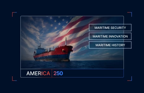
Celebrating 250 Years of American Maritime Strength
What’s inside?
In 1776, the ocean was opaque.
A ship’s captain leaving an American port for European waters could not be certain when they would arrive, or whether they would arrive at all. A typical Atlantic crossing took six to eight weeks, shaped by weather, currents, and chance on every individual voyage. Navigation depended on what a watchful crew could see from the deck, what the stars revealed at night, and what experienced mariners had learned to read on the surface of the water itself. A new nation was being declared on the western edge of that opacity. Independence meant building everything outward from a coast that opened onto a world the founders could not fully see. American maritime identity began in that uncertainty, and in the courage of the sailors who crossed an ocean they could not fully chart to secure the country that would become the United States.
Two hundred and fifty years later, that courage remains. The ocean has become more legible. The American instinct to see through it has been continuous.
Charting the Ocean
By the 1840s, the U.S. Navy had been operating for decades, and the volume of information sitting in its records had outpaced the country’s ability to use it. Thousands of ships’ logbooks, gathered over generations of voyages, contained scattered observations on winds, currents, water temperatures, and weather conditions. Almost none of it had been organized in a way that helped the next captain making the same voyage.
Lieutenant Matthew Fontaine Maury, a U.S. Navy officer working at the Navy’s Depot of Charts and Instruments, recognized that the scattered information was the answer to a question every American mariner faced.

He began compiling the logbooks systematically. By 1847, he had published the first Wind and Current Charts of the North Atlantic, organized from the accumulated data of thousands of voyages.

The result was transformative. The New York to San Francisco voyage, which had averaged 188 days, dropped by roughly 47 days under Maury’s routing. Every shipping company in the world eventually adopted the methodology. American merchant captains carried Maury’s charts as standard equipment. The U.S. Navy’s investment in turning data into clarity had become a foundation of global maritime commerce.
The pattern Maury established became distinctly American. Take what is scattered, find the order inside it, and hand the result to the people who need it most. The ingenuity was not in the data itself. It was in the discipline of making it legible.
Reading What the Sea Conceals
The ocean has always concealed as much as it reveals. The mariners who built American naval and commercial strength learned early that some of what they would encounter at sea was designed to deceive them.
The tactic of flying false flags is centuries old. Pirates and privateers raised the flags of friendly nations to close on their targets before revealing their true identity. The practice predates the American republic by centuries and was a fixture of maritime conflict from the Mediterranean to the Caribbean. American crews encountered it from the earliest days of the merchant fleet and the young Navy alike.
Reading the ocean for what it actually was, not what it claimed to be, became part of the craft of being an American mariner. A vessel approaching with the wrong silhouette under a friendly flag. A merchant ship whose course did not match its declared destination. A trader whose papers were technically clean but whose behavior suggested something else. The vigilance required to interpret these signals was learned at sea and passed down through generations of American maritime tradition.
The same patterns are visible in 2026. Approximately 290 tankers are currently broadcasting under fraudulent registry flags, with 88% of them under Western sanctions. Twenty different fraudulent registries are now in active use, including two (Nicaragua and Equatorial Guinea) that emerged within the last half year. The Netherlands Antilles, Guyana, Guinea, and Madagascar lead the list. Vessels cycle through these flags rapidly, with flag-hopping at unprecedented levels, designed to defeat the list-based screening that conventional enforcement relies on.
The forms of deception have changed across two and a half centuries. The instinct to see through them has not. It remains one of the most distinctly American contributions to maritime practice, and one of the threads that runs uninterrupted from the Continental Navy to the present.
Moving the Nation’s Goods
The American maritime story is not only about exploration and conflict. It is also, and more often, about commerce. The country’s economy has been carried by sea from the beginning, and the ports that handle that commerce are some of the most important pieces of infrastructure the nation possesses.
The San Pedro Bay complex on the Pacific coast, comprising the Ports of Los Angeles and Long Beach, is the busiest port complex in the United States. It handles roughly 31% of all U.S. containerized waterborne trade and moves more containers per ship call than any port complex in the world. The cargo that passes through it touches almost every American household. The goods on shelves in every state, the components in factories across the country, the materials in construction projects from coast to coast, a meaningful share of all of it moves through Los Angeles and Long Beach.
The complex runs because the people running it do. A workforce of longshore workers, terminal operators, vessel traffic controllers, customs officials, truck drivers, rail crews, marine pilots, and tugboat operators keeps the country supplied, day after day, in conditions that demand precision and stamina. The country has marked 250 years of independence in part because every day for those 250 years, Americans have done the work of moving the goods that hold the economy together.
Cutting Through the Data
The contemporary maritime environment carries forward every challenge the previous eras knew, plus several that are genuinely new. Vessels still fly the wrong flags. Ports still depend on a workforce that keeps the country moving. The ocean still conceals as much as it reveals.
What has changed is the volume and the form of what needs to be seen. A modern vessel broadcasts its identity, position, and course continuously through digital signals that ports, regulators, insurers, and other ships rely on to keep the global maritime system functioning. The signals can be jammed. They can be spoofed, placing a ship in a location it never sailed. The result is a maritime environment in which the data abundance that should produce clarity sometimes produces the opposite.
The American response has been the same instinct Maury brought to the logbooks. The technologies are new. Satellite imagery, radio frequency detection, behavioral pattern recognition, and artificial intelligence trained to surface what a human analyst could not process in the available time. The discipline is old. The discipline is the part that has been American from the beginning.
The country that crossed an opaque Atlantic in 1776 is the same country that has spent two and a half centuries learning to see through what the ocean conceals. The methods have evolved with every generation. The pursuit of clarity has remained continuous.
A Maritime Nation, Still
Two hundred and fifty years after the Declaration of Independence, the United States is still a maritime nation. Its commerce moves by sea. Its security depends on what its maritime forces can see and verify. Its economic life is connected through the ports that handle the world’s goods. Its naval and commercial traditions continue to set the standards that the global maritime community builds on.
Windward is proud to stand with America in that ongoing pursuit. As a partner working at the intersection of maritime intelligence and the technologies shaping the next era, we are honored to celebrate this milestone alongside the country whose maritime heritage made the modern industry possible.
Explore more

Top 5 Takeaways from America’s Maritime Action Plan
America’s Maritime Action Plan outlines a coordinated effort to rebuild domestic shipbuilding capacity, expand the U.S.-flag fleet, reform procurement, strengthen workforce pipelines, and modernize maritime regulation. Key Takeaways What It Means for Maritime Stakeholders The Maritime Action Plan aligns industrial policy, fleet policy, procurement reform, workforce development, and regulatory modernization into a unified structure. For...
Read more

Tanker Evading Venezuela Blockade Paints Russian Flag as U.S. Pursuit Continues
According to New York Times reporting, the runaway tanker Bella 1 is claiming Russian protection after painting a Russian flag on its hull and being formally renamed and entered into an official Russian vessel registry — moves that could complicate U.S. efforts to board the ship. The runaway tanker Bella 1 is claiming Russian protection...
Read more

U.S. Sanctions Six Shipowners and Prepares to Seize More Venezuela Tankers
Expanding Sanctions and the First Enforcement Actions As the United States prepared to intercept and seize more tankers off Venezuela, six shipping companies that owned sanctions-evading very large crude carriers were designated yesterday, with more expected in the coming days. The six companies were each the registered owners of six VLCCs (White Crane IMO 9323429;...
Read more
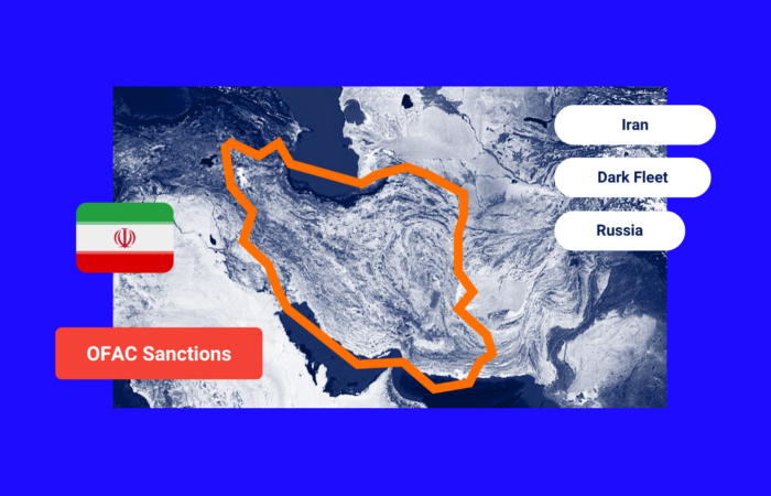
Largest Iranian Shipping Network Sanctioned in Sweeping OFAC Crackdown
Sweeping U.S. sanctions imposed on Iran’s oil and shipping network on July 30 are the most extensive since 2018 and focus on the shipping empire controlled by Mohammad Hossein Shamkhani, widely known in trading circles as “Hector”. The Office of Foreign Asset Control package added 62 vessels to the sanctions list for shipping Iranian oil,...
Read more