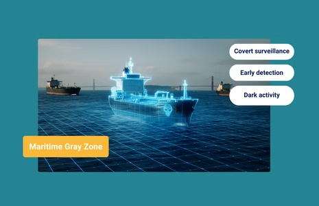
At a Glance What Is the Maritime Gray Zone? The maritime gray zone describes state or state-aligned actions that fall between routine presence and open conflict. These operations are intentionally deniable, often unattributable, and designed to achieve strategic gains without crossing the threshold of armed escalation. Gray-zone maritime activity includes behaviors that look routine on...
At a Glance The Foundation of Truth: Elevating Maritime Intelligence Above the Noise In the global maritime ecosystem, data is the new oil, but “dirty oil” is currently clogging the engines of compliance and national security. For years, the industry has focused on Know Your Customer (KYC) and Windward’s trademarked Know Your Vessel (KYV™). While...
Early Detection enables governments to expose gray-zone behavior before escalation or infrastructure disruption occurs.
Windward provides the fused intelligence layer required to identify, classify, and understand gray-zone maritime activity.
What Is the Maritime Gray Zone?
The maritime gray zone describes state or state-aligned actions that fall between routine presence and open conflict. These operations are intentionally deniable, often unattributable, and designed to achieve strategic gains without crossing the threshold of armed escalation.
Gray-zone maritime activity includes behaviors that look routine on the surface – fishing, surveying, drifting, patrolling – but serve adversarial objectives such as mapping undersea infrastructure, coercing neighbors, gathering intelligence, or preparing the operational environment.
What makes gray-zone operations uniquely dangerous is their ambiguity. They are not violations dramatic enough to trigger a military response, but they slowly shift control, create uncertainty, and erode the security environment in ways that accumulate over time.
How the Gray Zone Works: Tactics Beneath the Threshold of Conflict
The modern gray zone is built on behaviors that appear compliant, even when they are not. Adversaries rely on maritime patterns that blend into commercial traffic, coastal fishing activity, and normal anchorage flows. Some of the most common tactics include:
Dark activity: Turning off AIS or operating with extended gaps, particularly near sensitive waters, EEZ boundaries, or undersea infrastructure.
AIS manipulation & identity deception: Broadcasting false positions, cloning MMSIs, spoofing tracks, or operating under fraudulent or rapidly shifting flags and registries.
Strategic loitering: Slow-speed or stationary behavior near military bases, undersea cables, pipelines, or disputed territories, framed as fishing or weather-related holding.
Coordinated vessel networks: Groups of vessels that operate in patterns inconsistent with commercial logic, such as revisiting the same coordinates, shadowing naval assets, or conducting synchronized movements.
Underwater & subsurface reconnaissance: Using trawlers, research vessels, and unmanned systems to map infrastructure without declaring the nature of their activity.
Relay-based activity: Multi-vessel approaches where tasks are divided to obscure intent, for example, one vessel conducts the surveillance, another handles logistics, and another provides cover as a “normal” operator.
These behaviors are not accidental. They are engineered to appear harmless, buying time and ambiguity, while governments see “movement,” not intent.
Why Attribution Is So Difficult
Gray-zone maritime threats exploit every blind spot in legacy surveillance:
AIS is cooperative, and gray-zone actors are not.
Radar and patrol assets only see position, not ownership, intent, or network activity.
Commercial traffic density creates plausible deniability for vessels behaving suspiciously.
Non-kinetic actions leave no debris, signatures, or proof of state involvement.
A vessel can loiter over an undersea cable without turning AIS off. It can shadow another nation’s naval assets at a legal distance. It can deploy a UUV under the guise of scientific research.
Every tactic is designed to create one outcome: no smoking gun.
This is why attribution requires something beyond manual monitoring – it requires a way to validate behavior independently of vessel declarations, correlate actions across time, and detect patterns before they escalate.
How Multi-Sensor Intelligence Detects Gray-Zone Behavior
Gray-zone tactics are designed to disappear into the background of legitimate maritime activity. They rely on ambiguity, deniability, and the limitations of cooperative systems like AIS. What exposes them is not a single sensor, but Remote Sensing Intelligence – the fusion of independent, non-cooperative detections that validate where a vessel is, how it behaves, and whether its actions align with its declared purpose.
Remote Sensing Intelligence transforms gray-zone detection from guesswork into evidence. By correlating SAR, EO, RF, AIS truth analysis, behavioral analytics, and ownership context, governments can see the actual operational picture, not the narrative a vessel broadcasts.
This is the layer that reveals intent: patterns that repeat, behaviors that break commercial logic, and movements that only make sense in the context of reconnaissance, coercion, or pre-operational staging.
Below is a breakdown of how each intelligence layer contributes to exposing gray-zone activity:
Intelligence Layer
What It Reveals
Gray-Zone Value
SAR
Vessel presence through darkness, clouds, and AIS silence.
Confirms physical location during dark activity or manipulated tracks.
EO Imagery
Visual identity and activity.
Validates loitering, rendezvous, or anomalous deck operations.
Flags mismatches between declared vs. observed patterns.
Behavioral Analytics
Patterns, anomalies, and network-level coordination.
Surfaces intent beyond dingle-vessel movement.
Ownership Intelligence
Beneficial owners, managers, affiliations.
Flags mismatches between declared and observed patterns.
Remote Sensing Intelligence ties these layers together, revealing activity that cannot be masked by compliant AIS tracks or plausible explanations. It shows when slow-speed passes form a reconnaissance pattern, when repeated visits to the same coordinates indicate mapping, and when multiple vessels, dispersed across regions, are connected by purpose.
In gray-zone environments, this is what separates visibility from understanding.
China’s Gray-Zone Playbook at Sea
China’s maritime gray zone campaign in the South China Sea is one of the clearest demonstrations of how states can advance strategic objectives without triggering open conflict. Through a mix of aggressive coast guard maneuvers, militia swarming, water-cannon use, laser harassment, and non-attributable interference with rival operations, China steadily applies pressure while staying below the threshold of war. These actions are framed domestically as “maritime rights protection,” but they function as a deliberate strategy to assert control over disputed waters, limit rivals’ access to resources, and normalize Chinese presence around contested features.
At the heart of this approach is deniability. Vessels operate with civilian markings, AIS remains on, and tactics – blocking, ramming, drifting, shadowing – are executed in ways that mimic routine maritime behavior. Even when incidents escalate, such as the 2025 collision and water-cannon assault on a Philippine resupply mission near Second Thomas Shoal, China characterizes them as law-enforcement responses rather than military aggression. This makes attribution difficult, slows international responses, and forces regional governments to manage recurring “incidents” that collectively shift the balance of control.
For governments, the challenge is not just China’s presence but its pattern – incremental, persistent, and intentionally ambiguous. Traditional maritime surveillance cannot reliably distinguish between lawful patrols and coercive maneuvers, especially when vessels present clean documentation and remain technically compliant with AIS. Detecting intent in this environment requires independent, multi-sensor evidence; Remote Sensing Intelligence that reveals loitering patterns, approach vectors, small-vessel support, and the networked coordination often invisible in AIS alone.
How Windward Detects Gray-Zone Maritime Behavior
Gray-zone operations are designed to look ordinary. They sit inside the noise of daily maritime traffic: compliant AIS signals, fishing speeds, slow drifts, and “routine” patrols. Windward’s role is to separate signal from noise, to reveal intent before escalation.
Windward’s Remote Sensing Intelligence provides the independent detections needed to verify what vessels are actually doing, not just what they declare.
But detection alone isn’t enough. Gray-zone activity is rarely the work of a single vessel – it is networked. Windward’s behavioral analytics map how vessels patrol, escort, shadow, or rotate through the same coordinates over time, surfacing patterns that resemble pre-operational surveillance or coordinated harassment. Visual Link Analysis (VLA) connects vessels to their operators, owners, and broader fleets, revealing when “independent” actors share infrastructure, planning cycles, or tasking logic.
This multi-sensor, multi-layer approach gives governments the visibility they need to understand not just what happened, but why it happened, who is involved, and what will likely occur next. It enables early detection of coercive maneuvers, attribution of ambiguous activity, and informed decisions before a gray-zone incident becomes a crisis.
Windward brings these layers together into one operational picture – a verified view of the maritime environment where gray-zone behavior can no longer hide in plain sight.
Frequently Asked Questions (FAQs)
What qualifies as gray-zone activity at sea?
Gray-zone maritime activity includes coercive or ambiguous actions – such as coordinated loitering, ramming, shadowing, AIS manipulation, or pressure around disputed features – that fall below the threshold of armed conflict while advancing strategic objectives.
Why is attribution so difficult in the maritime gray zone?
These operations are designed to look routine: vessels maintain AIS, follow commercially plausible routes, and use civilian platforms that conceal military intent. Without independent verification, governments cannot easily differentiate normal behavior from deliberate coercion.
How does Remote Sensing Intelligence help detect gray-zone behavior?
Remote Sensing Intelligence provides non-cooperative visibility through SAR, EO, and RF detections, revealing presence, proximity, and patterns that AIS cannot. This allows agencies to validate behavior independently of what a vessel broadcasts.
Why isn’t AIS enough to identify gray-zone operations?
AIS was built for safety, not deception detection. Modern tactics exploit this by spoofing locations, manipulating identity, or behaving in ways that look compliant despite carrying strategic intent, making AIS a reference point rather than a source of truth.
How can governments distinguish legitimate maritime activity from pre-operational behavior?
They need multi-sensor fusion and behavioral analytics to compare vessel movements against known commercial logic. When a vessel repeats unusual patterns, returns to sensitive locations, or synchronizes with others, intent becomes visible long before an incident occurs.
Everything you need to know about Maritime AI™ directly to your LinkedIn
The Week in Focus Black Sea: Shadow Fleet Seeks Coastal Cover Following Ukrainian maritime drone strikes in late November and December, Russia’s shadow fleet has begun altering its operating patterns in the Black Sea. Instead of transiting directly across open water, tankers are increasingly hugging the coastlines of Georgia and Türkiye, in some cases operating...
Russian Dark Fleet Tankers Seek Shelter Along Turkish Coast from Ukrainian Drone Strikes
At a Glance The Black Sea has become increasingly treacherous for Russia’s shadow fleet of oil tankers. Following a wave of Ukrainian maritime drone strikes in late November and December, vessels transporting Russian crude have abandoned their traditional direct routes across open water. Instead, they’re taking a dramatically longer path — hugging the coastlines of...
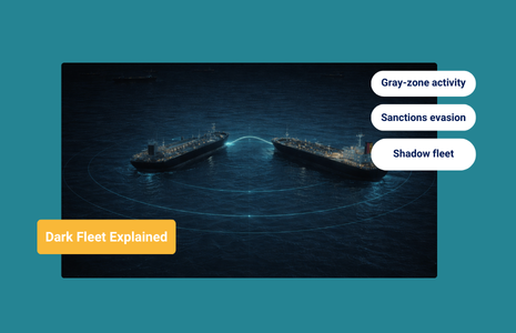
What Is the Dark Fleet? How Shadow Tankers Fund Sanctioned Regimes
At a Glance What Is the Dark Fleet? The dark fleet is a loose but increasingly well-defined group of oil tankers and cargo vessels that engage in deceptive shipping practices to transport sanctioned oil and other restricted commodities. These vessels continue trading globally while deliberately complicating detection, attribution, and enforcement under international maritime regulation. Unlike...
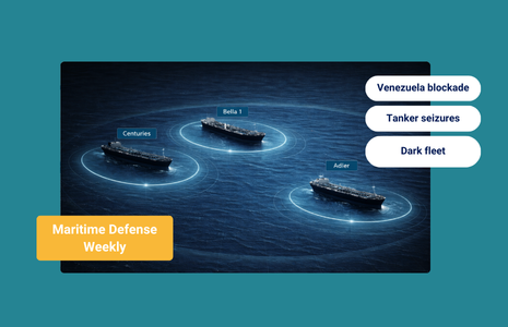
The Week in Focus Western Hemisphere: Venezuela Enforcement Escalates A Non-Sanctioned Tanker Is Seized When the U.S. Coast Guard boarded the tanker Centuries (IMO 9206310) in international waters off Venezuela, its AIS signal placed it near Aruba and Curaçao. Windward data confirms the vessel was operating far closer to the Venezuelan coast, a familiar pattern...